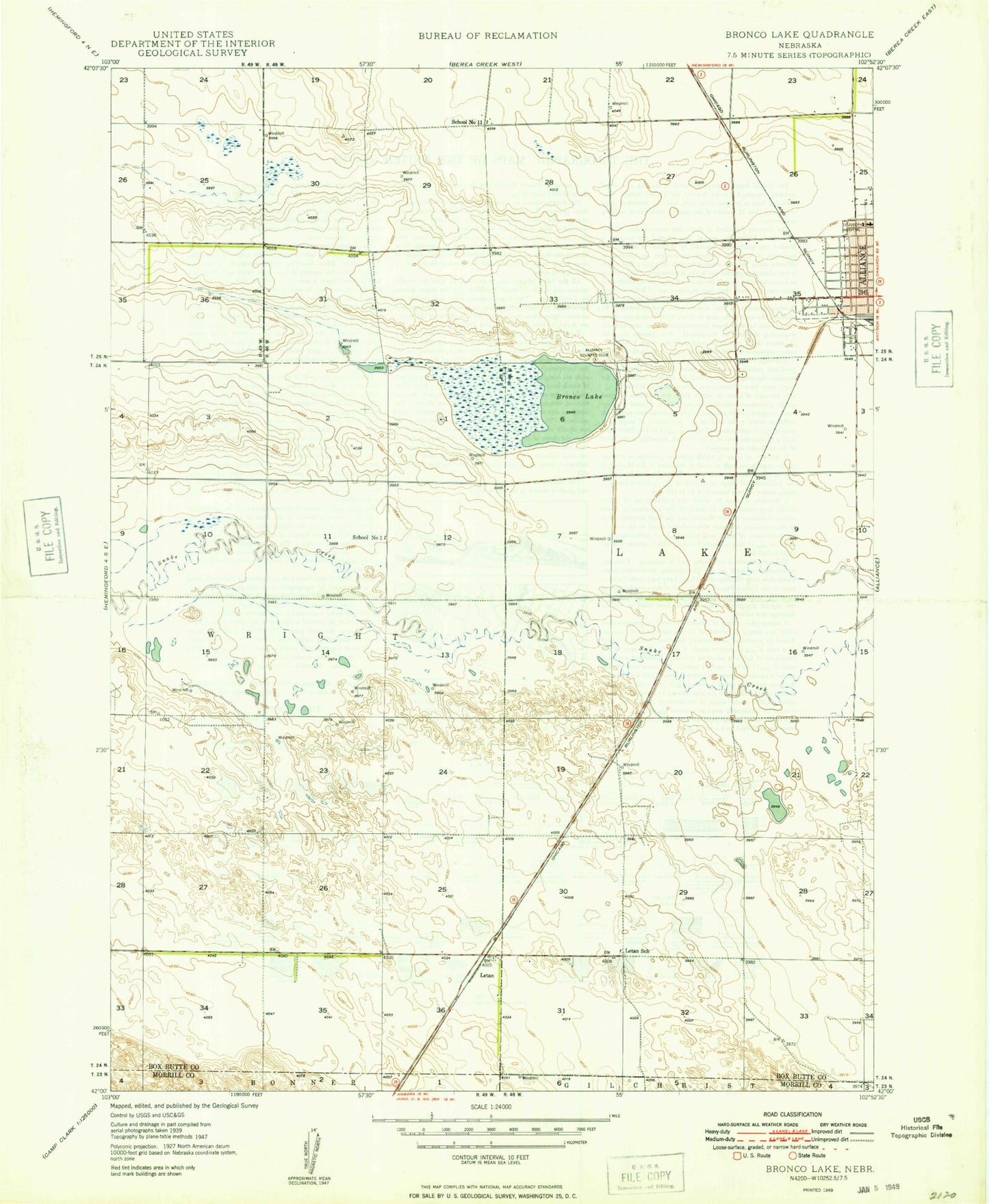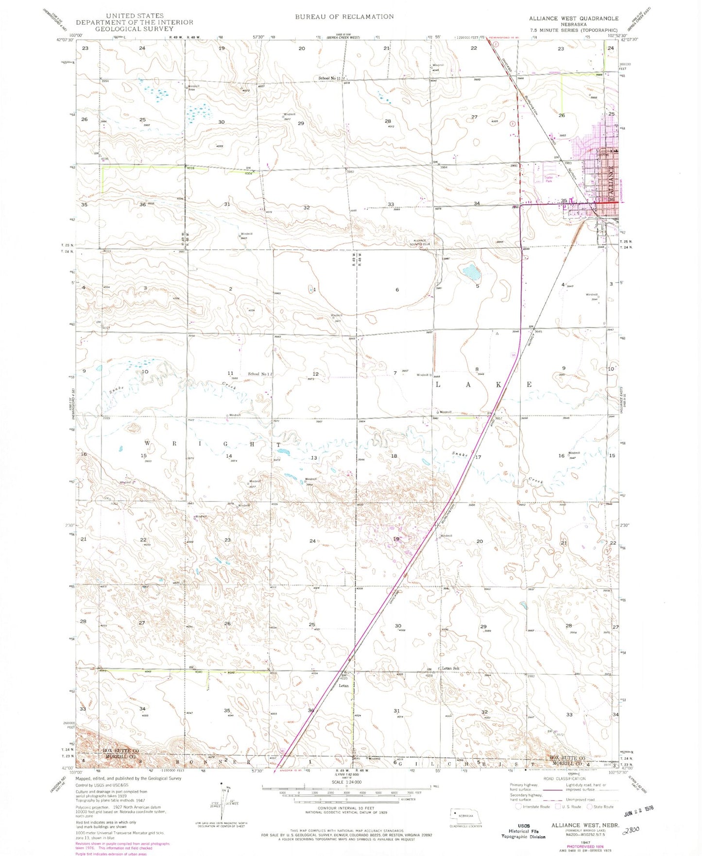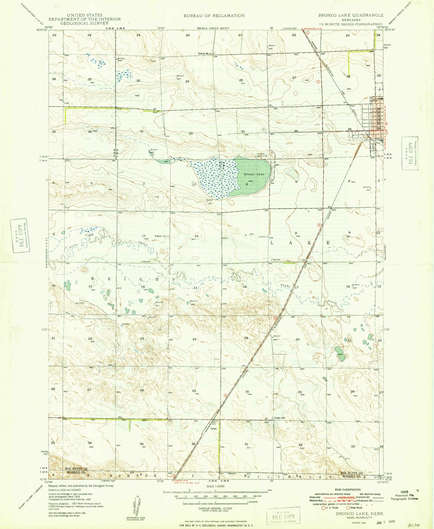
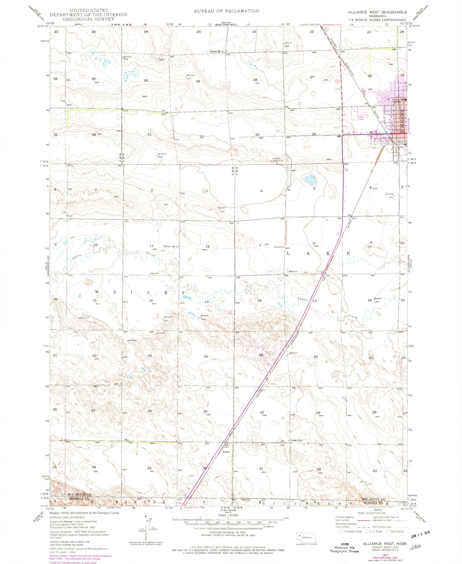
MyTopo
Classic USGS Alliance West Nebraska 7.5'x7.5' Topo Map
Couldn't load pickup availability
Historical USGS topographic quad map of Alliance West in the state of Nebraska. Map scale may vary for some years, but is generally around 1:24,000. Print size is approximately 24" x 27"
This quadrangle is in the following counties: Box Butte, Morrill.
The map contains contour lines, roads, rivers, towns, and lakes. Printed on high-quality waterproof paper with UV fade-resistant inks, and shipped rolled.
Contains the following named places: Alliance Berean Church, Alliance Country Club, Belle Acres Farm, Bronco Lake, City of Alliance, Cody Medical Associates, Copsey Clinic, Emerson Elementary School, Episcopal Evangelical Free Church, Gardner Farms, Hal Murray Softball Complex, KCOW-AM (Alliance), Kelley Bean Company Incorporated Elevator, Knight Park, Lakefield Wesleyan Chapel, Letan, Letan School, Presbyterian Church, Saint Johns Lutheran Church, School Number 1, School Number 11, Seventh Day Adventist Church, Spanish Assembly of God Church, The Church of Jesus Christ of Latter Day Saints, ZIP Code: 69301