MyTopo
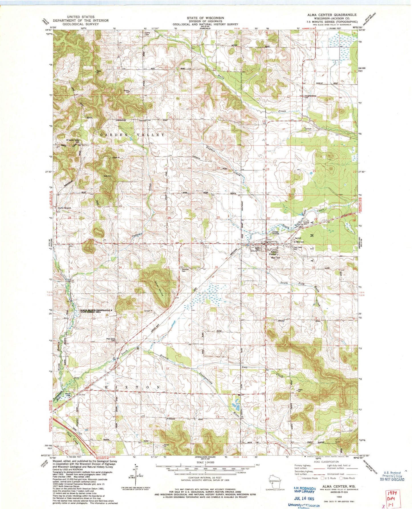
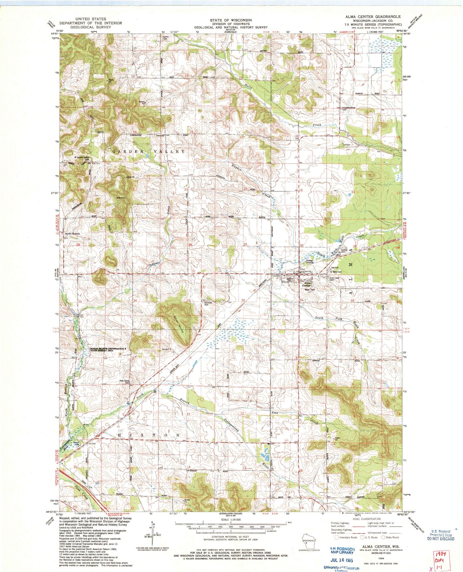
Classic USGS Alma Center Wisconsin 7.5'x7.5' Topo Map
Couldn't load pickup availability
Historical USGS topographic quad map of Alma Center in the state of Wisconsin. Map scale may vary for some years, but is generally around 1:24,000. Print size is approximately 24" x 27"
This quadrangle is in the following counties: Jackson.
The map contains contour lines, roads, rivers, towns, and lakes. Printed on high-quality waterproof paper with UV fade-resistant inks, and shipped rolled.
Contains the following named places: Alma Center, Alma Center Post Office, Alma Center Volunteer Fire Department, Amo Creek, Avon Road Jersey Farm, Curtis Cemetery, East Lawn Cemetery, Hayden Creek, Hixton Park, Houghtonburg Cemetery, Houghtonburg School, Judkins Creek, Judkins School, Leverett School, Lincoln Junior - Senior High School, Lincoln Junior / Senior High School, Lower North Branch School, North Branch, North Branch Trempealeau River, Pole Grove Cemetery, Pole Grove School, Pomroy School, Saddle Mound, Saint Marys Cemetery, Silver Mound, South Alma School, South Branch Trempealeau River, Stanford Cemetery, Town of Garden Valley, Town of Hixton, Village of Alma Center, West Garden Valley Cemetery, West Garden Valley Church, ZIP Code: 54611