MyTopo
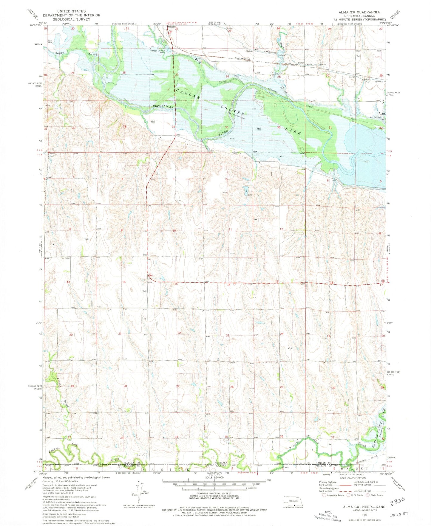
Classic USGS Alma SW Nebraska 7.5'x7.5' Topo Map
Regular price
$16.95
Regular price
Sale price
$16.95
Unit price
per
Couldn't load pickup availability
Historical USGS topographic quad map of Alma SW in the states of Nebraska, Kansas. Map scale may vary for some years, but is generally around 1:24,000. Print size is approximately 24" x 27"
This quadrangle is in the following counties: Harlan, Phillips.
The map contains contour lines, roads, rivers, towns, and lakes. Printed on high-quality waterproof paper with UV fade-resistant inks, and shipped rolled.
Contains the following named places: Bantom-Coe Dam, Bantom-Coe Reservoir, Dry Creek, Flag Creek, Haeker Dam, Haeker Reservoir, Rope Canal, Rope Creek, Sappa Creek, Spring Brook, Township of Eldorado, Wolf Dam Number 1, Wolf Reservoir Number 1