
MyTopo
Classic USGS Alma Nebraska 7.5'x7.5' Topo Map
Couldn't load pickup availability
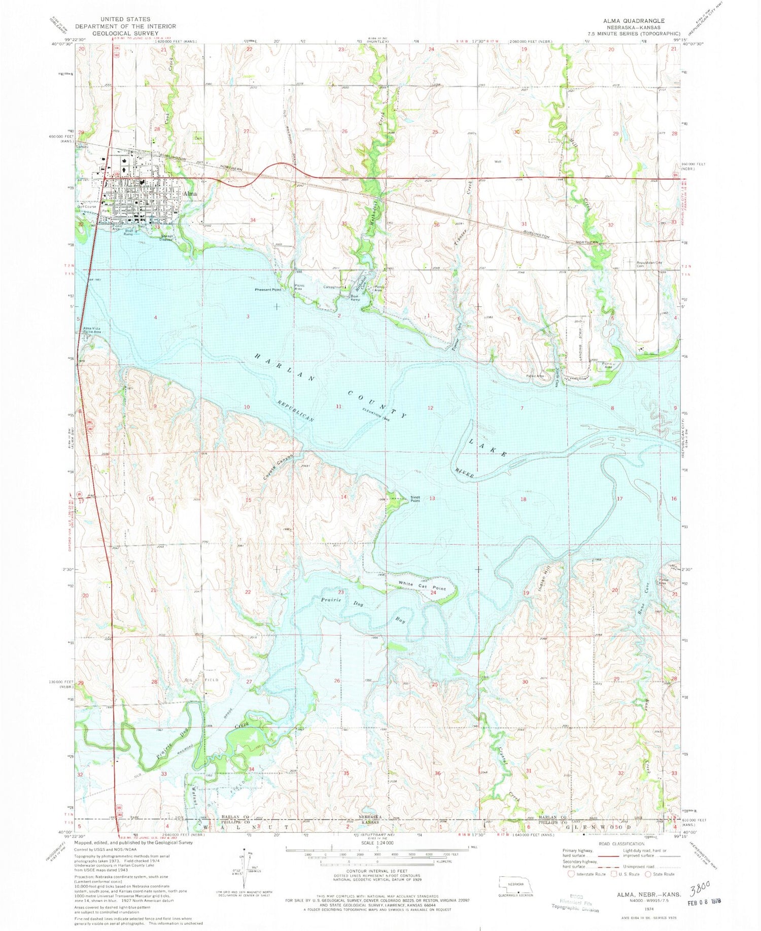
Historical USGS topographic quad map of Alma in the state of Nebraska. Typical map scale is 1:24,000, but may vary for certain years, if available. Print size: 24" x 27"
This quadrangle is in the following counties: Harlan, Phillips.
The map contains contour lines, roads, rivers, towns, and lakes. Printed on high-quality waterproof paper with UV fade-resistant inks, and shipped rolled.
Contains the following named places: Harlan County Lake, Walnut Creek, Bone Creek, Prairie Dog Creek, Alma, Alma Vista Picnic Area, Boat Ramp, Bone Cove, Cook Creek, Coyote Canyon, Crystal Creek, Indian Hill, Methodist Cove, Methodist Creek, Mill Creek, North Cove, Pheasant Point, Prairie Dog Bay, Republican City Cemetery, Sindt Point, Tipover Cove, Tipover Creek, White Cat Point, Alma Municipal Airport, Harlan County Lake Seaplane Base, City of Alma, Township of Prairie Dog, North Cove Campground, Methodist Cove Campground, Harlan County Lake Recreation Area, Alma, Harlan County Sheriff's Office, Harlan County Court House, Hoesch Memorial Library, Colonial Villa Good Samaritan Center, Harlan County Health System Hospital, Harlan County Medical Clinic, Alma Dental Clinic, Alma Post Office, Agri Co-op Elevator, United Methodist Church, Free Methodist Church, Peace Lutheran Church, First Christian Church, Saint Joseph Catholic Church, Alma Evangelical Free Church, Alma Municipal Golf Course, Alma Public Schools, Alma City Park, City of Alma Trailer Park, Alma Volunteer Fire Department


