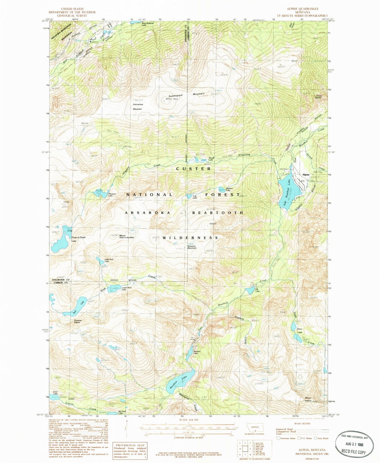
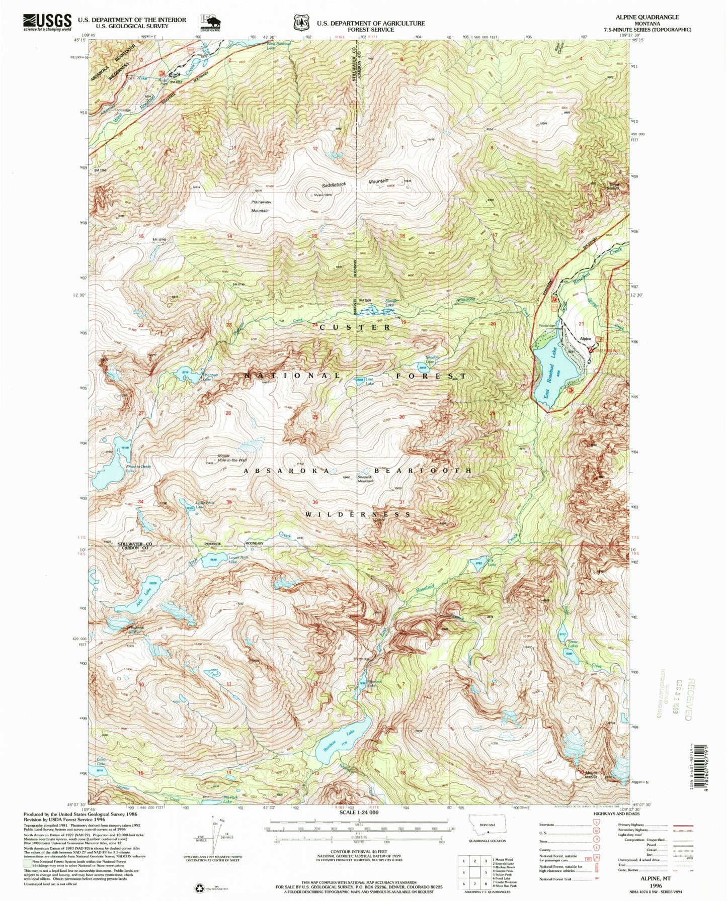
MyTopo
USGS Classic Alpine Montana 7.5'x7.5' Topo Map
Couldn't load pickup availability
Historical USGS topographic quad map of Alpinein the states of Montana, South Dakota, Wyoming. Scale: 1:24000. Print size: 24" x 27"
This quadrangle is in the following counties: Carbon, Stillwater.
The map contains contour lines, roads, rivers, towns, lakes, and grids including latitude / longitude and UTM / MGRS. Printed on high-quality waterproof paper with UV fade-resistant inks.
Contains the following named places: Rainbow Lake, Alpine, Arch Creek, Arch Lake, Armstrong Creek, Beartooth Mountains, Big Park Lake, East Rosebud Lake, Elk Lake, Fivemile Creek, Froze-to-Death Lake, Mount Hole-in-the-Wall, Mount Inabnit, Lost Lake, Phantom Creek, Phantom Glacier, Phantom Lake, Prairieview Mountain, Rimrock Lake, Saddleback Mountain, Shadow Lake, Shepard Mountain, Slough Lake, Snow Creek, Snow Lakes, Spread Creek, Whirlpool Creek, East Rosebud Campground, Mystic Lake Hydroelectric Plant, Chicken Creek, Echo Lake, Little Arch Lake, Lower Arch Lake, Three Sisters, Alpine Post Office (historical), Custer National Forest, East Rosebud Creek Wild and Scenic River, Custer National Forest, Beartooth Mountains, Custer National Forest