MyTopo
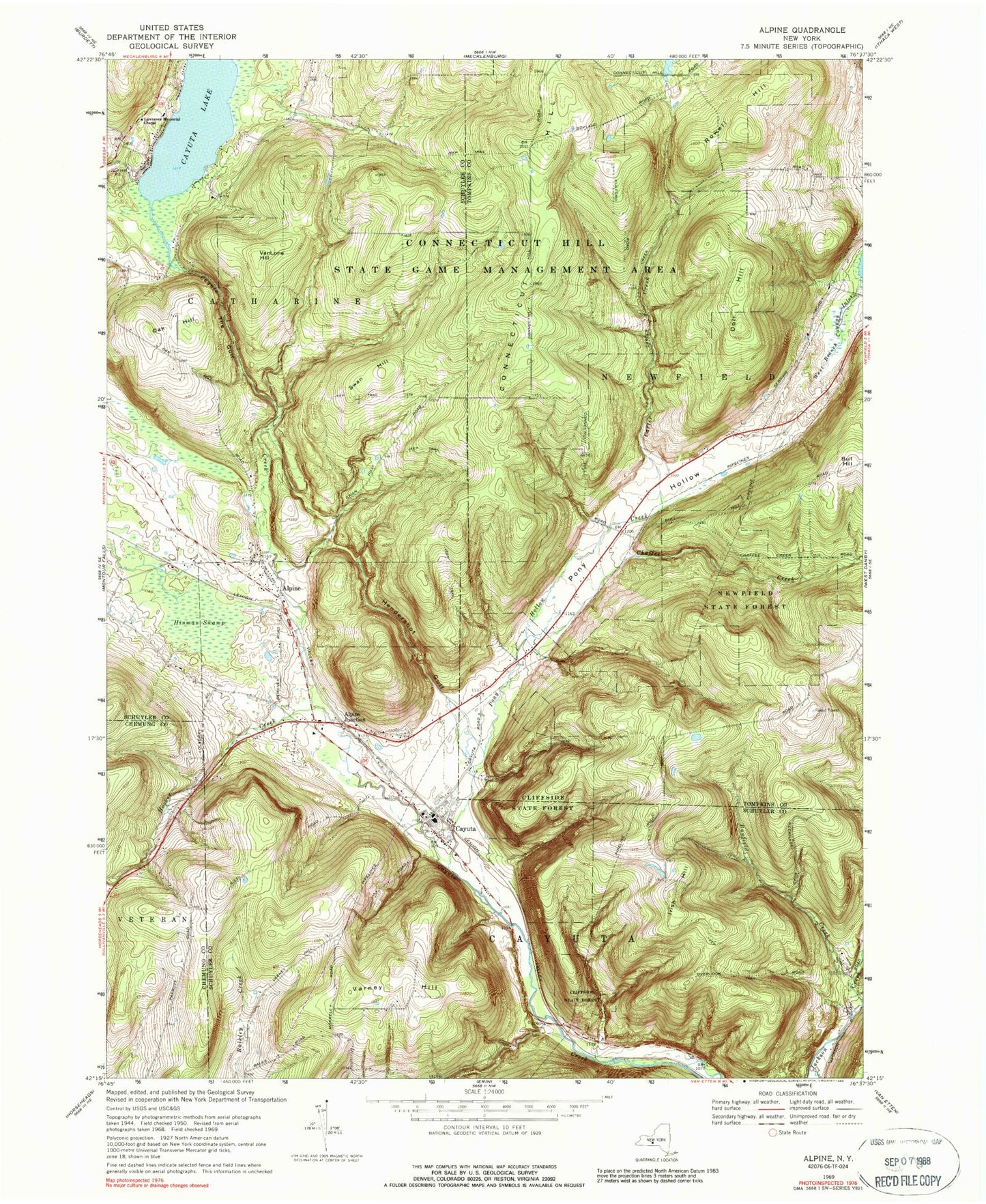
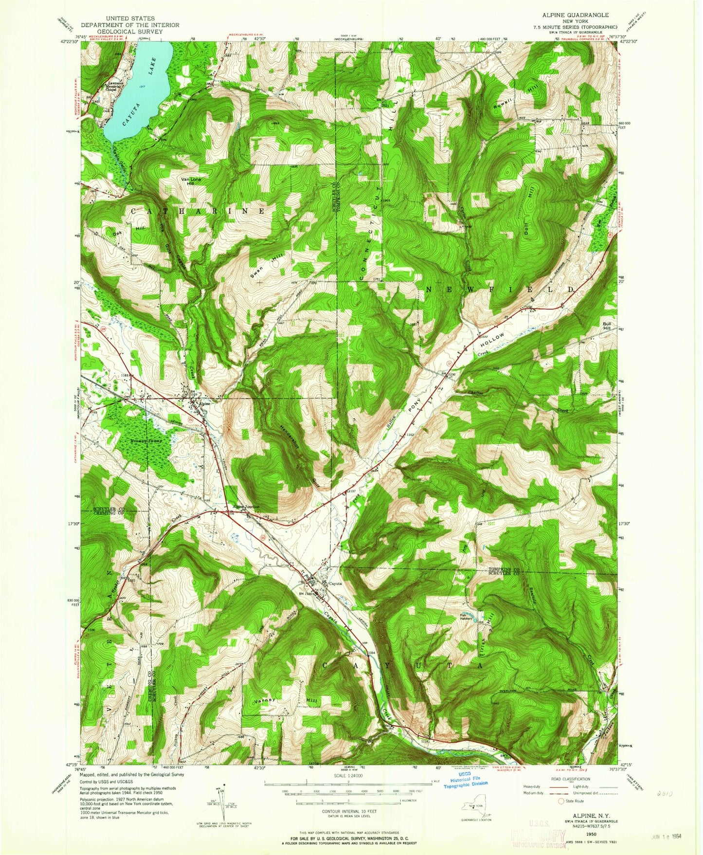
Classic USGS Alpine New York 7.5'x7.5' Topo Map
Couldn't load pickup availability
Historical USGS topographic quad map of Alpine in the state of New York. Typical map scale is 1:24,000, but may vary for certain years, if available. Print size: 24" x 27"
This quadrangle is in the following counties: Chemung, Schuyler, Tompkins.
The map contains contour lines, roads, rivers, towns, and lakes. Printed on high-quality waterproof paper with UV fade-resistant inks, and shipped rolled.
Contains the following named places: Alpine, Banfield Creek, Carter Creek, Cayuta, Chaffee Creek, Cliffside State Forest, Cornish Hollow, Doll Hill, Hendershot Gulf, Hinman Swamp, Hooker Creek, Irish Hill, Lawrence Memorial Chapel, Newfield State Forest, Oak Hill, Pony Hollow, Pony Hollow Creek, Rowell Hill, Swan Hill, The Gulf, VanLone Hill, Varney Hill, Alpine Junction, Cayuta Lake, Connecticut Hill State Game Management Area, Kayutah Lake Airport, Town of Catharine, Town of Cayuta, Lawrence Cemetery, Wildwood Mobile Home Park, Estabrook Cemetery, Connecticut Hill Cemetery, Cool Lea Campground, Bible Baptist Fellowship, Cayuta Post Office, Alpine Post Office