
MyTopo
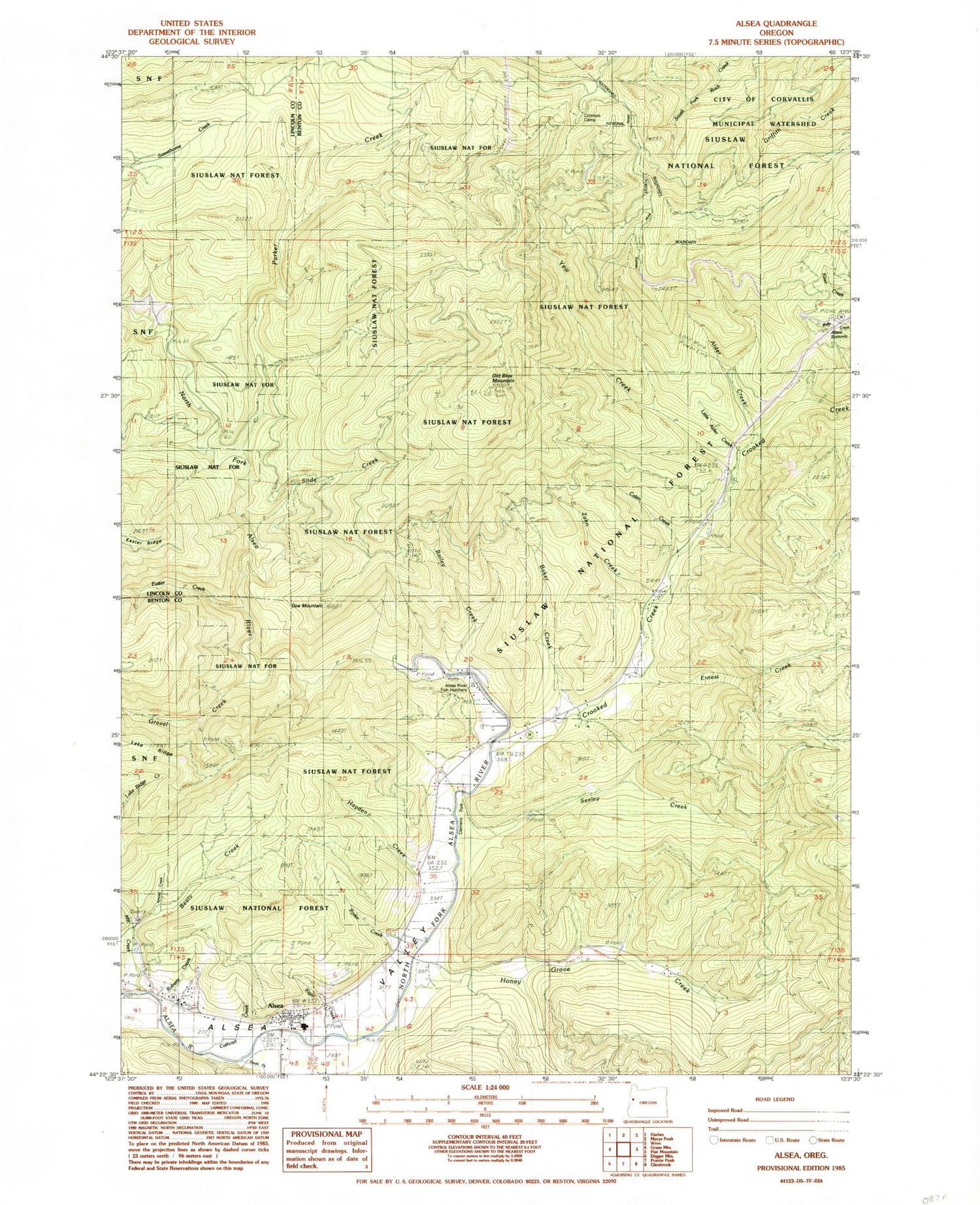
Classic USGS Alsea Oregon 7.5'x7.5' Topo Map
Couldn't load pickup availability
Historical USGS topographic quad map of Alsea in the state of Oregon. Map scale may vary for some years, but is generally around 1:24,000. Print size is approximately 24" x 27"
This quadrangle is in the following counties: Benton, Lincoln.
The map contains contour lines, roads, rivers, towns, and lakes. Printed on high-quality waterproof paper with UV fade-resistant inks, and shipped rolled.
Contains the following named places: Ahsney Creek, Alder Creek, Alsea, Alsea Cemetery, Alsea Census Designated Place, Alsea Community Library, Alsea County Service District, Alsea Elementary School, Alsea Guard Station, Alsea High School, Alsea Mountain Roadside Rest Area, Alsea Post Office, Alsea Ranger Station, Alsea River Hatchery, Alsea Rural Fire Protection District, Alsea Summit, Alsea United Methodist Church, Arnold Creek, Bailey Creek, Baker Creek, Beaty Creek, Cabin Creek, Cathcart Creek, Cathcart Springs, Chittam Creek, Clemens County Park, Connors Camp Recreation Site, Crooked Creek, Doe Mountain, Easter Creek, Ernest Creek, Gravel Creek, Hayden Creek, Honey Grove Creek, Kiger Creek, Lake Ridge, Little Alder Creek, Lo wa' ha yu Creek, Maddsens Knob, Marys Wayside Recreation Site, Mill Creek, North Fork Alsea River, Old Blue Mountain, Parker Creek, Pa'wint Creek, Roberts Creek, Ryder Creek, Salmon Creek, Seeley Creek, Slide Creek, South Fork Alsea River, Southwest Benton Division, Wusi'n Creek, Yew Creek, Zahn Creek


