MyTopo
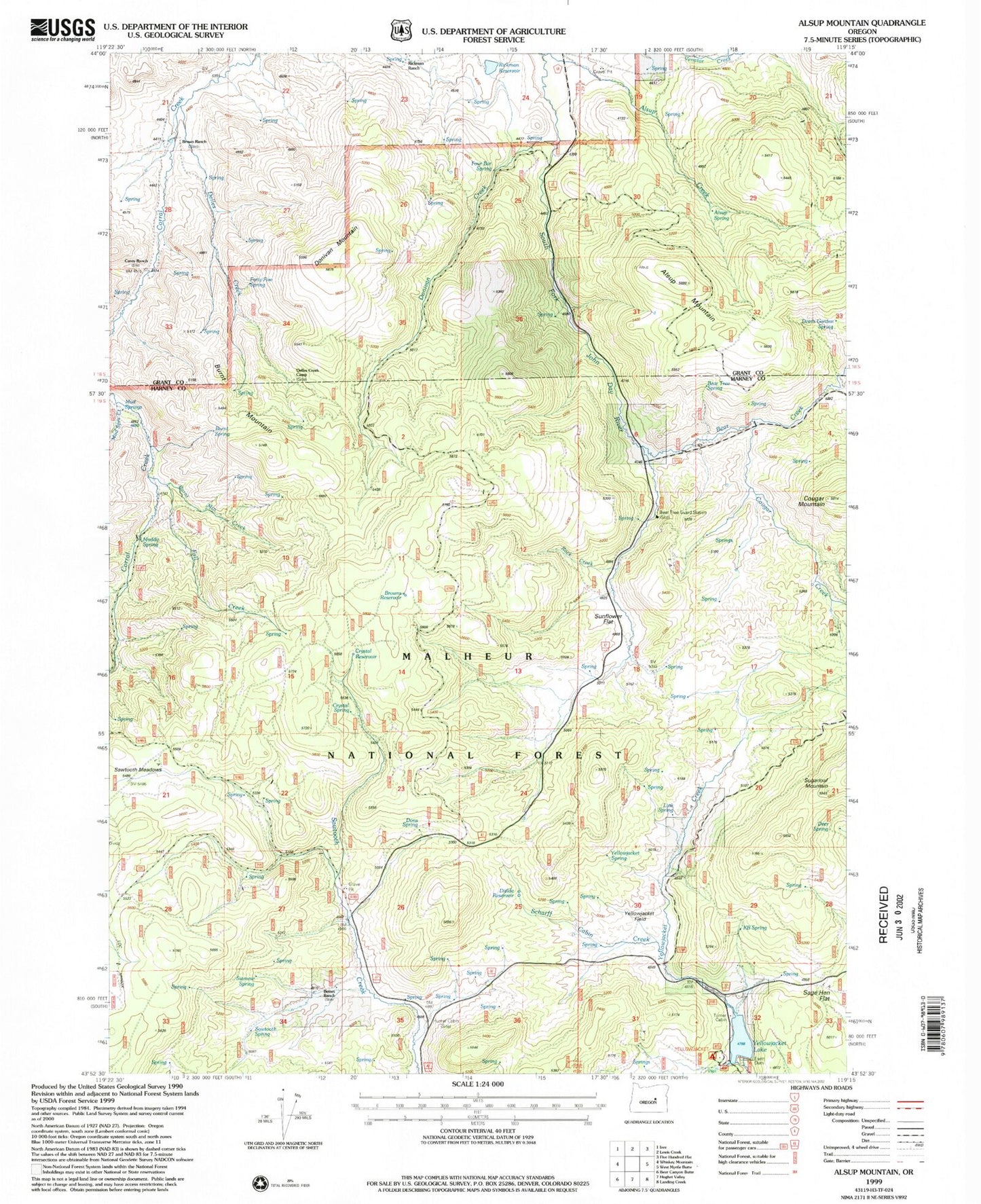
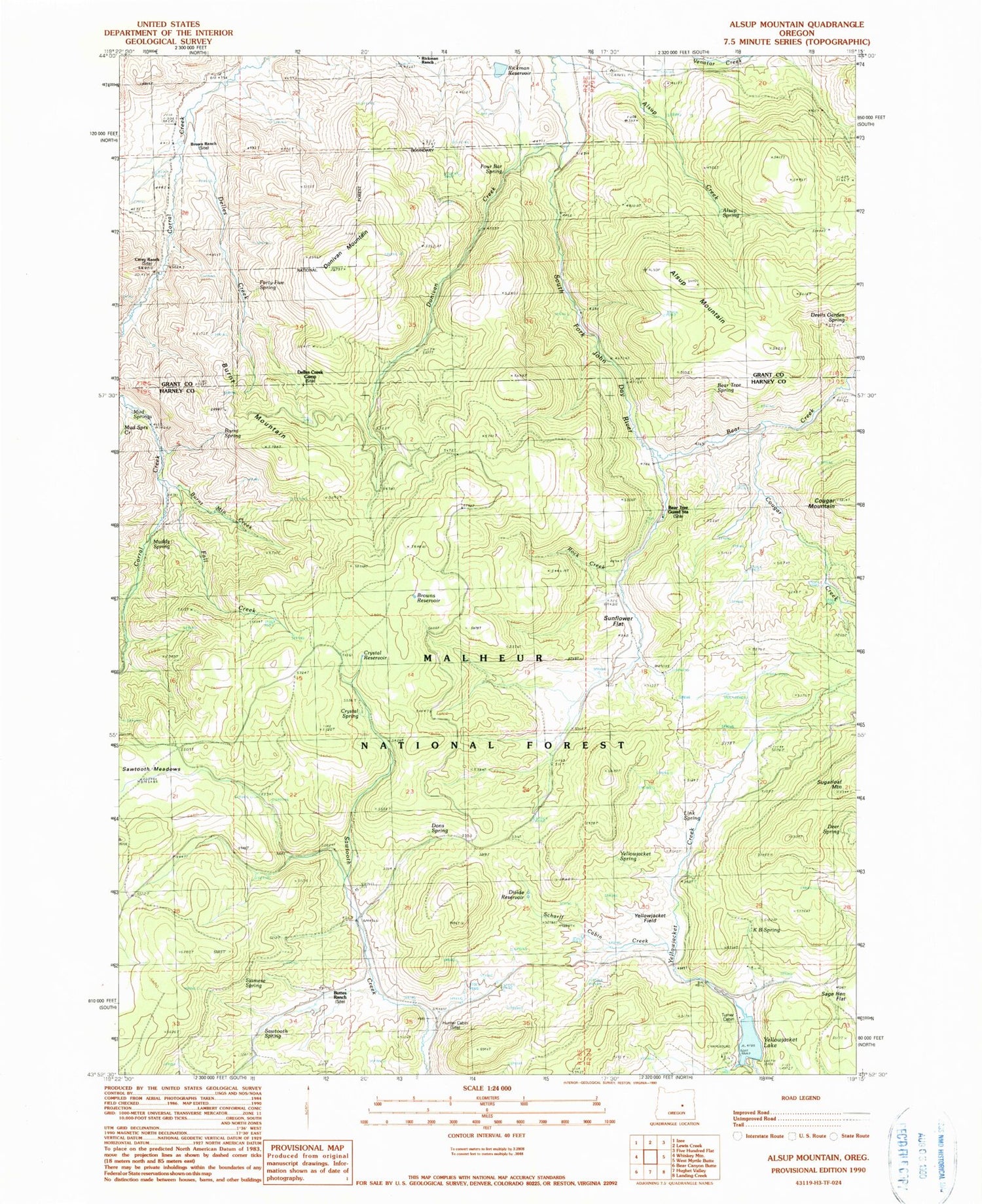
Classic USGS Alsup Mountain Oregon 7.5'x7.5' Topo Map
Couldn't load pickup availability
Historical USGS topographic quad map of Alsup Mountain in the state of Oregon. Map scale may vary for some years, but is generally around 1:24,000. Print size is approximately 24" x 27"
This quadrangle is in the following counties: Grant, Harney.
The map contains contour lines, roads, rivers, towns, and lakes. Printed on high-quality waterproof paper with UV fade-resistant inks, and shipped rolled.
Contains the following named places: Alsup Creek, Alsup Mountain, Alsup Spring, Bear Creek, Bear Tree Guard Station, Bear Tree Spring, Brown Ranch, Browns Reservoir, Burnt Mountain, Burnt Mountain Creek, Burnt Spring, Buttes Ranch, Carey Ranch, Chris Borg Spring, Clemens Dam, Cougar Creek, Cougar Mountain, Crystal Reservoir, Crystal Spring, Deer Spring, Delles Creek, Delles Creek Camp, Devils Garden Spring, Divide Reservoir, Donivan Creek, Donivan Mountain, Dons Spring, Fall Creek, Forty-five Spring, Four Bar Spring, Hunter Cabin, K B Spring, Link Spring, Mud Springs, Mud Springs Creek, Muddy Spring, Rickman Ranch, Rickman Reservoir, Rock Creek, Sage Hen Flat, Sawtooth Meadows, Sawtooth Spring, Scharff Cabin Creek, Siamese Spring, Spring Valley meadow, Sunflower Flat, Turner Cabin, Yellowjacket Field, Yellowjacket Lake, Yellowjacket Recreation Site, Yellowjacket Spring