
MyTopo
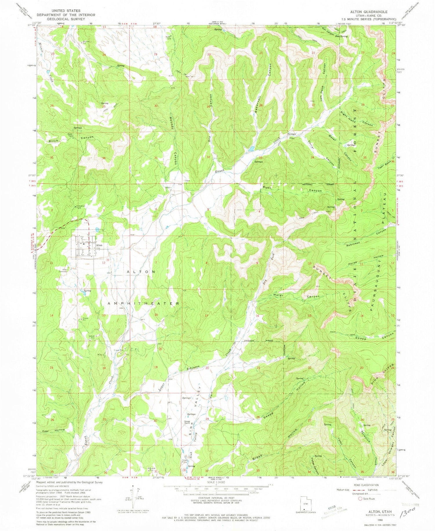
Classic USGS Alton Utah 7.5'x7.5' Topo Map
Couldn't load pickup availability
Historical USGS topographic quad map of Alton in the state of Utah. Map scale may vary for some years, but is generally around 1:24,000. Print size is approximately 24" x 27"
This quadrangle is in the following counties: Kane.
The map contains contour lines, roads, rivers, towns, and lakes. Printed on high-quality waterproof paper with UV fade-resistant inks, and shipped rolled.
Contains the following named places: Alton, Alton Amphitheater, Alton Cemetery, Alton Fire Department, Alton Post Office, Birch Canyon, Coal Hollow, Corral Canyon, Don Spring, Dry Canyon, Dry Fork, Kane County Ambulance - Alton, Left Hand Canyon, Lower Robinson Creek, Lower Straight Canyon, Paunsaugunt Plateau, Reservoir Canyon, Right Hand Canyon, Roundy / Johnson Cemetery, Roundy Canyon, Roundy Cemetery, Rush Canyon, Sink Valley, Swapp Hollow, Swapp Ranch, The Church of Jesus Christ of Latter Day Saints, Water Canyon, ZIP Code: 84710


