MyTopo
Classic USGS Alvin SW Wisconsin 7.5'x7.5' Topo Map
Regular price
$16.95
Regular price
Sale price
$16.95
Unit price
per
Couldn't load pickup availability
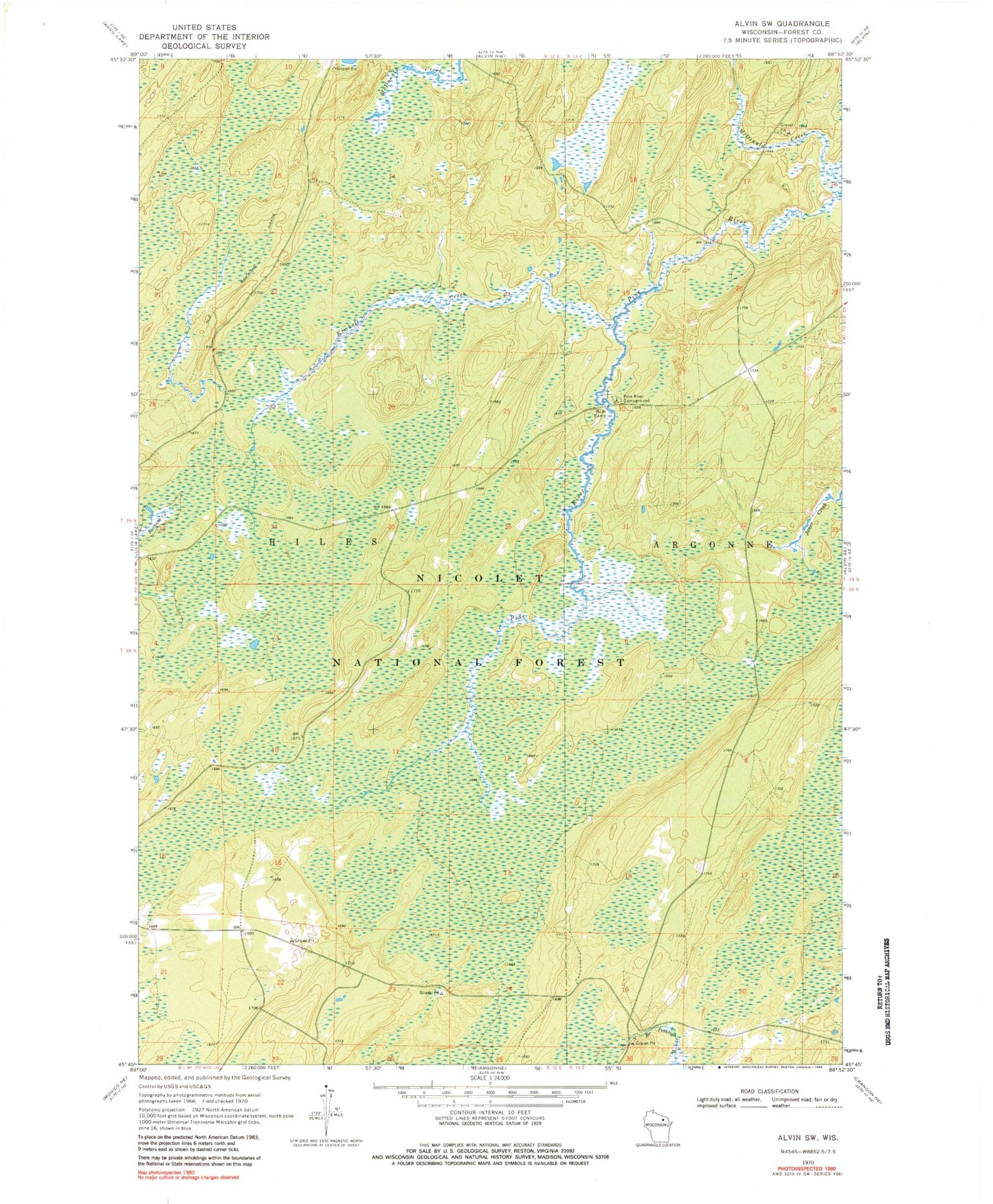
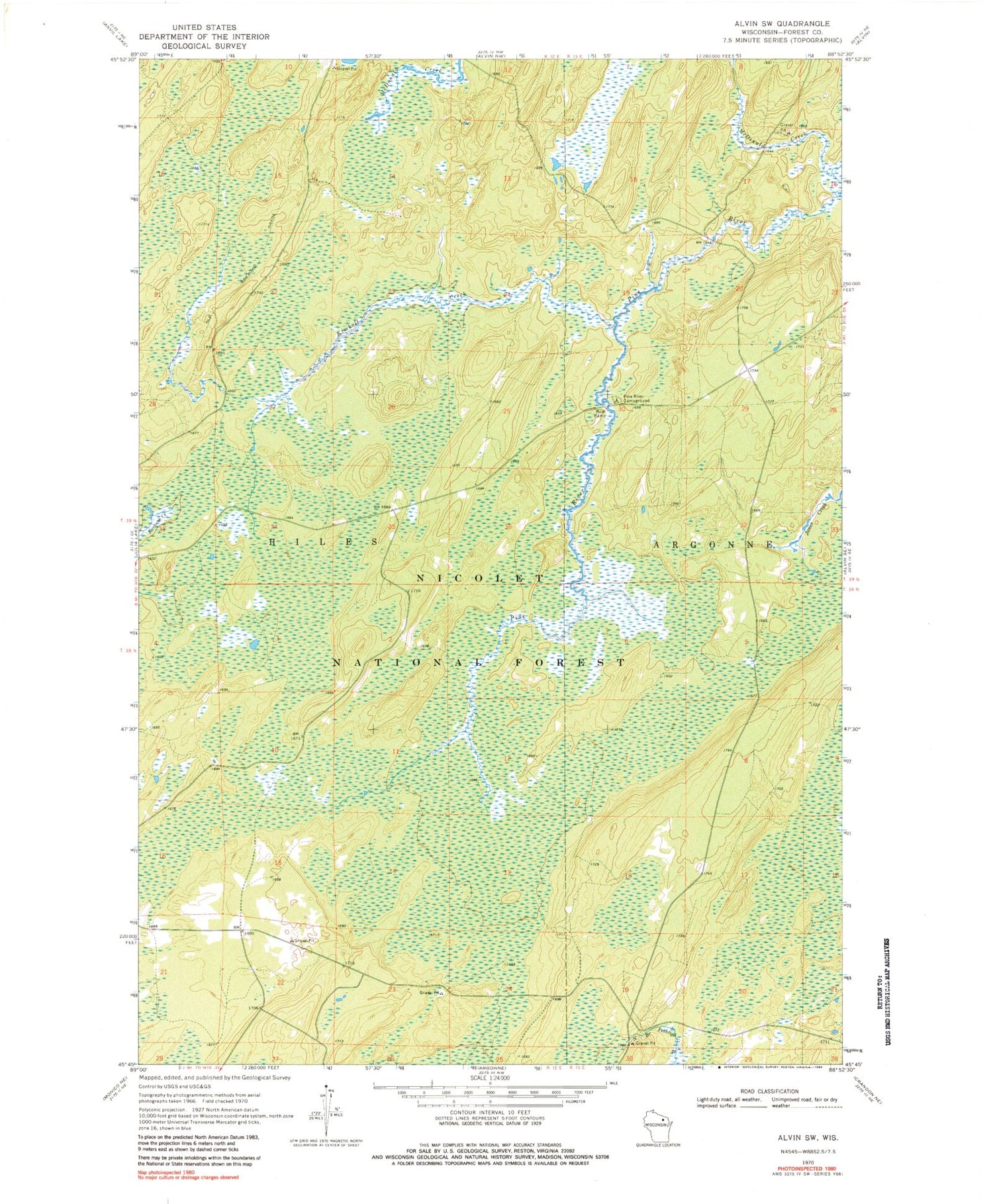
Historical USGS topographic quad map of Alvin SW in the state of Wisconsin. Typical map scale is 1:24,000, but may vary for certain years, if available. Print size: 24" x 27"
This quadrangle is in the following counties: Forest.
The map contains contour lines, roads, rivers, towns, and lakes. Printed on high-quality waterproof paper with UV fade-resistant inks, and shipped rolled.
Contains the following named places: Kimball Creek, McDonald Creek, Pine River Campground, Kimball Creek Trail, Headwaters Wilderness, Giant Pine Ski and Hike Parking Lot, Giant Pine Grove Point of Interest, Town of Hiles, Jones Dam Camp Grounds (historical), Giant White Pine Grove State Natural Area