MyTopo
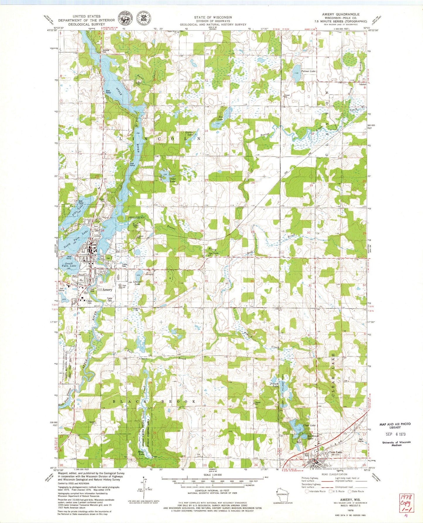
Classic USGS Amery Wisconsin 7.5'x7.5' Topo Map
Couldn't load pickup availability
Historical USGS topographic quad map of Amery in the state of Wisconsin. Map scale may vary for some years, but is generally around 1:24,000. Print size is approximately 24" x 27"
This quadrangle is in the following counties: Polk.
The map contains contour lines, roads, rivers, towns, and lakes. Printed on high-quality waterproof paper with UV fade-resistant inks, and shipped rolled.
Contains the following named places: Amery, Amery 3WR1627 Dam, Amery Area Emergency Medical Services, Amery Fire Department, Amery High School, Amery Intermediate School, Amery Middle School, Amery Municipal Airport, Amery Police Department, Amery Post Office, Amery Regional Medical Center, Apple River Church, Apple River Flowage 134, Beaver Brook, Beaver Brook School, Bethany Church, Bull Brook, Burns Creek, City of Amery, Clayton Townhall, Clear Creek Police Department, Clear Lake, Clear Lake Ambulance Service, Clear Lake Fire Department, Clear Lake Post Office, Clear Lake Village Park, East Lincoln Church, East Lincoln School, Flannigan School, French Creek, French Lake, Gorres Lake, Ice House Lake, Jim Lake, Joel School, Lien Elementary School, Lincoln Lake, Lincoln School, North Branch Beaver Brook, North Twin Lake, Oak View School, Omer Lake, Palmer Lake, Pike Lake, Snake Creek, Snake Creek State Public Fishing Area, Snake Lake, South Branch Beaver Brook, South Twin Lake, Town of Black Brook, Town of Lincoln, West Clayton School, WXCE-AM (Amery)