MyTopo
Classic USGS Andersonburg Pennsylvania 7.5'x7.5' Topo Map
Couldn't load pickup availability
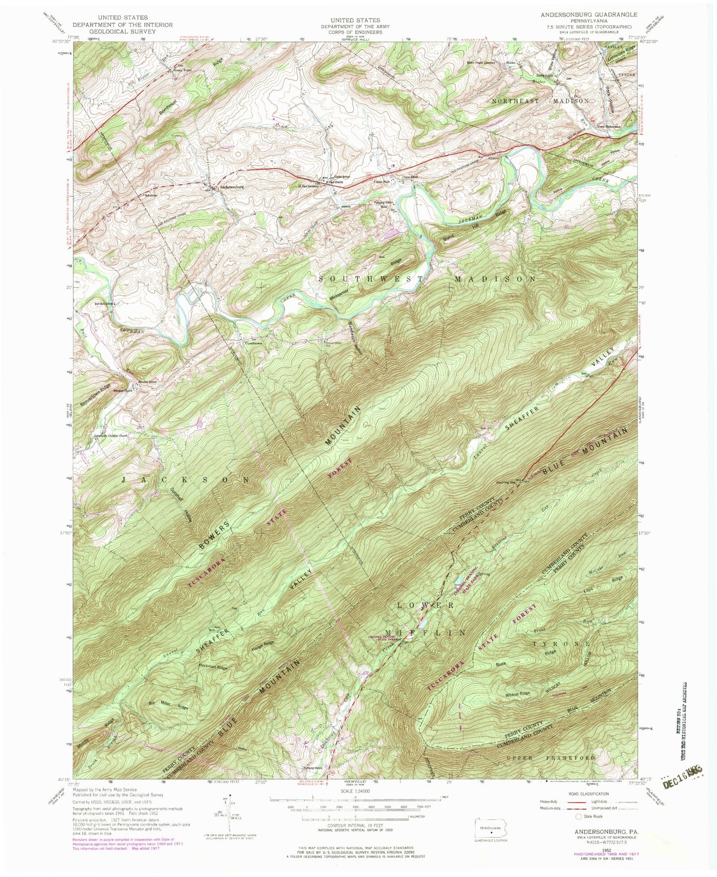
Historical USGS topographic quad map of Andersonburg in the state of Pennsylvania. Typical map scale is 1:24,000, but may vary for certain years, if available. Print size: 24" x 27"
This quadrangle is in the following counties: Cumberland, Perry.
The map contains contour lines, roads, rivers, towns, and lakes. Printed on high-quality waterproof paper with UV fade-resistant inks, and shipped rolled.
Contains the following named places: Andersonburg, Bernheisel Ridge, Bill Miller Ridge, Bowers Mountain, Buck Ridge, Bull Run, Burnt Hill Ridge, Centre, Centre Church, Community Christian Church, Doubling Gap, Emory Chapel Cemetery, Gutshall Hollow, Heckman Ridge, Hedge Ridge, Manassa Church, Manassa School, Messamer Ridge, Rock Hollow, Saint Paul Cemetery, Saint Paul Church, Shaw Hollow, South Branch Laurel Run, Stambaugh Hollow, Wildcat Hollow, Wildcat Ridge, Lays Ridge, Lake Kimberly Dam, Colonel Denning State Park, Divide School, Center School (historical), Sundy Place, Flat Rock, Chimney Rocks, Bixler, Cisna Run, Couchtown, Fort Robertson, Stony Point, Lightner Trail, Cider Path, Old Blain Trail, Pioneer Cemetery, Woodburn Trail, Bill Miller Trail, Flat Rock Trail, Doubling Gap, Cisna Run, Bull Run School, Cisna School, Clarks School, Green Grove School, Township of Southwest Madison, Doubling Gap Post Office (historical)