
MyTopo
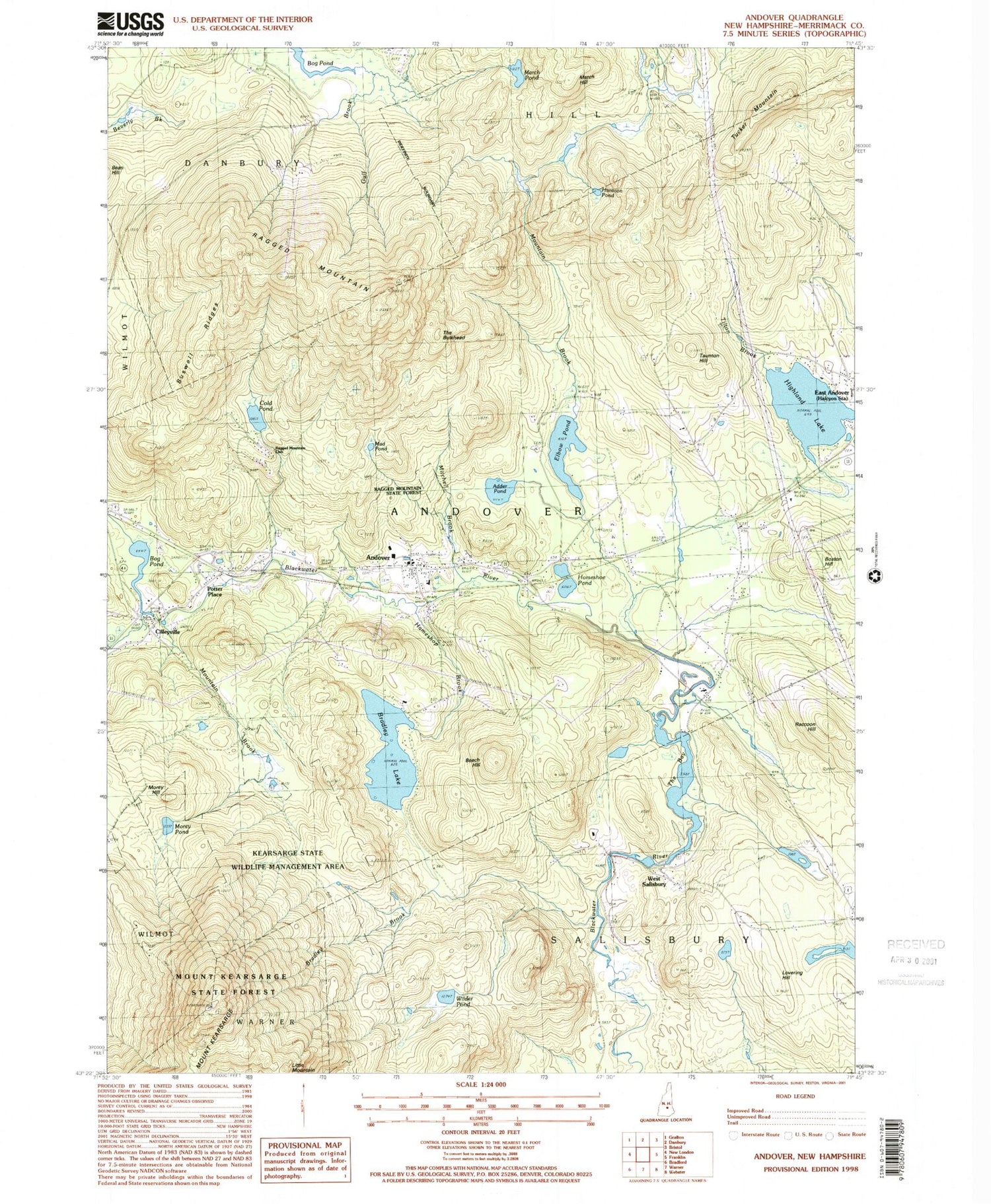
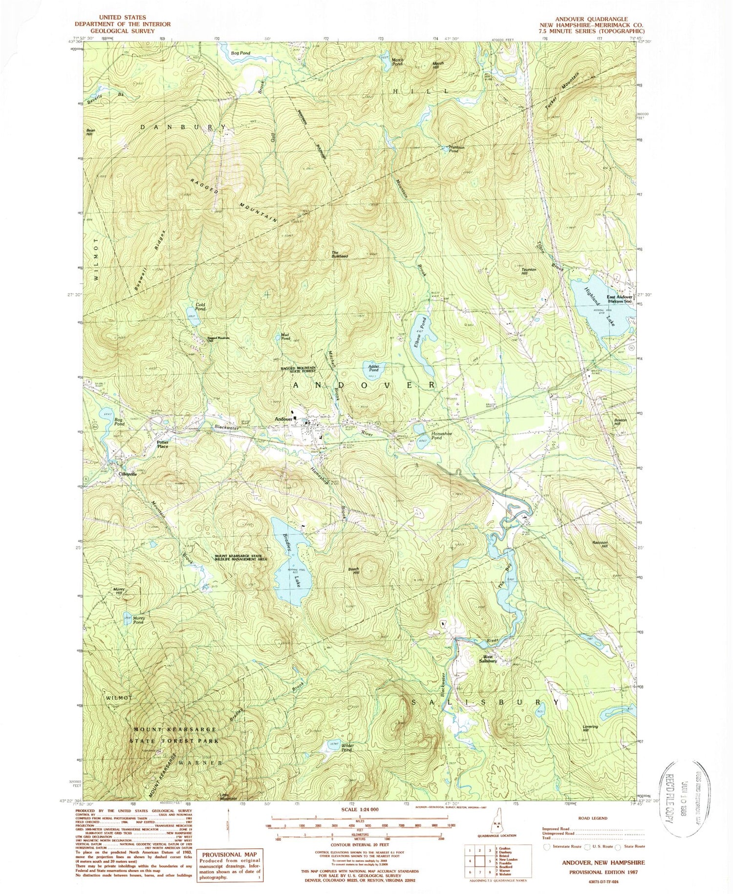
Classic USGS Andover New Hampshire 7.5'x7.5' Topo Map
Couldn't load pickup availability
Historical USGS topographic quad map of Andover in the state of New Hampshire. Typical map scale is 1:24,000, but may vary for certain years, if available. Print size: 24" x 27"
This quadrangle is in the following counties: Merrimack.
The map contains contour lines, roads, rivers, towns, and lakes. Printed on high-quality waterproof paper with UV fade-resistant inks, and shipped rolled.
Contains the following named places: Adder Pond, Andover, Beech Hill, Bog Pond, Boston Hill, Bradley Brook, Bradley Lake, Buswell Ridges, Cascade Brook, Cilleyville, Cold Pond, Elbow Pond, Frazier Brook, Gulf Brook, Hameshop Brook, Highland Lake, Horseshoe Pond, Huntoon Pond, Mount Kearsarge, Lake View Cemetery, Little Mountain, Lovering Hill, March Hill, March Pond, Mitchell Brook, Morey Hill, Morey Pond, Mount Kearsarge State Forest Park, Mountain Brook, Mountain Brook, Mud Pond, Potter Place, Raccoon Hill, Ragged Mountain, Ragged Mountain State Forest, Taunton Hill, The Bay, The Bulkhead, Tilton Brook, Tucker Mountain, West Salisbury, Wilder Pond, Wilmot Trail, The Pinnacle, Ragged Mountains, Ragged Mountain Club, Town of Andover, Town of Salisbury, Johnson Mill Dam, Bradley Lake Dam, Morey Pond Dam, Andover Elementary School, Andover Post Office, Childrens Camp, Cilleyville Bridge, Immaculate Conception Church, Keniston Bridge, Mount Kearsarge State Wildlife Management Area, Proctor Academy, Ragged Mountain Ski Area, Andover Fire Department, Andover Police Department


