MyTopo
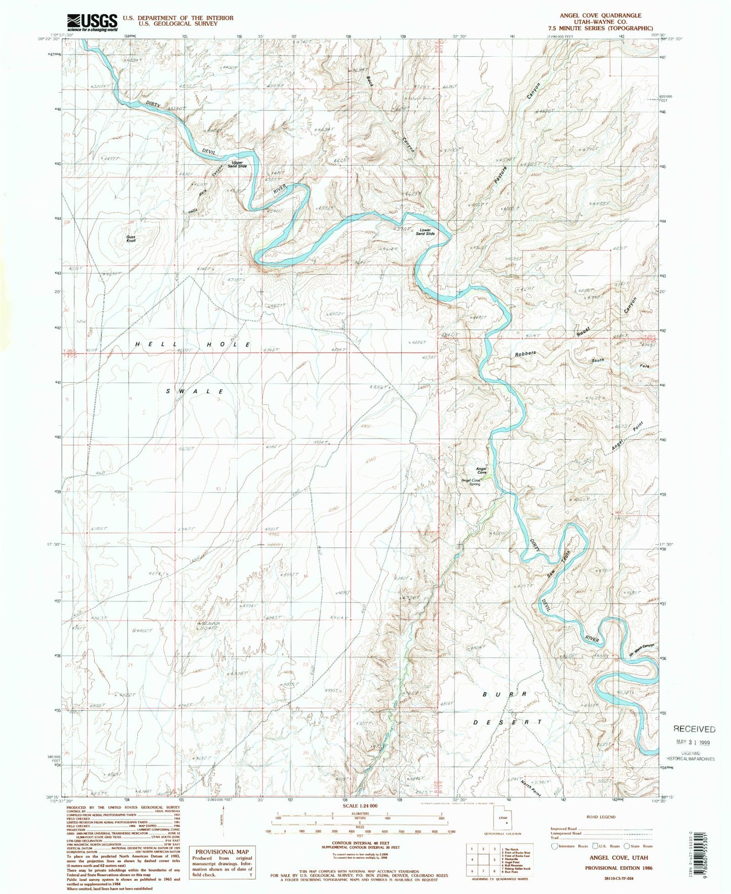
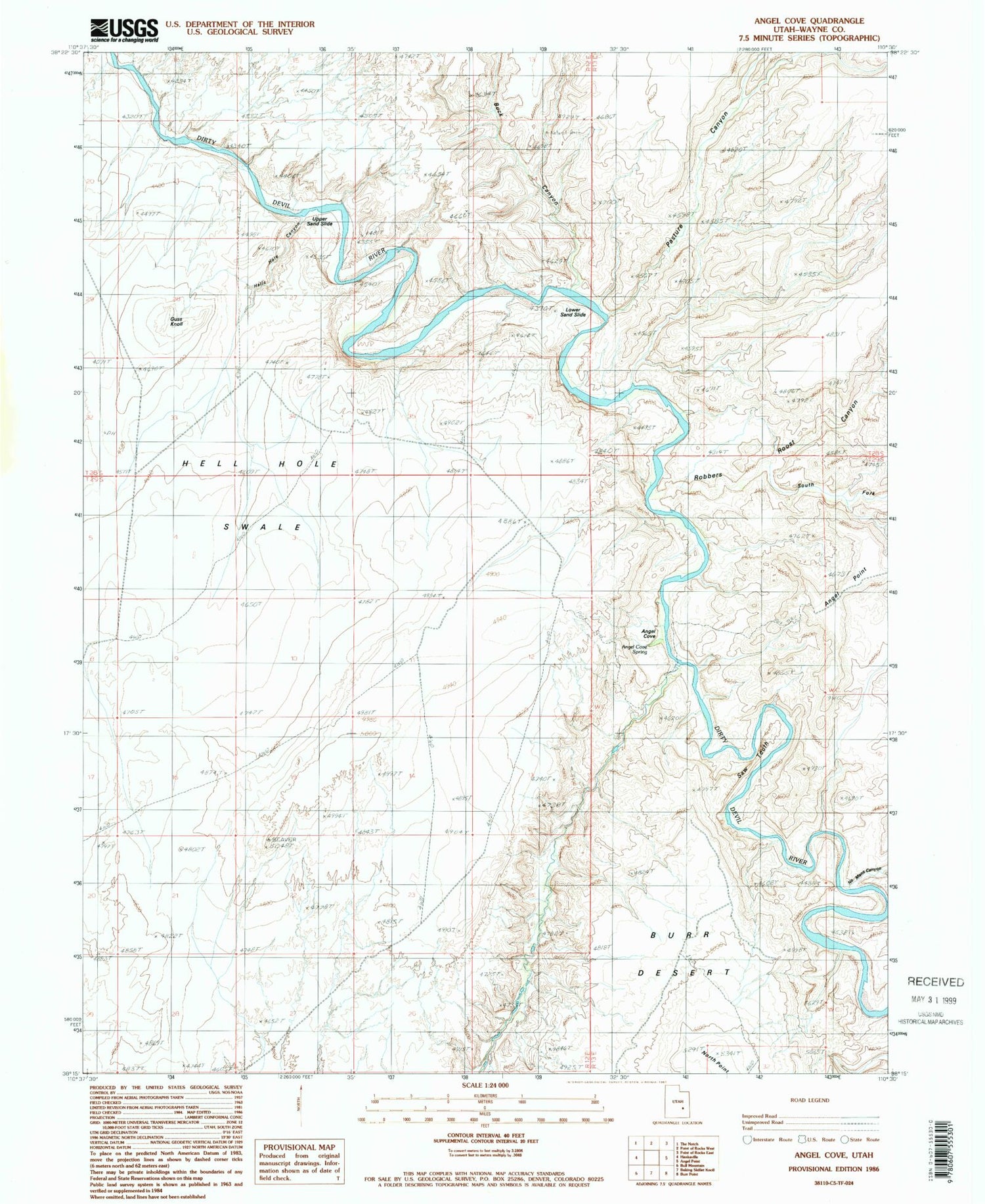
Classic USGS Angel Cove Utah 7.5'x7.5' Topo Map
Regular price
$16.95
Regular price
Sale price
$16.95
Unit price
per
Couldn't load pickup availability
Historical USGS topographic quad map of Angel Cove in the state of Utah. Typical map scale is 1:24,000, but may vary for certain years, if available. Print size: 24" x 27"
This quadrangle is in the following counties: Wayne.
The map contains contour lines, roads, rivers, towns, and lakes. Printed on high-quality waterproof paper with UV fade-resistant inks, and shipped rolled.
Contains the following named places: Angel Cove, Angel Cove Spring, Beaver Canyon, Buck Canyon, Guss Knoll, Hell Hole Swale, Lower Sand Slide, No Mans Canyon, North Point, Pasture Canyon, Robbers Roost Canyon, Saw Tooth, South Fork Robbers Roost Canyon, Upper Sand Slide, Beaver Wash