MyTopo
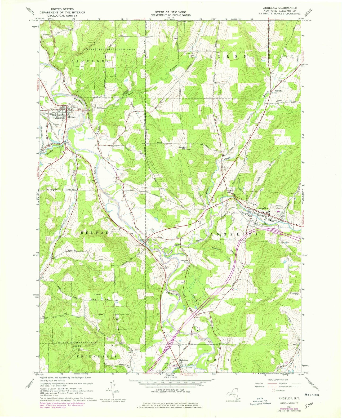
Classic USGS Angelica New York 7.5'x7.5' Topo Map
Couldn't load pickup availability
Historical USGS topographic quad map of Angelica in the state of New York. Map scale may vary for some years, but is generally around 1:24,000. Print size is approximately 24" x 27"
This quadrangle is in the following counties: Allegany.
The map contains contour lines, roads, rivers, towns, and lakes. Printed on high-quality waterproof paper with UV fade-resistant inks, and shipped rolled.
Contains the following named places: Allegany County, Allegany County Landfill, Allen Cemetery, Angelica, Angelica Creek, Angelica Fire and Rescue Department, Angelica Free Library, Angelica Park Circle Historic District, Angelica Post Office, Angelica United Methodist Church, Aristotle, Baker Creek, Bartlett Memorial Library, Basswood Hill Farm, Belfast, Belfast Census Designated Place, Belfast Fire Department, Belfast Post Office, Belfast Town Hall, Belfast United Methodist Church, Belvidere, Black Creek, Brentwood Camp, Central School, Chamberlain Cemetery, Christ Church, Christ Church Cemetery, Erb Acres Airport, Evergreen Trails Campground, First Baptist Church, First Free Methodist Church, Grace Episcopal Church, Hyland Landfill, Jacobs Hill, Nineteen Gully, Riverside Cemetery, Saint Patrick's Roman Catholic Church, Town of Angelica, Transit Bridge, Transit Bridge Church, Until the Day Dawn Cemetery, Van Campen Creek, Village of Angelica, Village Park, Wellspring Ministries, White Creek, Wigwam Creek, ZIP Code: 14711