MyTopo
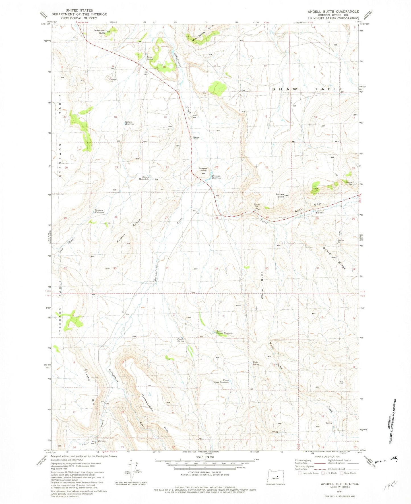
Classic USGS Angell Butte Oregon 7.5'x7.5' Topo Map
Couldn't load pickup availability
Historical USGS topographic quad map of Angell Butte in the state of Oregon. Map scale may vary for some years, but is generally around 1:24,000. Print size is approximately 24" x 27"
This quadrangle is in the following counties: Crook.
The map contains contour lines, roads, rivers, towns, and lakes. Printed on high-quality waterproof paper with UV fade-resistant inks, and shipped rolled.
Contains the following named places: Angell Butte, Angell Ranch, Axtell Gap, Brennan Dam, Brennan Ranch, Brennan Reservoir, Coffee Creek, Coyote Spring, Davin Spring, Dorschied Butte, Forbes Butte, Gollum Reservoir, Grindstone Rim, Halfway Waterhole, Hardin, Hardin Post Office, Kuhn Ranch, Layton Dam Number 2, Layton Reservoir Number 2, Lower Coyote Reservoir, Oberg Ridge, Ryegrass Table, Scareoff Point, Shaw Table, Stump Waterhole, Trail Basin, Trout Creek, Upper Coyote Reservoir, Wade Spring, White Butte Creek, Yreka Rim