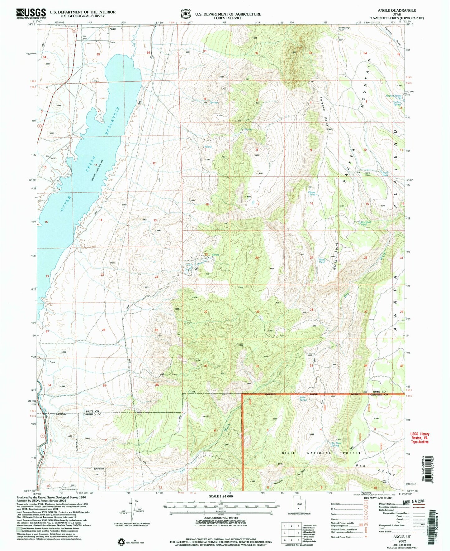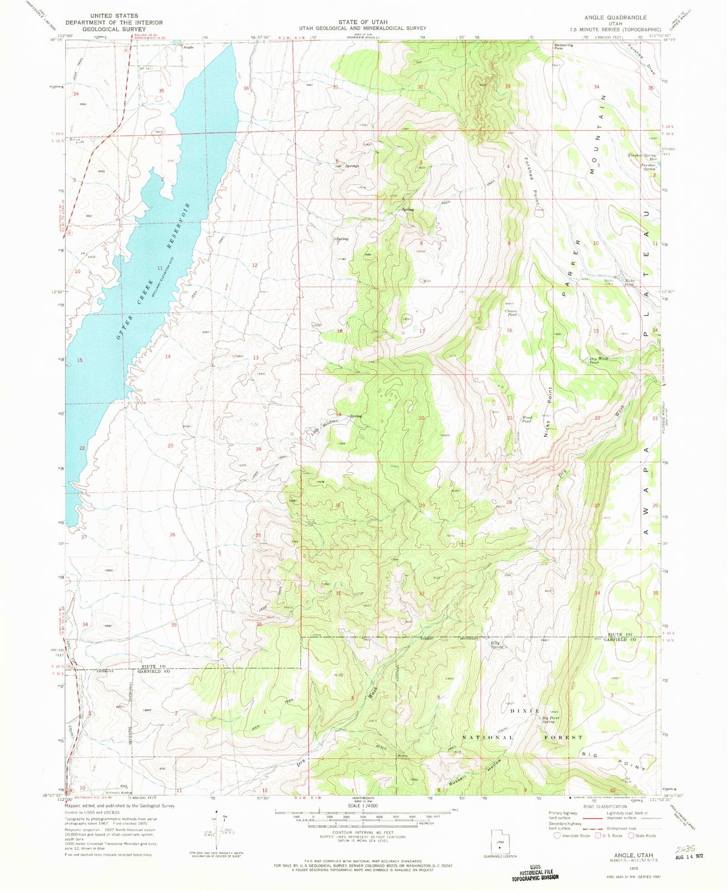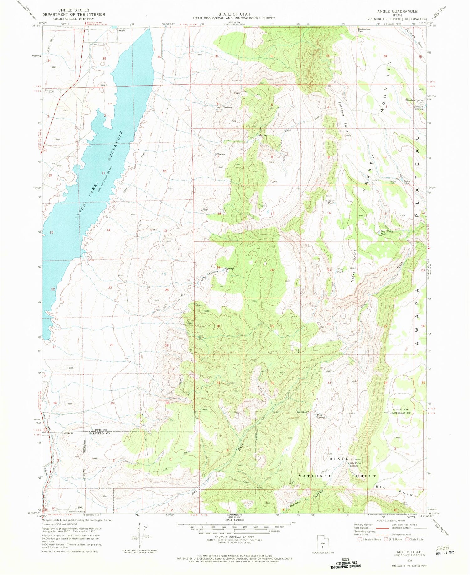
MyTopo
Classic USGS Angle Utah 7.5'x7.5' Topo Map
Couldn't load pickup availability
Historical USGS topographic quad map of Angle in the state of Utah. Map scale may vary for some years, but is generally around 1:24,000. Print size is approximately 24" x 27"
This quadrangle is in the following counties: Garfield, Piute.
The map contains contour lines, roads, rivers, towns, and lakes. Printed on high-quality waterproof paper with UV fade-resistant inks, and shipped rolled.
Contains the following named places: Angle, Bedspring Pass, Big Point, Big Point Spring, Billy Spring, Black Burn Trail, Clause Pond, Dry Wash Pond, East Fork Canal, Forshea Point, Forshea Spring, Forshea Spring Reservoir, Little Meadows, Nicks Cabin, Nicks Point, Nicks Pond, Otter Creek, Otter Creek Reservoir, Wood Pond