
MyTopo
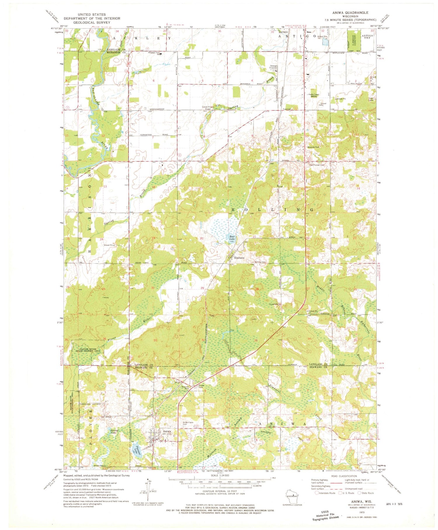
Classic USGS Aniwa Wisconsin 7.5'x7.5' Topo Map
Couldn't load pickup availability
Historical USGS topographic quad map of Aniwa in the state of Wisconsin. Map scale may vary for some years, but is generally around 1:24,000. Print size is approximately 24" x 27"
This quadrangle is in the following counties: Langlade, Marathon, Shawano.
The map contains contour lines, roads, rivers, towns, and lakes. Printed on high-quality waterproof paper with UV fade-resistant inks, and shipped rolled.
Contains the following named places: Aniwa, Aniwa Post Office, Antigo Air Force Station, Antigo City Landfill, Bear Lake, Eau Claire Valley School, Elmhurst, Elmhurst Cemetery, Elmwood Cemetery, Fernwood School, Hall Pioneer Cemetery, Mattoon Swamp, Oldens Creek, Pleasant Lake, Pleasant View Elementary School, Rolling Townhall, Saint Boniface Cemetery, Spring Lake, Sunnyside School, Town of Rolling, Village of Aniwa, WATK-AM (Antigo), ZIP Code: 54409


