MyTopo
Classic USGS Annabella Utah 7.5'x7.5' Topo Map
Couldn't load pickup availability
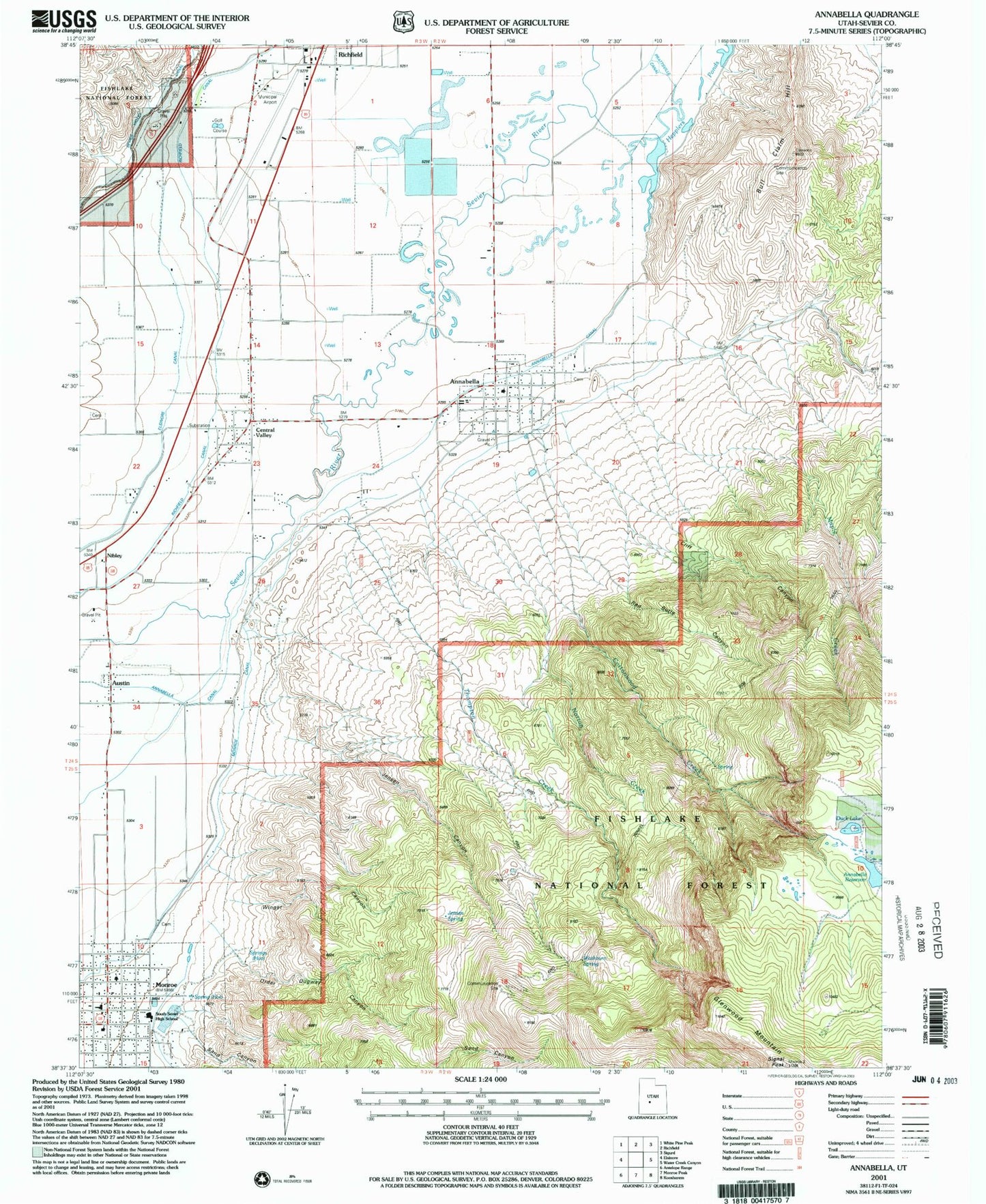
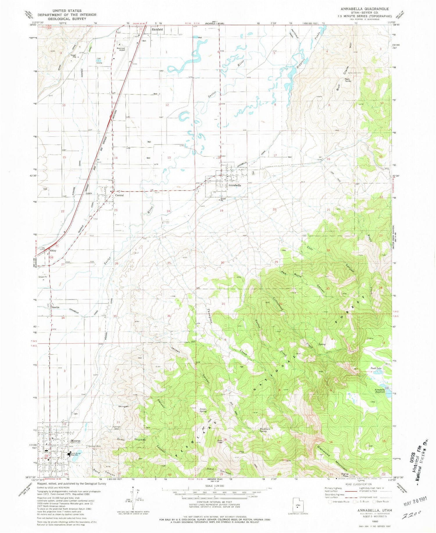
Historical USGS topographic quad map of Annabella in the state of Utah. Map scale may vary for some years, but is generally around 1:24,000. Print size is approximately 24" x 27"
This quadrangle is in the following counties: Sevier.
The map contains contour lines, roads, rivers, towns, and lakes. Printed on high-quality waterproof paper with UV fade-resistant inks, and shipped rolled.
Contains the following named places: Annabella, Annabella Canal, Annabella Cemetery, Annabella Dam, Annabella Post Office, Annabella Reservoir, Austin, Bull Claim Hill, Central Valley, Central Valley Cemetery, Cliff Canyon, Cottonwood Creek, Duck Lake, Elisnore Canal, Glenwood Mountain, Hepplers Ponds, Hot Springs, Jensen, Jensen Canyon, Jensen Spring, Maple Creek, Monroe, Monroe Canal, Monroe City Cemetery, Monroe Elementary School, Monroe Hot Springs Resort, Monroe Post Office, Nibley, Norton Creek, Order Dugway Canyon, Red Butte Canyon, Richfield Interagency Fire Center, Richfield Municipal Airport, Sand Canyon, Signal Peak, South Sevier Middle School, The Church of Jesus Christ of Latter Day Saints, Thompson Creek, Town of Annabella, Town of Central Valley, Washburn Spring, Winget Canyon, Winkel Bob Trail, ZIP Codes: 84711, 84730