MyTopo
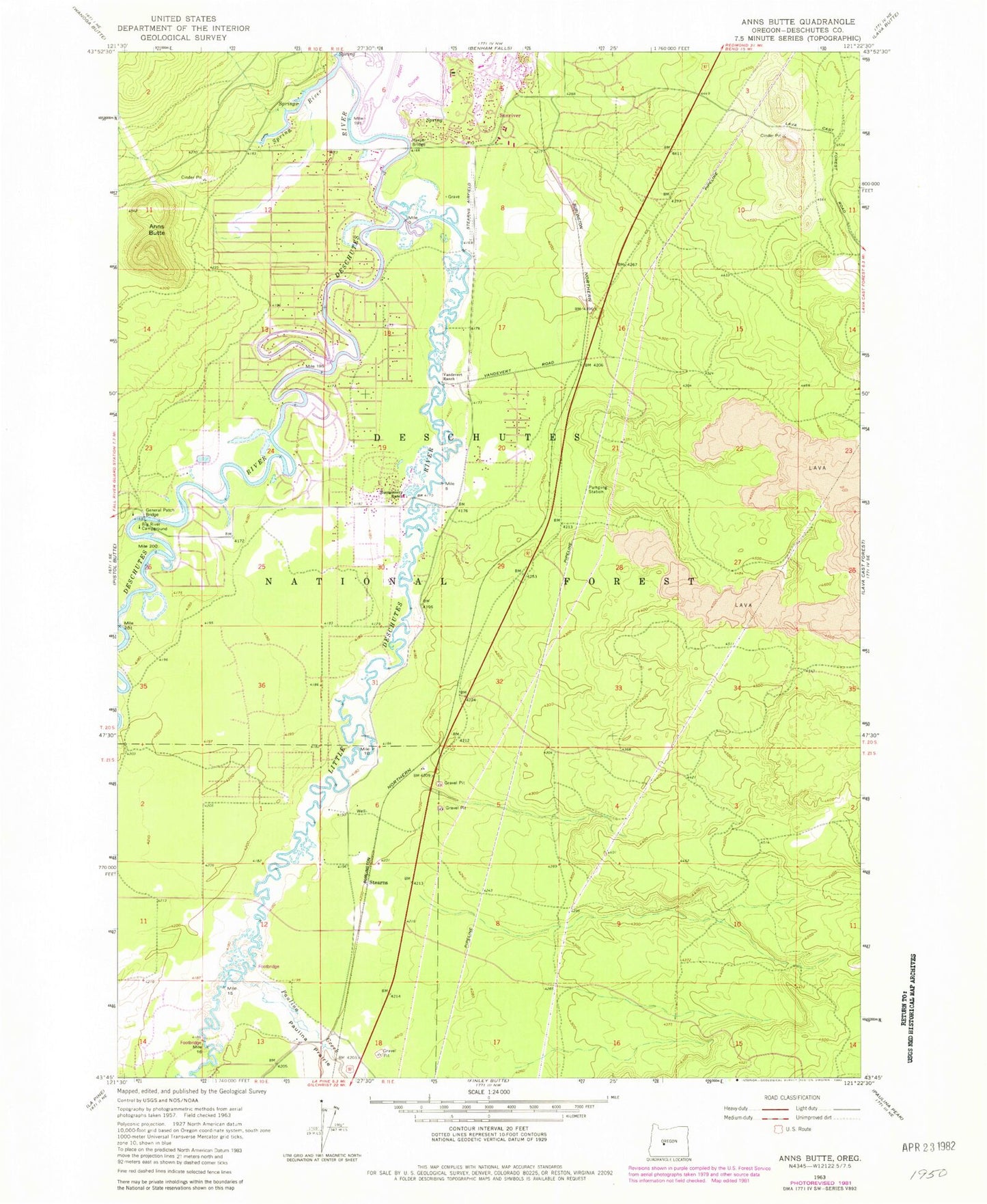
Classic USGS Anns Butte Oregon 7.5'x7.5' Topo Map
Couldn't load pickup availability
Historical USGS topographic quad map of Anns Butte in the state of Oregon. Map scale may vary for some years, but is generally around 1:24,000. Print size is approximately 24" x 27"
This quadrangle is in the following counties: Deschutes.
The map contains contour lines, roads, rivers, towns, and lakes. Printed on high-quality waterproof paper with UV fade-resistant inks, and shipped rolled.
Contains the following named places: Anns Butte, Big River Campground Boat Ramp, Big River Recreation Site, Camp Abbot, Camp Abbot Bridge, Camp Abbot Buttes, Carlisle Post Office, Crater Post Office, Crosswater Golf Course, General Patch Bridge, Harper, Harper Bridge, Harper Cemetery, Harpers Bridge Boat Launch, La Pine Fire Department Station 102, Lava Post Office, Little Deschutes River, Montgomery Bridge, Montgomery Ranch, Oregon Water Wonderland Unit II Sanitary District Lagoon, Paulina Creek, Robert D. Maxwell Veterans Memorial Bridge, Shevlin, Shevlin Hixon Junction, Spring River, Stearns, Stearns Airfield, Sunriver Area Public Library, Sunriver Post Office, Sunriver Resort Great Hall Conference Center, Three Rivers, Three Rivers Census Designated Place, Three Rivers Elementary School, Vandevert Ranch, Wanoga Siding, ZIP Code: 97707