
MyTopo
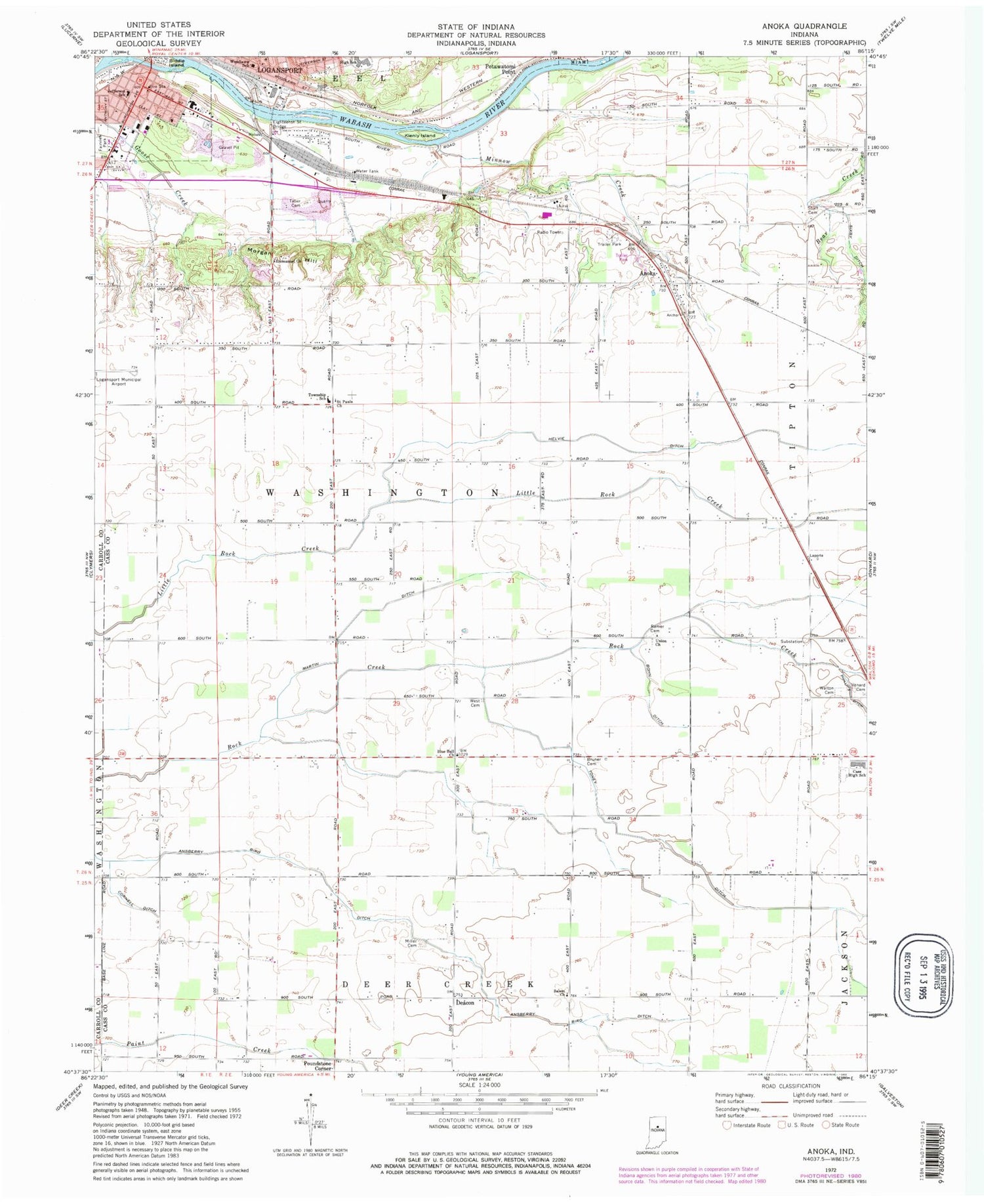
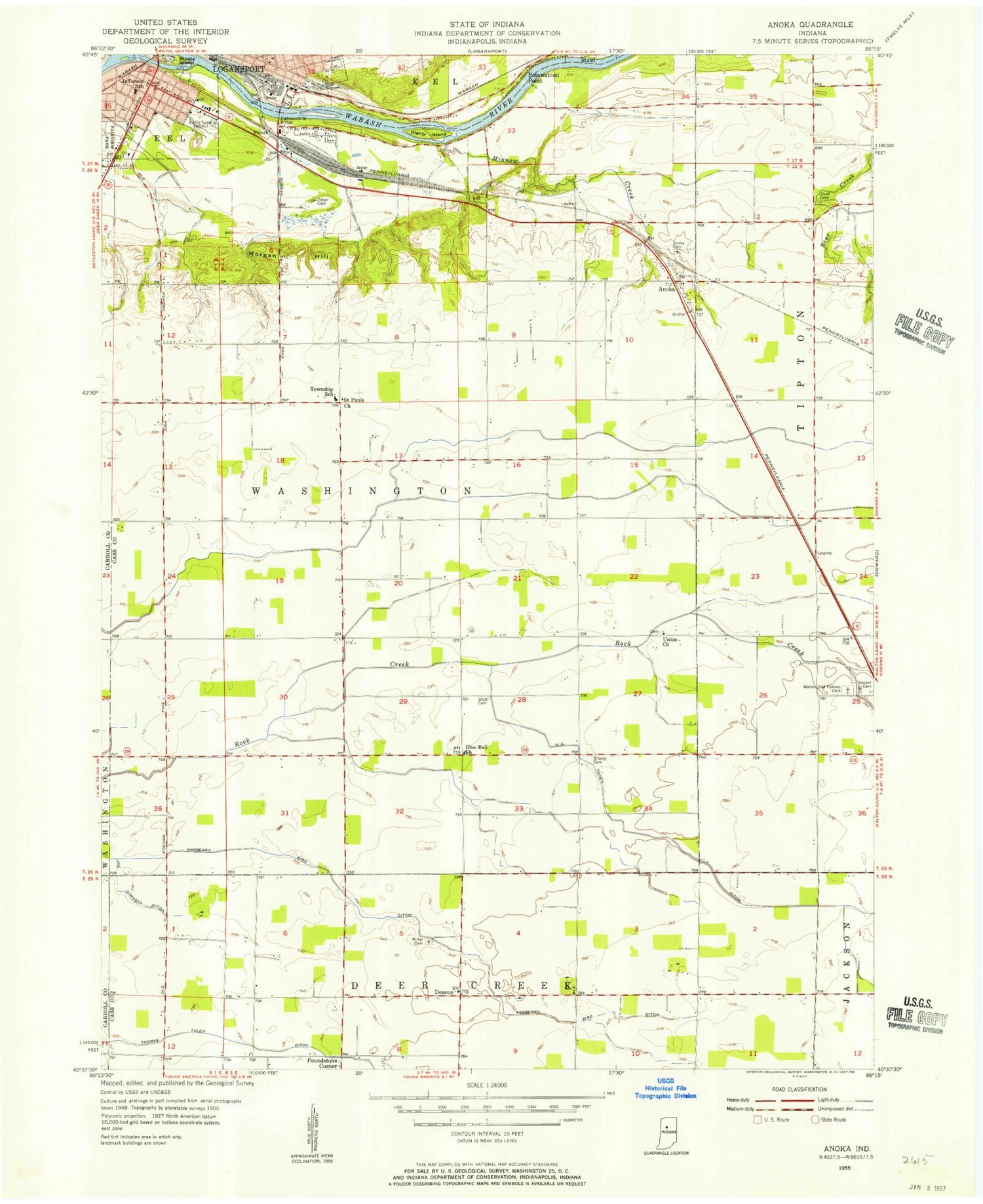
Classic USGS Anoka Indiana 7.5'x7.5' Topo Map
Couldn't load pickup availability
Historical USGS topographic quad map of Anoka in the state of Indiana. Map scale may vary for some years, but is generally around 1:24,000. Print size is approximately 24" x 27"
This quadrangle is in the following counties: Carroll, Cass.
The map contains contour lines, roads, rivers, towns, and lakes. Printed on high-quality waterproof paper with UV fade-resistant inks, and shipped rolled.
Contains the following named places: Anoka, Ansberry Bird Ditch, Biddle Island, Blue Ball Church, Bohn Ditch, Bruner Cemetery, City of Logansport, Cornell Ditch, Cromley Ditch, Deacon, Eighteenth Street Bridge, Emmanuel Church, Fairview Park, Helvie Ditch, Jefferson School, Kienly Island, Lewis Cass Junior-Senior High School, Logansport City Fire Department Station 4, Logansport Community High School, Martin Ditch, Miller Cemetery, Minnow Creek, Morgan Hill, Potawatomi Point, Poundstone Corner, Ramer Cemetery, Saint Pauls Church, Salem Church, Shaff Cemetery, Taber Cemetery, Tolen Ditch, Township of Washington, Turnpaugh Field, Union Church, Venard Cemetery, Walton Cemetery, West Cemetery, Woodlawn School, ZIP Code: 46994


