
MyTopo
Classic USGS Ansley Alabama 7.5'x7.5' Topo Map
Couldn't load pickup availability
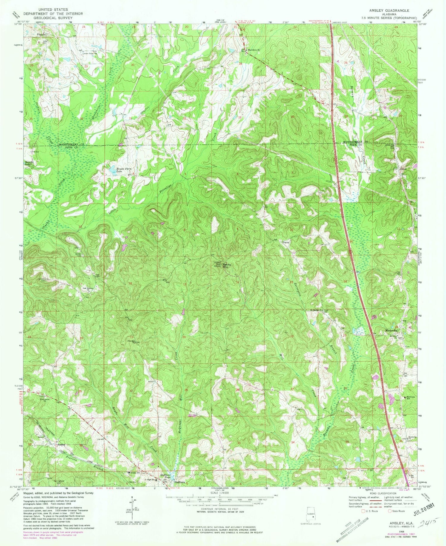
Historical USGS topographic quad map of Ansley in the state of Alabama. Map scale may vary for some years, but is generally around 1:24,000. Print size is approximately 24" x 27"
This quadrangle is in the following counties: Montgomery, Pike.
The map contains contour lines, roads, rivers, towns, and lakes. Printed on high-quality waterproof paper with UV fade-resistant inks, and shipped rolled.
Contains the following named places: Ansley, Ansley Church, Ansley School, Antioch Cemetery, Antioch Church of Christ, Becks Mountain, Belsor Cemetery, Bethel Church, Bethlehem Church, Brooks Farm Lake, Center Point, Center Point Church, Curry, Friendship, Friendship Church, Greenbrier Creek, Harmony, Harmony Church, Harmony Elementary School, Jackson Creek, Little Patsaliga Creek, Macedonia Church, Macedonia School, McQuagge Mill Creek, Meeksville, Meeksville Volunteer Fire Department, Menefee Lake, Mill Creek, Mount Gilead Cemetery, Mount Moriah Cemetery, Mount Moriah Church, Mount Olive Church, Oak Bowery, Oak Bowery Church of Christ, Orion, Orion Cemetery, Orion Church, Orion Institute, Pine Grove Cemetery, Pine Grove Church, Pine Hill Church, Pisgah, Pisgah Church, Saint James Church, Sanders Cemetery, Shellhorn, Shellhorn Junior High School, Shellhorn Pond, Springfield Cemetery, Surveyors Branch


