MyTopo
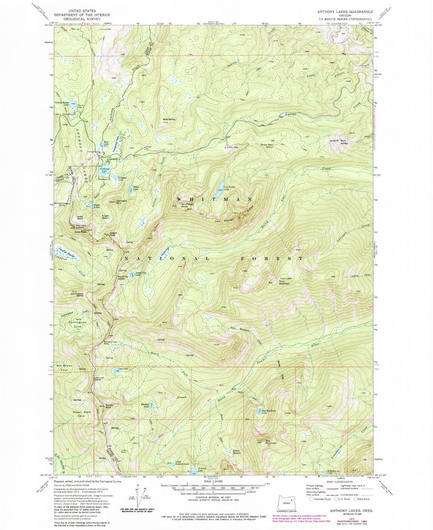
Classic USGS Anthony Lakes Oregon 7.5'x7.5' Topo Map
Couldn't load pickup availability
Historical USGS topographic quad map of Anthony Lakes in the state of Oregon. Typical map scale is 1:24,000, but may vary for certain years, if available. Print size: 24" x 27"
This quadrangle is in the following counties: Baker, Grant, Union.
The map contains contour lines, roads, rivers, towns, and lakes. Printed on high-quality waterproof paper with UV fade-resistant inks, and shipped rolled.
Contains the following named places: Antone Burn, Angell Basin, Angell Peak, Anthony Lake, Anthony Lakes, Bear Butte, Black Lake, Bobier Meadow, Bobier Slide, Brown Bear Spring, Cunningham Cove, Cunningham Saddle, Dutch Flat, Dutch Flat Lake, Dutch Flat Saddle, Floodwater Flats, Grande Ronde Lake, Gunsight Mountain, Hoffer Lakes, Horse Creek, Lees Peak, Lilypad Lake, Little Summit Lake, Lost Lake, Lost Lake Saddle, Loy Mine, Meadow Lake, Mount Ruth Cove, Mud Lake, Nip and Tuck Pass, North Fork North Powder River, Parker Creek, Red Mountain, Red Mountain Lake, Mount Ruth, Summit Lake, The Lakes Lookout, The Lakes Lookout Spring, Twin Mountain, Twin Mountain Creek, Van Patten Butte, Van Patten Lake, Van Patten Ridge, Van Patten Lake Dam, Station Spring, Tumbledown Spring, Tumbledown Creek, Anthony Lakes Sno-Park, Killamacue Dam, Hoffer Butte, Little Alps, Crawfish Meadow, Anthony Lakes Shoreline Recreation Site, Anthony Lakes Forest Service Station, Mud Lake Recreation Site, Grande Ronde Lake Recreation Site, Elkhorn Mountains, Anthony Lake Campground, Grande Ronde Lake Campground Boat Ramp, North Powder Wild and Scenic River