
MyTopo
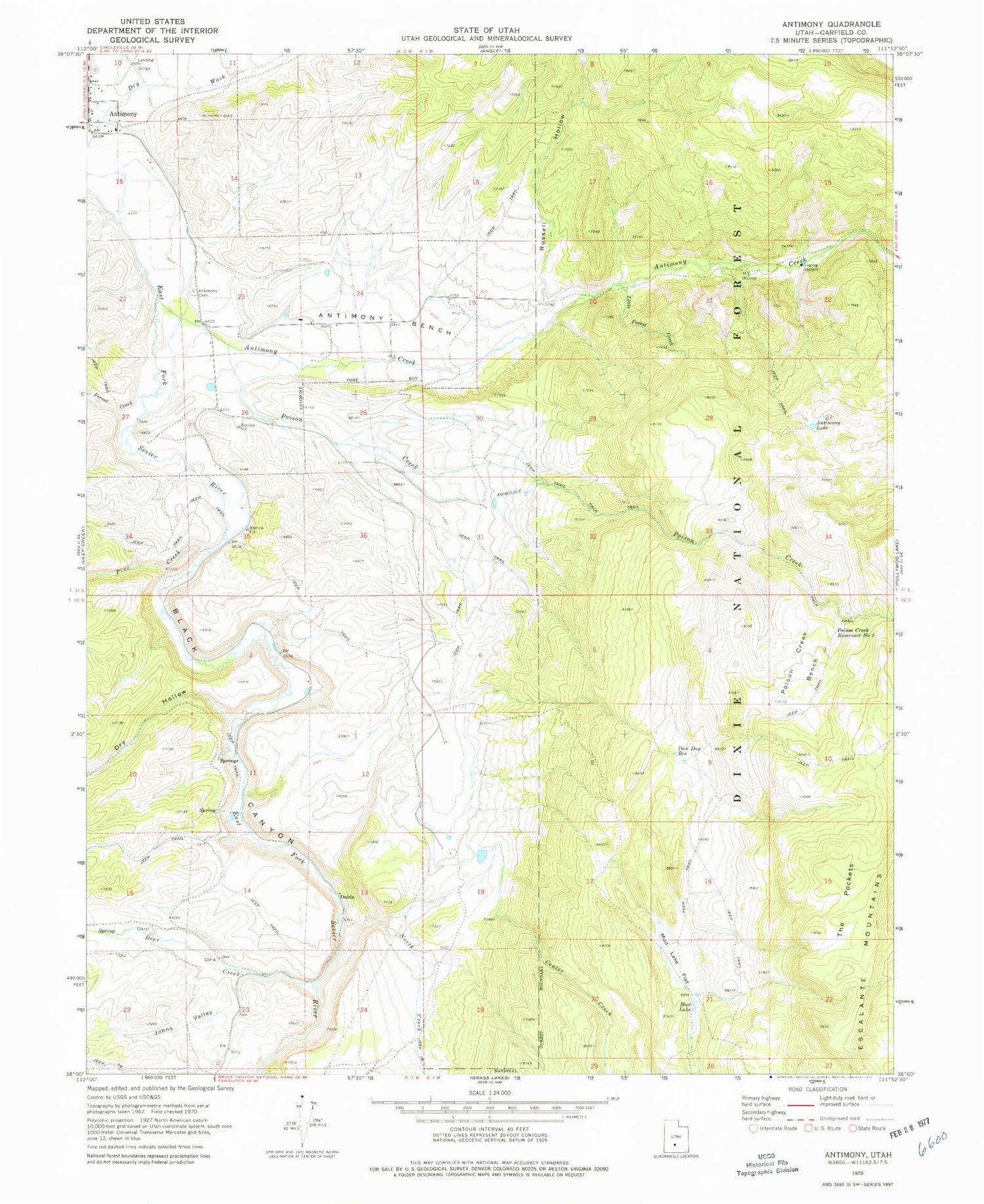
Classic USGS Antimony Utah 7.5'x7.5' Topo Map
Couldn't load pickup availability
Historical USGS topographic quad map of Antimony in the state of Utah. Map scale may vary for some years, but is generally around 1:24,000. Print size is approximately 24" x 27"
This quadrangle is in the following counties: Garfield.
The map contains contour lines, roads, rivers, towns, and lakes. Printed on high-quality waterproof paper with UV fade-resistant inks, and shipped rolled.
Contains the following named places: Antimony, Antimony Bench, Antimony Cemetery, Antimony Creek, Antimony Elementary School, Antimony Lake, Antimony Volunteer Fire Department, Black Canyon, Center Creek, Dan Day Reservoir, Deer Creek, Dry Hollow, Forest Creek, Johns Valley, Little Forest Creek, Mud Lake, Mud Lake Flat, North Creek, Osiris, Pine Creek, Poison Creek, Poison Creek Bench, Poison Creek Reservoir Number 1, Poison Creek Reservoir Number 2, Russell Hollow, The Church of Jesus Christ of Latter Day Saints, The Pockets, Town of Antimony


