MyTopo
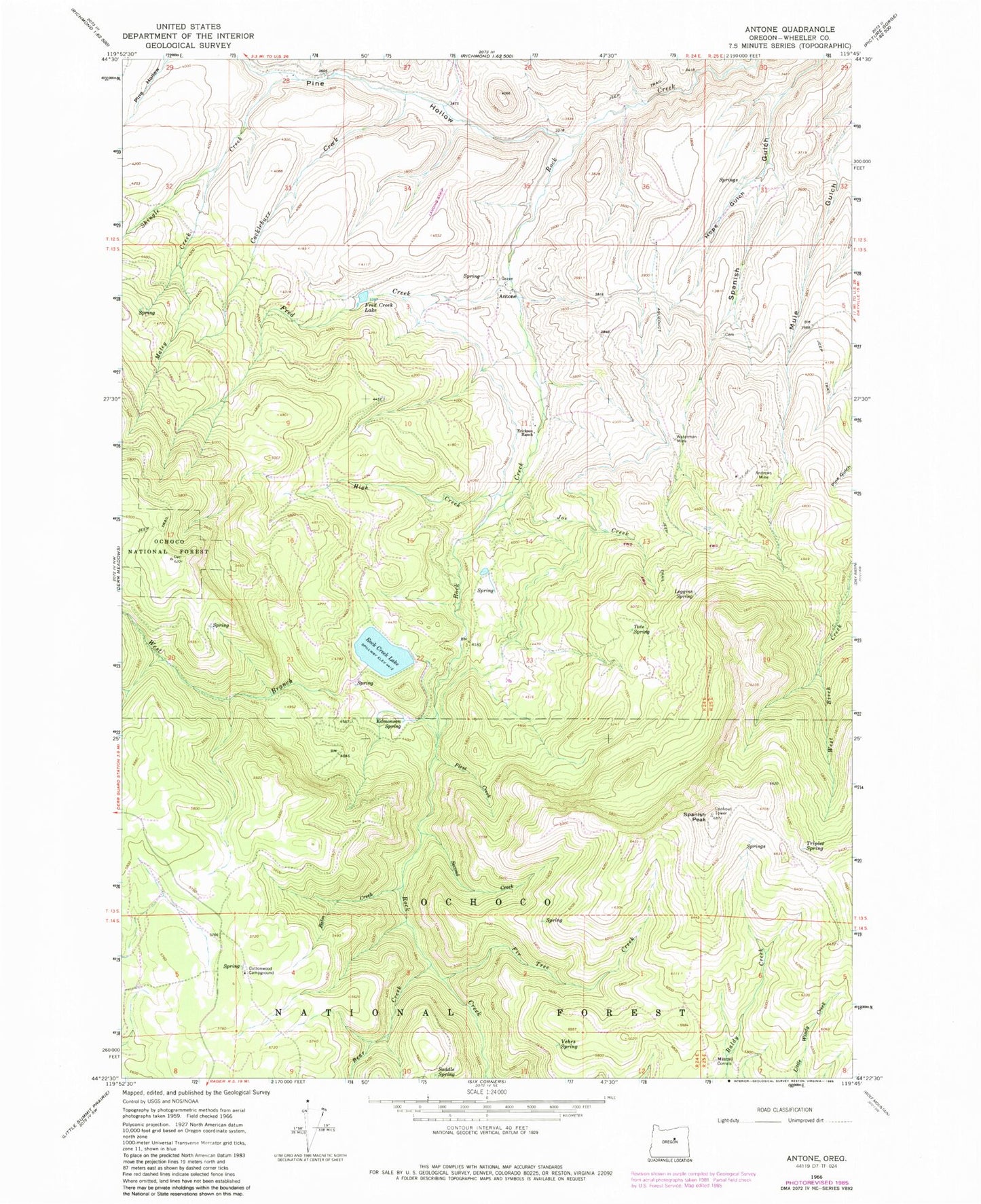
Classic USGS Antone Oregon 7.5'x7.5' Topo Map
Couldn't load pickup availability
Historical USGS topographic quad map of Antone in the state of Oregon. Map scale may vary for some years, but is generally around 1:24,000. Print size is approximately 24" x 27"
This quadrangle is in the following counties: Wheeler.
The map contains contour lines, roads, rivers, towns, and lakes. Printed on high-quality waterproof paper with UV fade-resistant inks, and shipped rolled.
Contains the following named places: Andrews Mine, Antone, Antone Post Office, Antone Ranch Airport, Balm Creek, Bear Creek, Buck Pasture, Cockleburr Creek, Cottonwood Recreation Site, Cottonwood Spring, Edmonson Spring, Erickson Ditch, Erickson Ranch, Fir Tree Creek, First Creek, Fred Creek, Fred Creek Lake, High Creek, Hope Gulch, Joe Creek, Leggins Spring, Maley Creek, Mary Waterman Grave, Mascall Corralls, Nelson Place, Philling-McFadden Ditch, Pine Gulch, Pine Hollow, Rock Creek Lake, Rock Creek Lake Dam, Saddle Spring, Second Creek, Shingle Creek, Spanish Gulch Cemetery, Spanish Peak, Tate Spring, Ted Glover Spring, Triplet Spring, Vehrs Spring, Waterman Mine, West Branch Rock Creek