
MyTopo
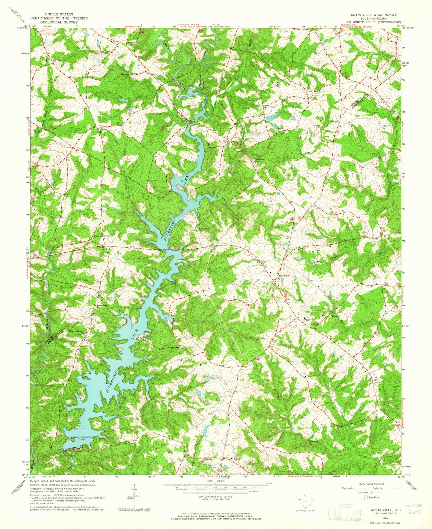
Classic USGS Antreville South Carolina 7.5'x7.5' Topo Map
Couldn't load pickup availability
Historical USGS topographic quad map of Antreville in the state of South Carolina. Map scale may vary for some years, but is generally around 1:24,000. Print size is approximately 24" x 27"
This quadrangle is in the following counties: Abbeville, Anderson.
The map contains contour lines, roads, rivers, towns, and lakes. Printed on high-quality waterproof paper with UV fade-resistant inks, and shipped rolled.
Contains the following named places: Abbeville County Fire Department Antreville, Abbeville County Fire Department McGill Substation 3, Antreville, Antreville Census Designated Place, Antreville School, Antreville-Lowndesville Division, Asaville School, Bear Creek, Beaver Creek, Bells Chapel Cemetery, Bells Church, Bowen School, Carswell Baptist Cemetery, Carswell Baptist Church, Carswell School, Cedar Grove School, Dry Hollow School, First Creek, First Creek Baptist Church, Governors Creek, H Patterson Pond Dam D-3030, Hall - Cromer Cemetery, Hall Pond Dam D-3136, Hencoop Creek, J W Wilson Pond Dam D-3031, Jackson Rosenwald School, Jacksons Mill, Jordan Creek, Lake Secession, Lake Secession Census Designated Place, Lee Shoals Church, Lees Shoals, Leverett Cemetery, McCaw Poultry Farm, Milfords Upper Mill, Mulberry Creek, R Watson Pond Dam D-3129, Rock Hill School, Rocky River Baptist Church, Rocky River Cemetery, Rocky River Church, Secession Lake, Shiloh Cemetery, Shiloh United Methodist Church, South Carolina Noname 01007 Dam, Storeville, Storeville Post Office, Varennes Church, W T Wilson Pond Dam D-3032, Wilson Creek Number 1 Church, Wilson Creek Number 2 Church


