
MyTopo
Classic USGS Antrim Pennsylvania 7.5'x7.5' Topo Map
Couldn't load pickup availability
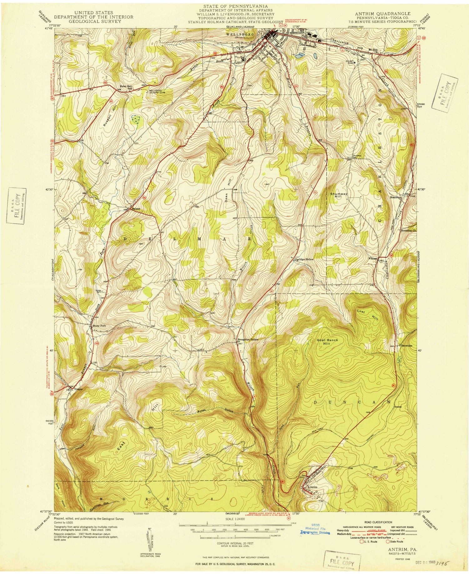
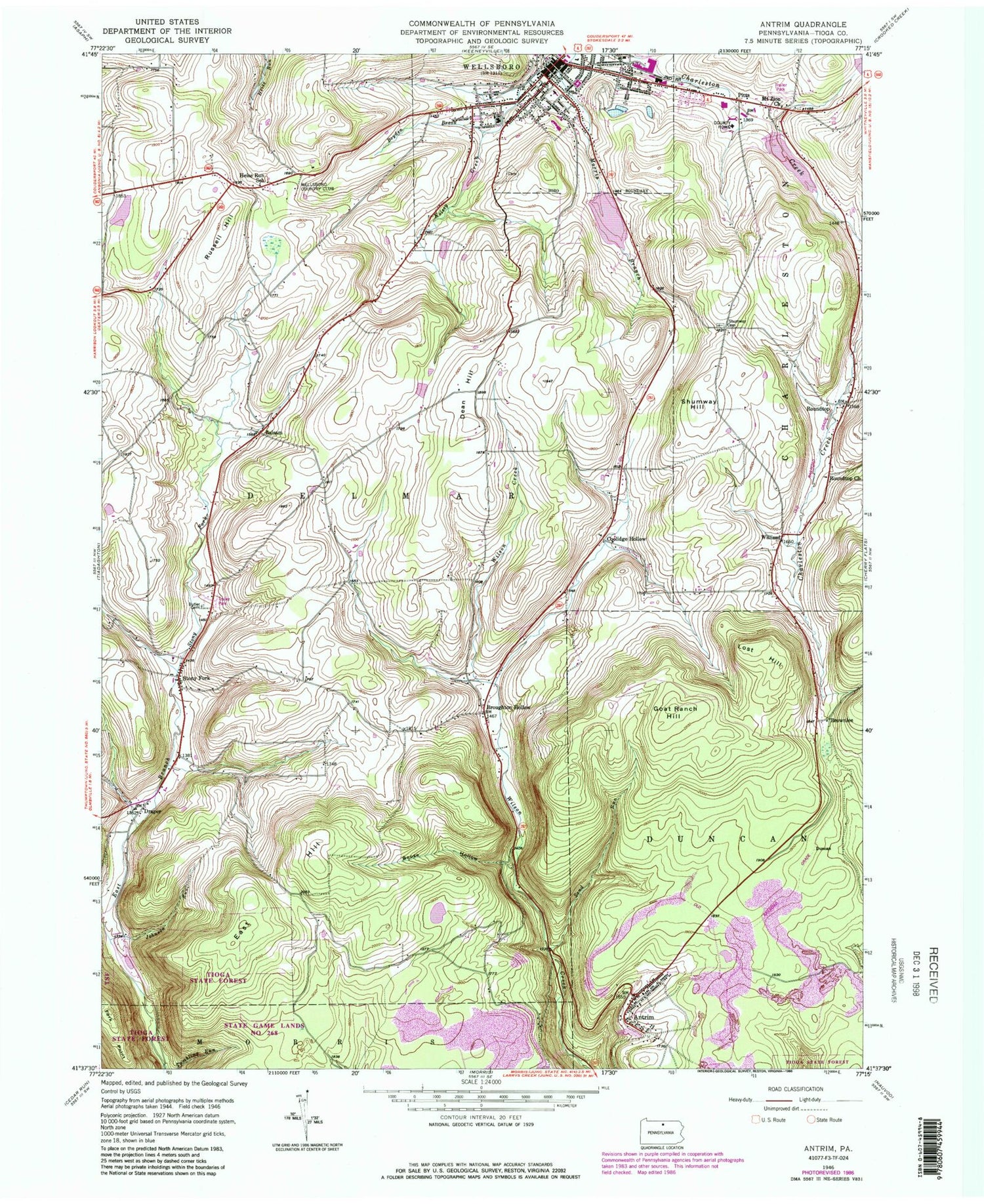
Historical USGS topographic quad map of Antrim in the state of Pennsylvania. Typical map scale is 1:24,000, but may vary for certain years, if available. Print size: 24" x 27"
This quadrangle is in the following counties: Tioga.
The map contains contour lines, roads, rivers, towns, and lakes. Printed on high-quality waterproof paper with UV fade-resistant inks, and shipped rolled.
Contains the following named places: Antrim, Boose Hollow, Boyden Brook, Stony Fork Butler Family Cemetery, Dean Hill, Fork Point, Goat Ranch Hill, Heise Run School, Johnson Run, Lost Hill, Mount Zion Church, Roundtop Church, Russell Hill, Sand Run, Shumway Hill Cemetery, Shumway Hill, Stony Fork, Wellsboro, Lake Nessmuk, Lake Nessmuk Dam, Kelsey Creek Lake, Kelsey Creek Dam Pa-600, Hamilton Lake Dam, Hamilton Lake, Hoover Brook, WGCR-FM (Wellsboro), WNBT-AM (Wellsboro), Balsam, Broughton Hollow, Brownlee, Coolidge Hollow, Draper, Duncan, Pitts, Roundtop, Williard, Wellsboro Country Club, East Hill, Borough of Wellsboro, Township of Delmar, Township of Duncan, Wellsboro Firemen's EMS, Wellsboro Fire Department, UPMC Wellsboro Hospital, Tioga County Sheriff's Office, Wellsboro Borough Police Department, Bacon Family Burial Ground Cemetery, Old Charleston Cemetery, Academy Hill Cemetery, Broadacres Cemetery, Saint Peter's Cemetery, Stony Fork Baptist Church Cemetery, Stony Fork Mennonite Church Cemetery, Tioga County Jail


