MyTopo
Classic USGS Applegate Butte Oregon 7.5'x7.5' Topo Map
Regular price
$16.95
Regular price
Sale price
$16.95
Unit price
per
Couldn't load pickup availability
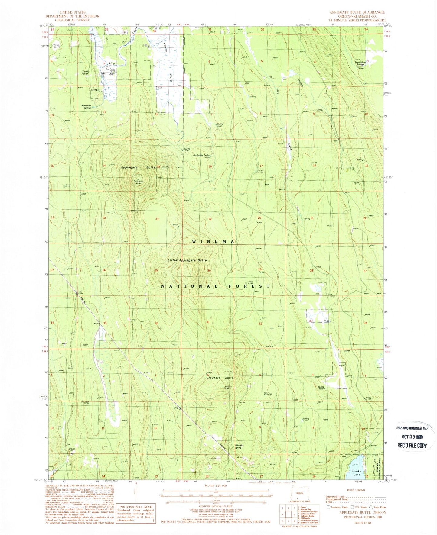
Historical USGS topographic quad map of Applegate Butte in the state of Oregon. Map scale may vary for some years, but is generally around 1:24,000. Print size is approximately 24" x 27"
This quadrangle is in the following counties: Klamath.
The map contains contour lines, roads, rivers, towns, and lakes. Printed on high-quality waterproof paper with UV fade-resistant inks, and shipped rolled.
Contains the following named places: Applegate Butte, Applegate Spring, Beaverdam Springs, Crawford Butte, Klamath County, Little Applegate Butte, Miranda Spring, Ray Ranch, Sand Point, Slabhouse Springs, Wilson Flats