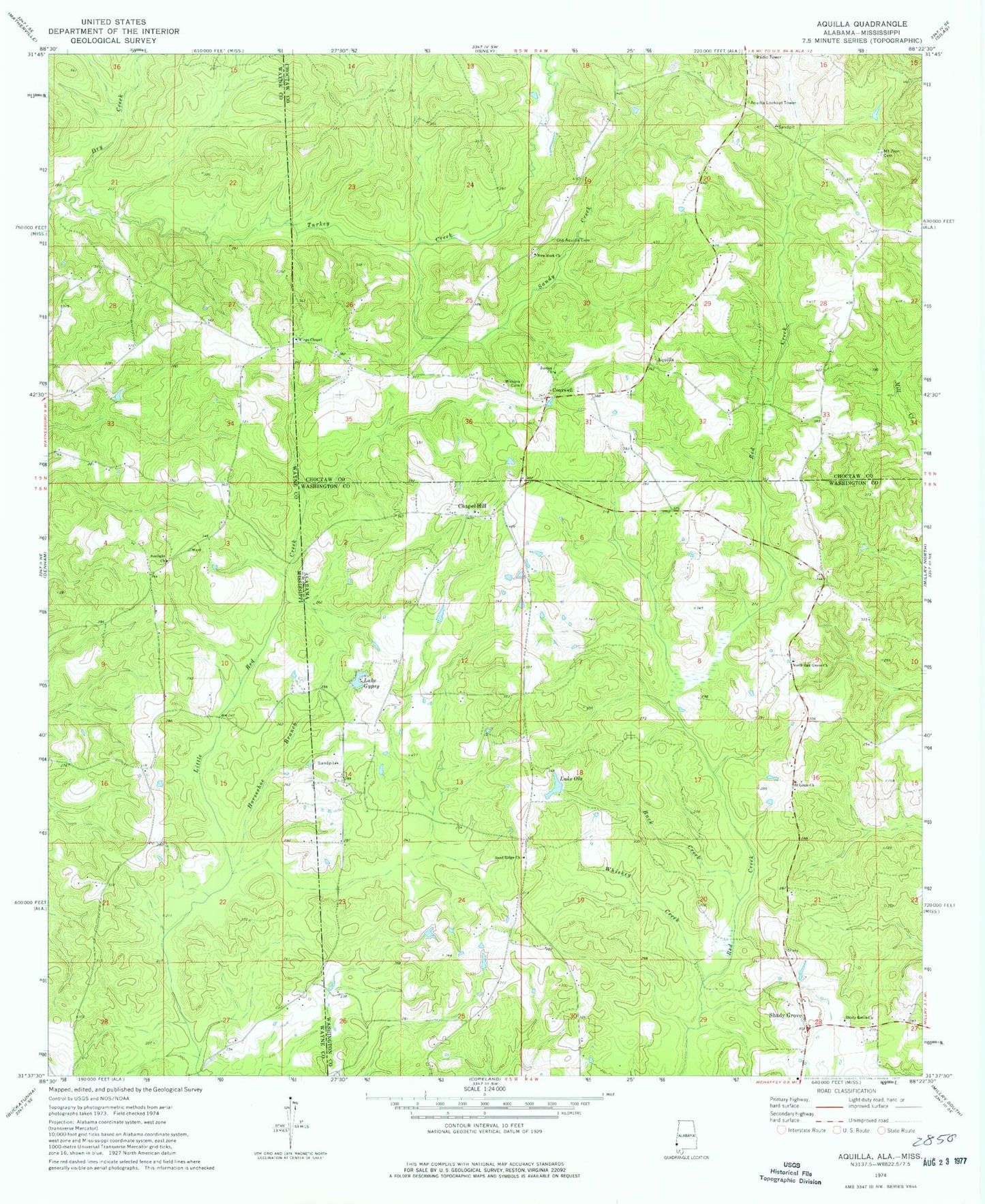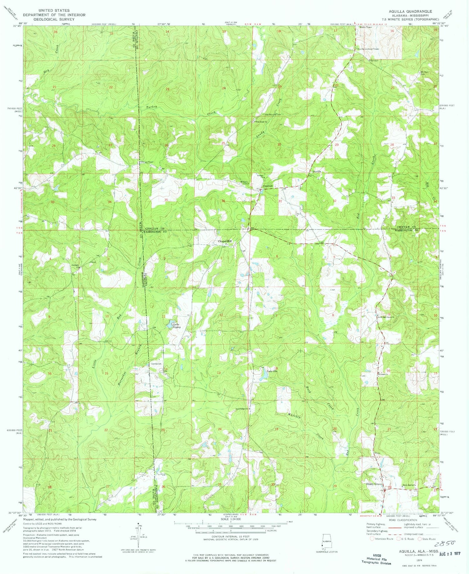
MyTopo
Classic USGS Aquilla Alabama 7.5'x7.5' Topo Map
Couldn't load pickup availability
Historical USGS topographic quad map of Aquilla in the states of Alabama, Mississippi. Map scale may vary for some years, but is generally around 1:24,000. Print size is approximately 24" x 27"
This quadrangle is in the following counties: Choctaw, Washington, Wayne.
The map contains contour lines, roads, rivers, towns, and lakes. Printed on high-quality waterproof paper with UV fade-resistant inks, and shipped rolled.
Contains the following named places: Aquilla, Aquilla Cemetery, Aquilla Lookout Tower, Aquilla Post Office, Aquilla United Methodist Church, Browns Store, Buck Creek, Canaz Field, Chapel Hill, Chapel Hill Baptist Church, Chapel Hill Cemetery, Contwell, Dearmon Church, Dry Creek, Fail, Ganus Mill, Ganus School, Healing Springs Gas Field, Horseshoe Branch, Jordan Church, Kings Chapel African Methodist Episcopal Church, Knight's Chapel Baptist Church, Lake Gypsy, Lake Ola, Lake Ola Dam, Mount Zion Cemetery, New Rock Missionary Baptist Church, North Oak Grove Baptist Church, North Oak Grove Cemetery, North Oak Grove Volunteer Fire Department, Old Aquilla Cemetery, Red Creek, Red Creek Volunteer Fire Department, Saint Louis Church, Sand Ridge Baptist Church, Sand Ridge Cemetery, Sand Ridge Church of God, Sandy Creek, Shady Grove, Shady Grove Baptist Church, Shady Grove Cemetery, Sunlight Church, Whiskey Creek, Wilkins Cemetery, Zion Chapel Oil Field