
MyTopo
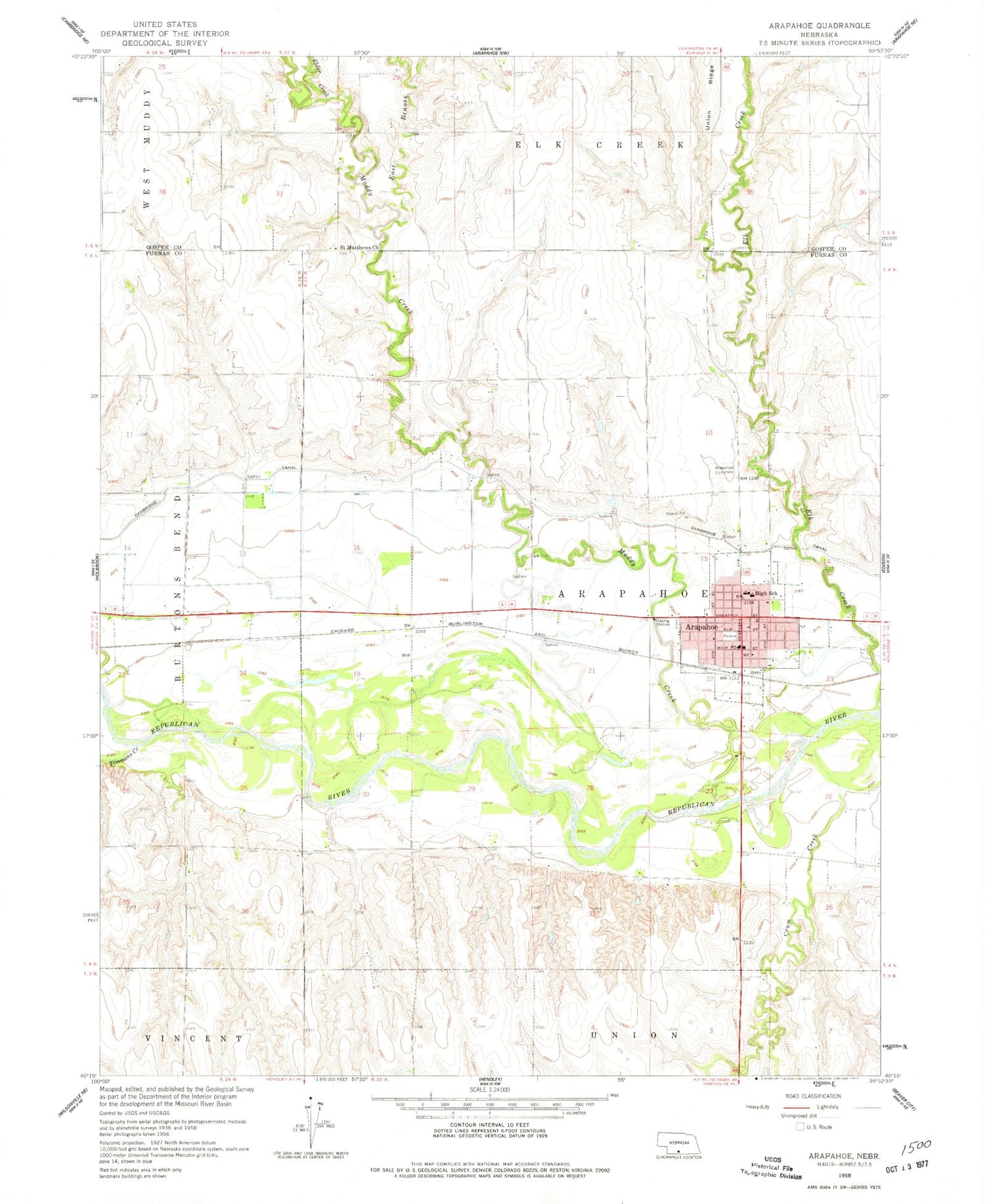
Classic USGS Arapahoe Nebraska 7.5'x7.5' Topo Map
Couldn't load pickup availability
Historical USGS topographic quad map of Arapahoe in the state of Nebraska. Map scale may vary for some years, but is generally around 1:24,000. Print size is approximately 24" x 27"
This quadrangle is in the following counties: Furnas, Gosper.
The map contains contour lines, roads, rivers, towns, and lakes. Printed on high-quality waterproof paper with UV fade-resistant inks, and shipped rolled.
Contains the following named places: Arapahoe, Arapahoe Cemetery, Arapahoe Election Precinct, Arapahoe Golf Course, Arapahoe Good Samaritan Center, Arapahoe Medical Clinic, Arapahoe Municipal Airport, Arapahoe Post Office, Arapahoe Public Library, Arapahoe Public Schools, Arapahoe Volunteer Ambulance, Arapahoe Volunteer Fire Department, Christian Church of Christ, City of Arapahoe, Crum Creek, Dickmeyer Dam, Dickmeyer Reservoir, East Branch Muddy Creek, Elder Creek, Elk Creek, First United Methodist Church, Golter Overflow Dam, Golter Reservoir, Krumme Dam, Krumme Reservoir, Leissing Dam, Leissing Reservoir, Muddy Creek, Prairie Pines Retirement Community, Saint Germanus Catholic Church, Saint Matthews Church, Saint Pauls Episcopal Church, Shady Rest Camp Motel Campground, Timmons Creek, Township of Arapahoe, Trinity Lutheran Church, ZIP Code: 68922


