MyTopo
Classic USGS Ararat Alabama 7.5'x7.5' Topo Map
Couldn't load pickup availability
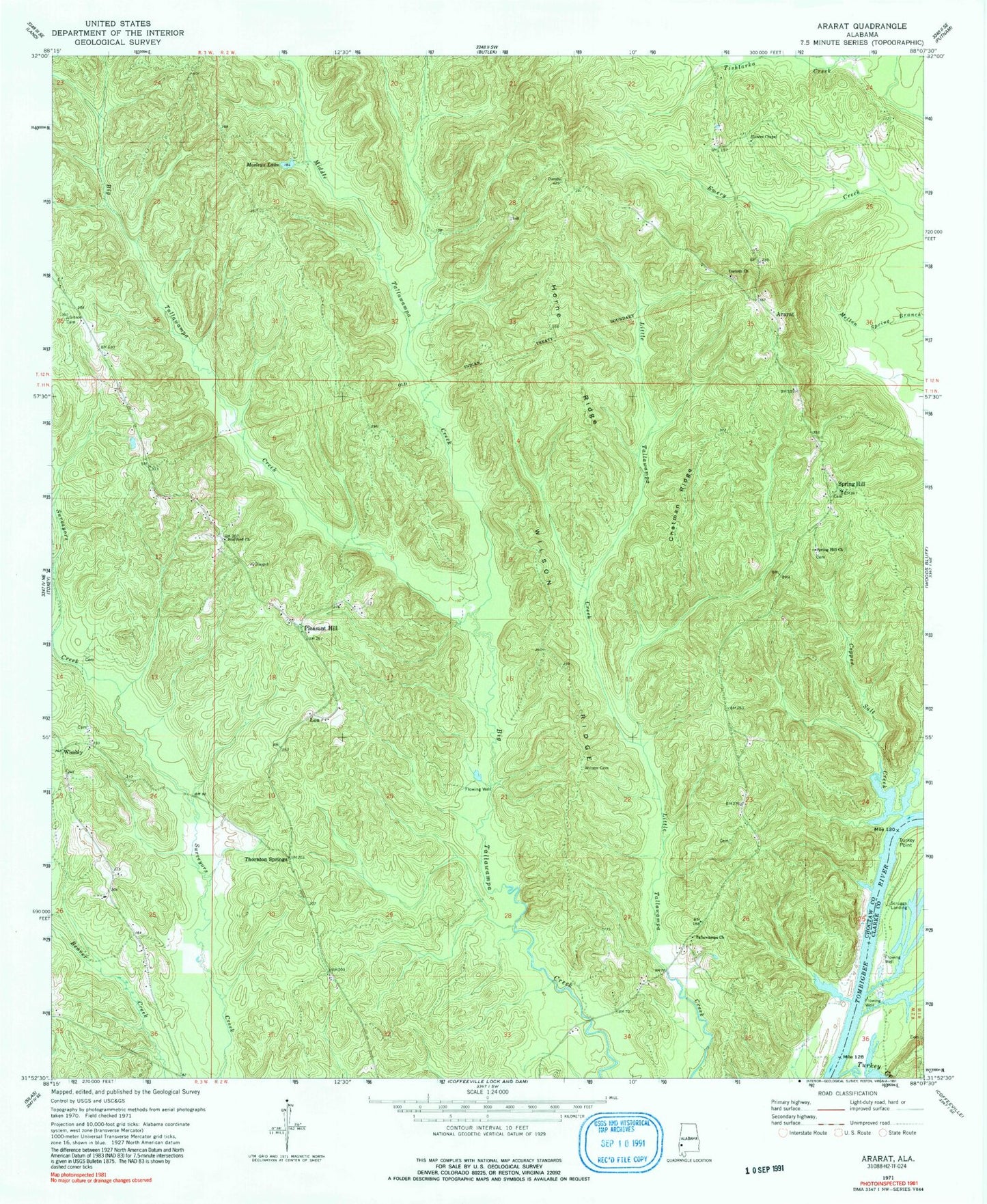
Historical USGS topographic quad map of Ararat in the state of Alabama. Map scale may vary for some years, but is generally around 1:24,000. Print size is approximately 24" x 27"
This quadrangle is in the following counties: Choctaw, Clarke.
The map contains contour lines, roads, rivers, towns, and lakes. Printed on high-quality waterproof paper with UV fade-resistant inks, and shipped rolled.
Contains the following named places: Ararat, Bucey Bluff, Campground Branch, Chappell Hill Oil Field, Chatman Ridge, Copassaw, Copper Salt Creek, Corinth Baptist Church, Ferrell Landing, Gibson Mill, Horne Ridge, I Martin Landing, J Martin Landing, Liberty Church, Little Cemetery, Lou, Middle Tallawampa Creek, Morgan Bluff, Mosleys Lake, Pleasant Hill, Pleasant Hill Baptist Church, Pleasant Hill Cemetery, Pleasant Hill United Methodist Church, Pleasant Hill Volunteer Fire Department, Rock Hill Branch, Scruggs Landing, Sisters Chapel, Slater Christian Methodist Episcopal Church, Spring Hill, Spring Hill Church, Stafford Congregational Methodist Church, Strafford School, Tailawampa Church, Tallawampa Baptist Church, Tallawampa School, Thornton Springs, Turkey Creek, Turkey Point, Wilson Cemetery, Wilson Ridge, Wimberly Methodist Protestant Church, Wimberly Oil Field, Wimbly, ZIP Code: 36921