
MyTopo
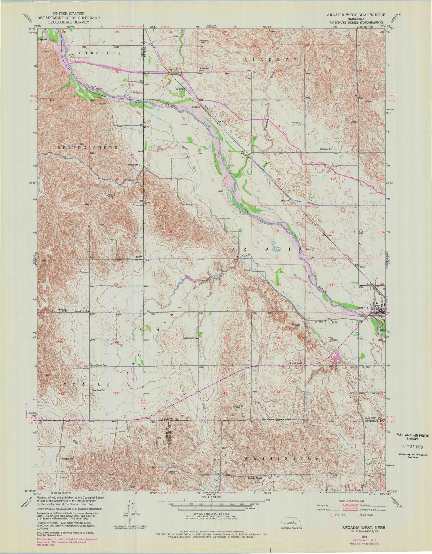
Classic USGS Arcadia West Nebraska 7.5'x7.5' Topo Map
Couldn't load pickup availability
Historical USGS topographic quad map of Arcadia West in the state of Nebraska. Map scale may vary for some years, but is generally around 1:24,000. Print size is approximately 24" x 27"
This quadrangle is in the following counties: Custer, Sherman, Valley.
The map contains contour lines, roads, rivers, towns, and lakes. Printed on high-quality waterproof paper with UV fade-resistant inks, and shipped rolled.
Contains the following named places: Arcadia, Arcadia Centennial Historical Marker, Arcadia City Police Department, Arcadia Clinic, Arcadia Diversion Dam, Arcadia Diversion Dam State Wildlife Management Area, Arcadia Post Office, Arcadia Public Schools, Arcadia Township Library, Arcadia Volunteer Fire and Rescue, Arcadia Wayside Park, Cottonwood Creek, Dunham School, East Side School, Harry Ritz Detention Dam, Knight School, Lee Creek, Lee Park, Lee Park Cemetery, Lee Park Post Office, Lewin Reservoir, Ohme School, Rosebud School, Sacred Heart Cemetery, School Number 11, School Number 25, School Number 60, Spring Creek, Township of Arcadia, United Methodist Church, Village of Arcadia, ZIP Code: 68815


