MyTopo
Classic USGS Arkansas Flat Oregon 7.5'x7.5' Topo Map
Couldn't load pickup availability
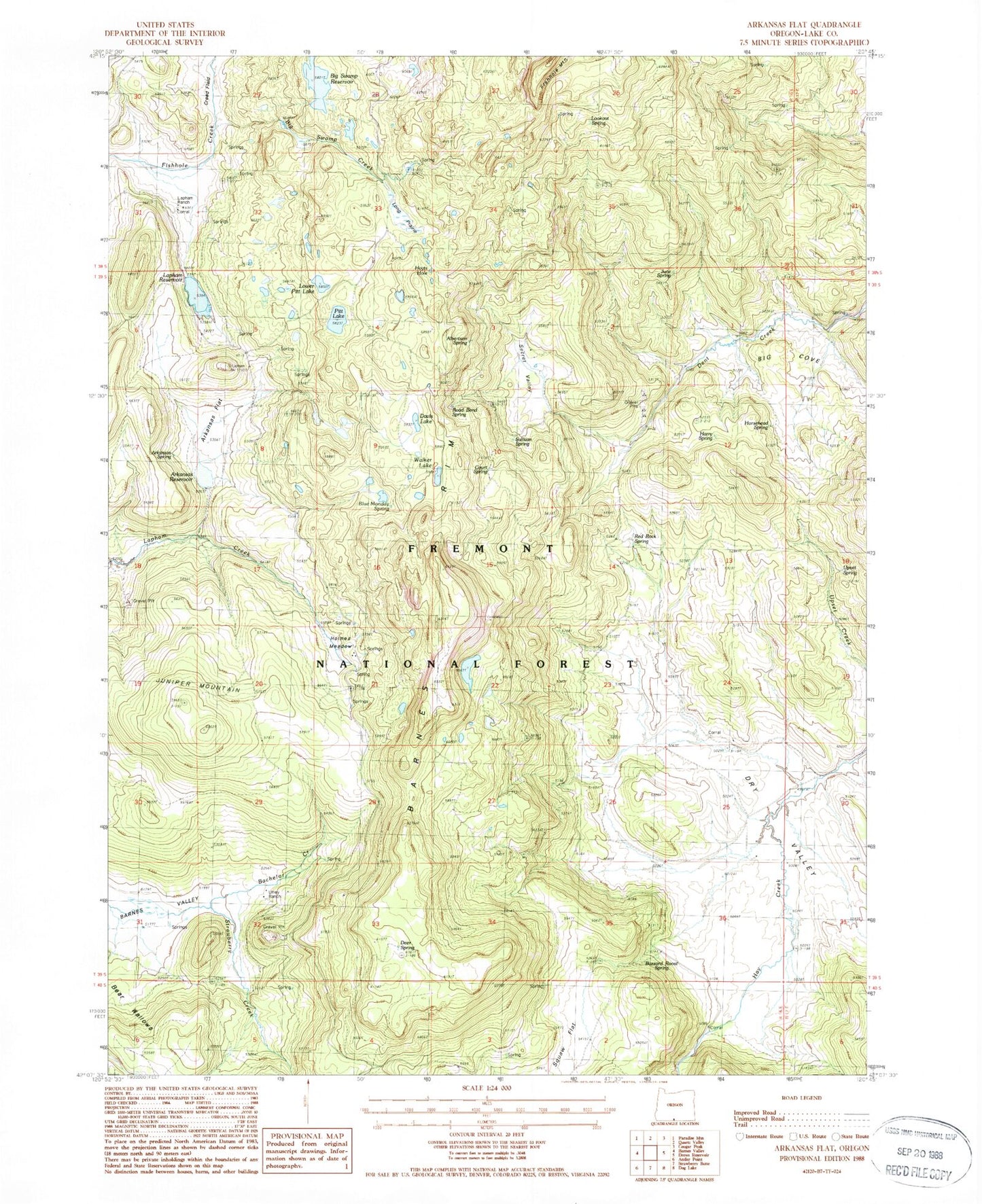
Historical USGS topographic quad map of Arkansas Flat in the state of Oregon. Map scale may vary for some years, but is generally around 1:24,000. Print size is approximately 24" x 27"
This quadrangle is in the following counties: Lake.
The map contains contour lines, roads, rivers, towns, and lakes. Printed on high-quality waterproof paper with UV fade-resistant inks, and shipped rolled.
Contains the following named places: Albertson Spring, Arkansas Dam, Arkansas Flat, Arkansas Reservoir, Arkansas Spring, Aspen Ridge Trailhead, Bachelor Creek, Barnes Rim, Bear Wallows, Big Cove, Big Swamp Creek, Big Swamp Dam, Big Swamp Reservoir, Blue Monday Spring, Buzzard Roost Spring, Court Spring, Creed Field, Davis Lake, Deer Spring, Dry Valley, Harry Spring, Holmes Meadow, Horsehead Spring, Hoyts Hole, July Spring, June Spring, Juniper Mountain, Lapham Dam, Lapham Ranch, Lapham Reservoir, Long Prairie, Lookout Spring, Lower Pitt Lake, Pitt Lake, Pitt Lake Dam, Red Rock Spring, Road Bend Spring, Secret Valley, Squaw Flat, Strawberry Creek, Sullivan Spring, Upset Spring, Utley Ranch, Walker Lake, Wilson Creek