MyTopo
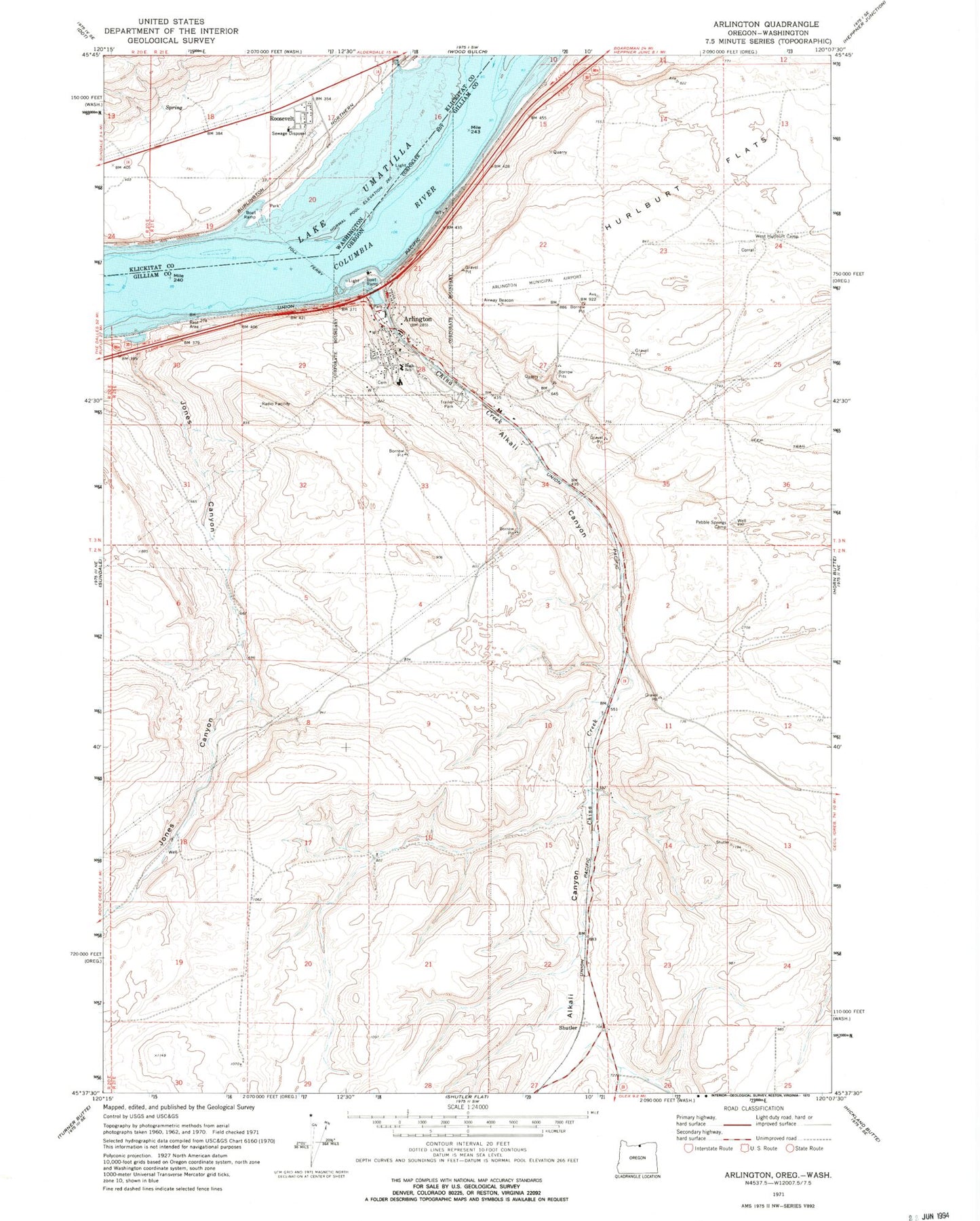
Classic USGS Arlington Oregon 7.5'x7.5' Topo Map
Couldn't load pickup availability
Historical USGS topographic quad map of Arlington in the states of Oregon, Washington. Map scale may vary for some years, but is generally around 1:24,000. Print size is approximately 24" x 27"
This quadrangle is in the following counties: Gilliam, Klickitat.
The map contains contour lines, roads, rivers, towns, and lakes. Printed on high-quality waterproof paper with UV fade-resistant inks, and shipped rolled.
Contains the following named places: Alkali Canyon, Alkali Park, Arlington, Arlington City Hall, Arlington Elementary School, Arlington High School, Arlington Masonic Cemetery, Arlington Municipal Airport, Arlington Post Office, Arlington Public Library, Arlington Public Works Department, Arlington Rodeo Grounds, Arlington Sewer Treatment Plant, Arlington State Park, China Ditch, City of Arlington, Earl Snell Memorial Park, East Fork Shutler Creek, Eddy, Gilliam County Justice Court Arlington Branch, Hurlburt Flats, Jones Canyon, Klickitat County Fire District 9, Nonose Creek, North Gilliam County Rural Fire Protection District, Oregon State Police Department Arlington, Owyhee Rapids, Pebble Springs Camp, Port of Arlington Marina, Port of Arlington Marina Boat Launch, Roosevelt, Roosevelt Census Designated Place, Roosevelt Elementary School, Roosevelt Post Office, Roosevelt Treaty Fishing Access Site, Shutler, Shutler Post Office, West Fork Shutler Creek, West Hurlburt Camp