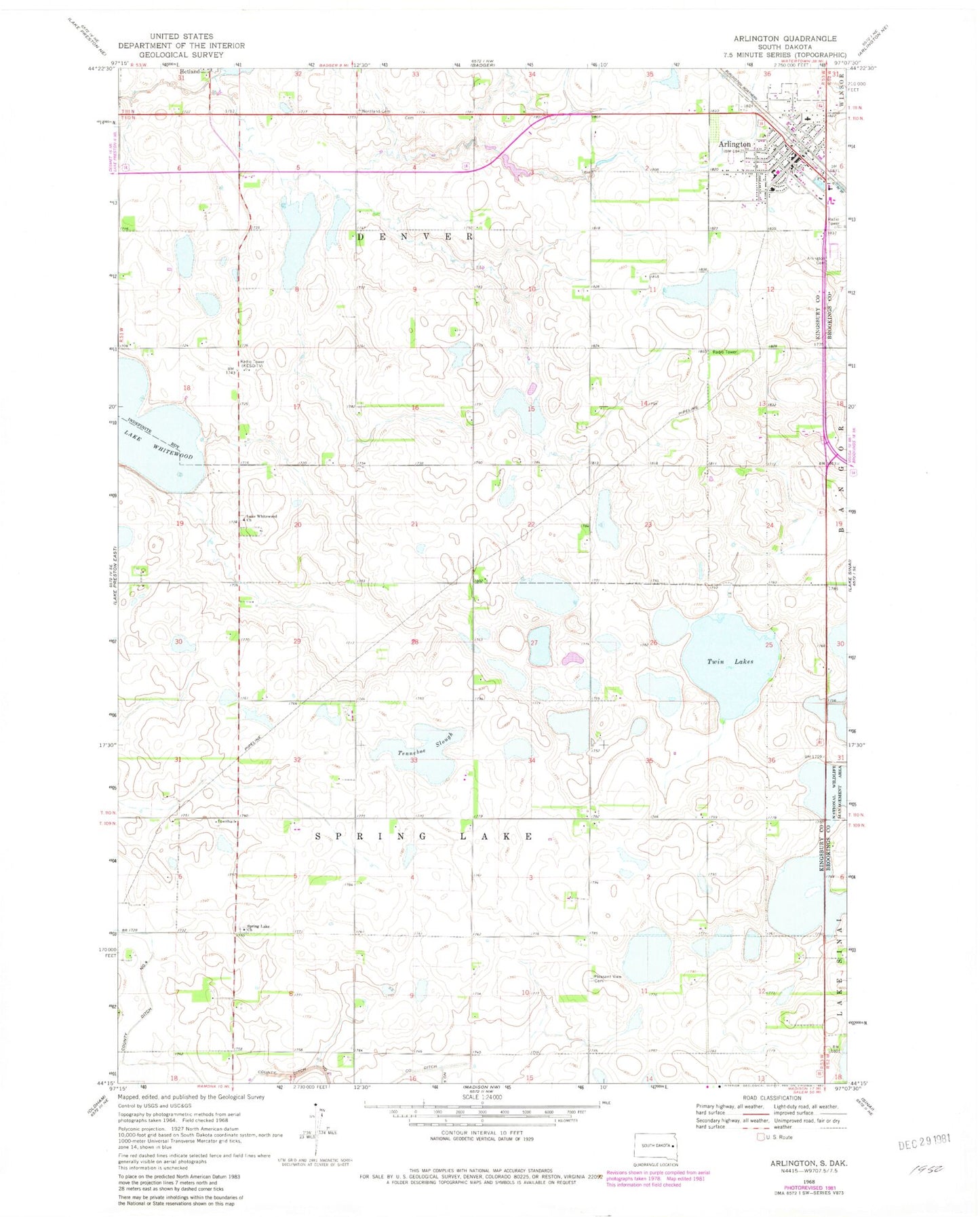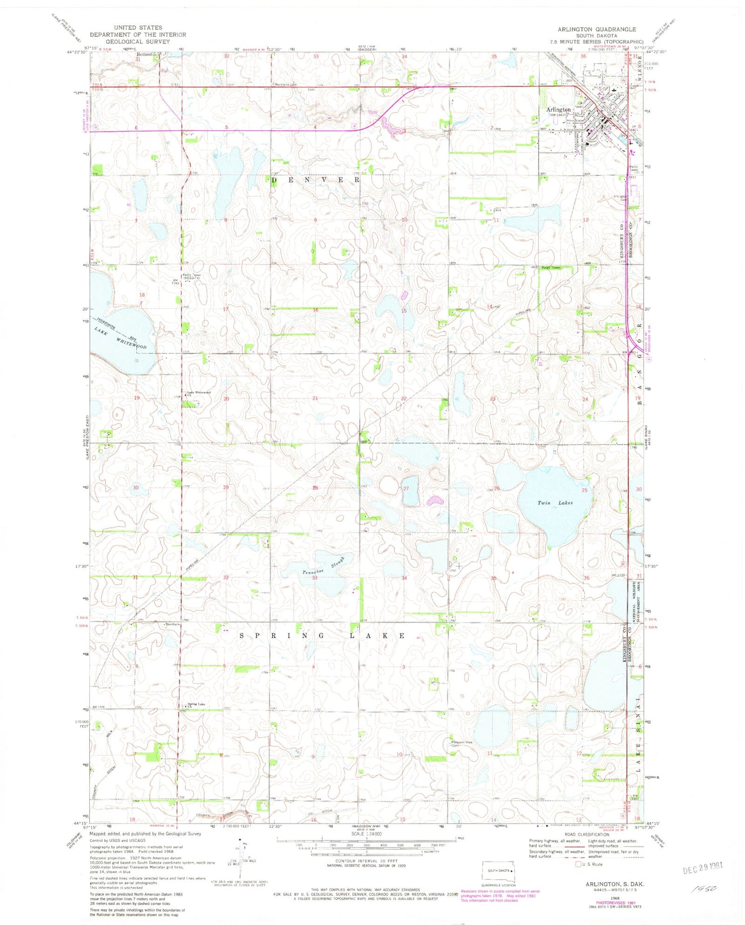
MyTopo
Classic USGS Arlington South Dakota 7.5'x7.5' Topo Map
Couldn't load pickup availability
Historical USGS topographic quad map of Arlington in the state of South Dakota. Map scale may vary for some years, but is generally around 1:24,000. Print size is approximately 24" x 27"
This quadrangle is in the following counties: Brookings, Kingsbury.
The map contains contour lines, roads, rivers, towns, and lakes. Printed on high-quality waterproof paper with UV fade-resistant inks, and shipped rolled.
Contains the following named places: Arlington, Arlington Ambulance Service, Arlington Cemetery, Arlington City Hall, Arlington Community Library, Arlington Elementary School, Arlington Fire Department, Arlington High School, Arlington Junior High School, Arlington Police Department, Arlington Post Office, City of Arlington, KESD-FM (Brookings), Kingsbury County Waterfowl Production Area, Lake Whitewood Church, Lake Whitewood Lutheran Cemetery, Lutheran Church, Nordland Cemetery, Old Nordland Cemetery, Pleasant View Cemetery, School Number 1, School Number 2, School Number 40, School Number 41, School Number 42, School Number 8, Spring Lake Church, Spring Lake Covenant Cemetery, Tenneboe Slough, Township of Spring Lake, Twin Lakes