MyTopo
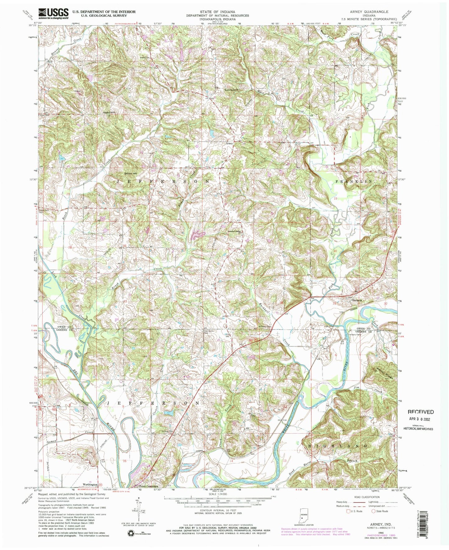
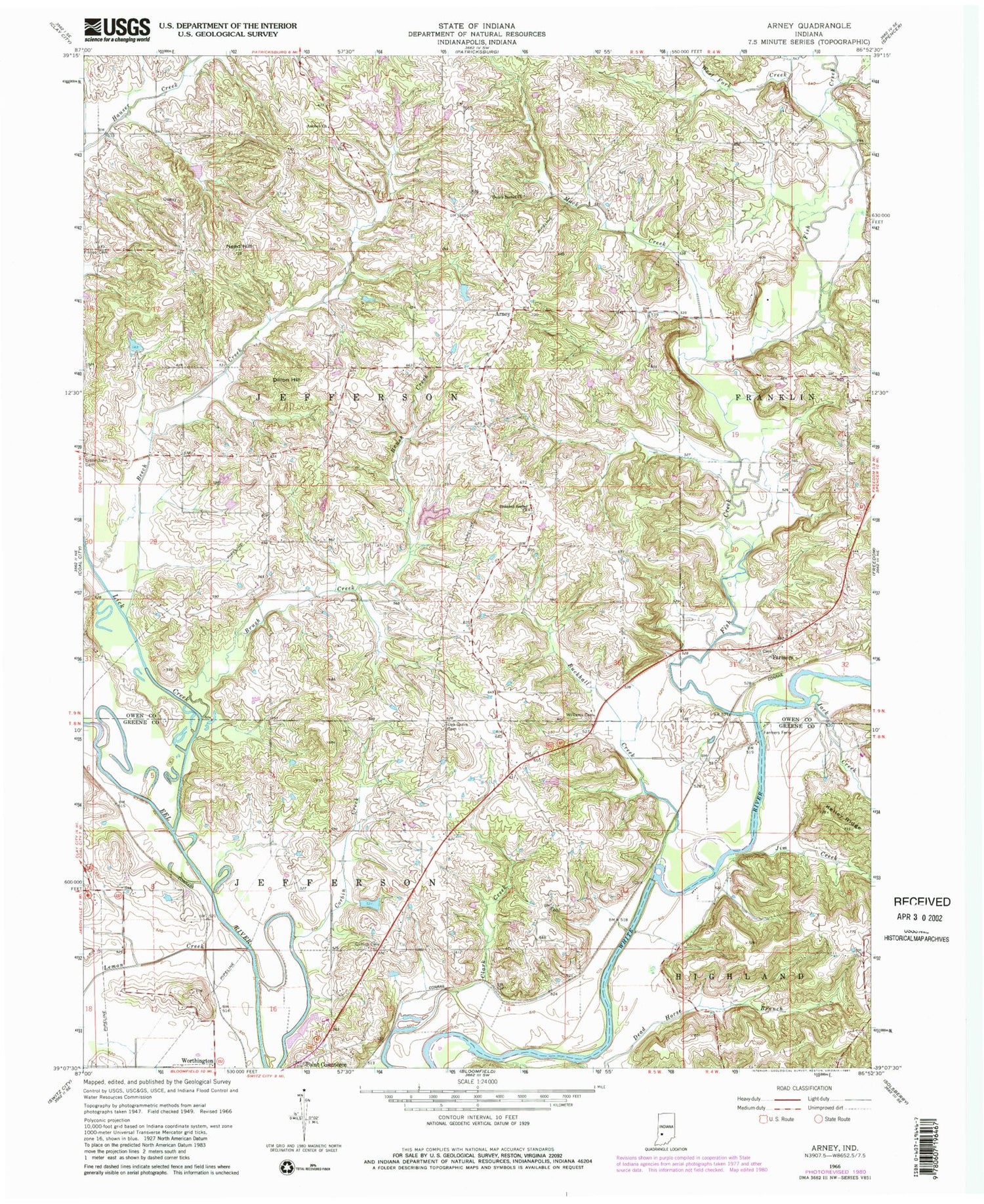
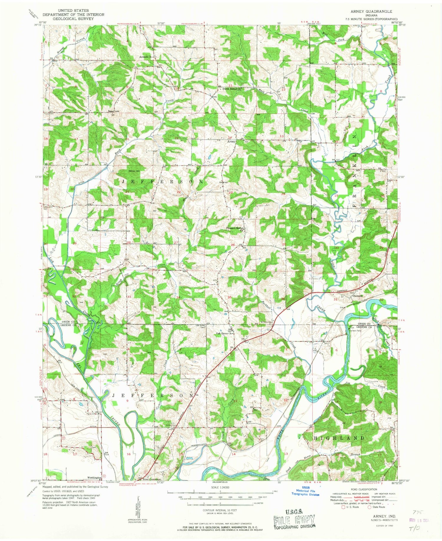
Classic USGS Arney Indiana 7.5'x7.5' Topo Map
Couldn't load pickup availability
Historical USGS topographic quad map of Arney in the state of Indiana. Map scale may vary for some years, but is generally around 1:24,000. Print size is approximately 24" x 27"
This quadrangle is in the following counties: Greene, Owen.
The map contains contour lines, roads, rivers, towns, and lakes. Printed on high-quality waterproof paper with UV fade-resistant inks, and shipped rolled.
Contains the following named places: Antioch Church, Arney, Beech Creek, Brush Creek, Buckhall Creek, Corbin Creek, Dillon Hill, Dutch Bethel Church, Dyer Lake, Dyer Lake Dam, Farmers, Farmers Ferry, Fish Creek, Goose Creek, Griffith Cemetery, Jack Creek, Jim Creek, Lemon Creek, Lick Creek, Little John Cemetery, Mack Creek, Need Hill, Oak Grove Cemetery, Pleasant Bethel Church, Point Commerce, Salter Lake, Salter Lake Dam, Township of Jefferson, Von Sloughs Airport, West Fork Creek, Williams Cemetery, Worthington, ZIP Code: 47431