MyTopo
Classic USGS Arnold Nebraska 7.5'x7.5' Topo Map
Couldn't load pickup availability
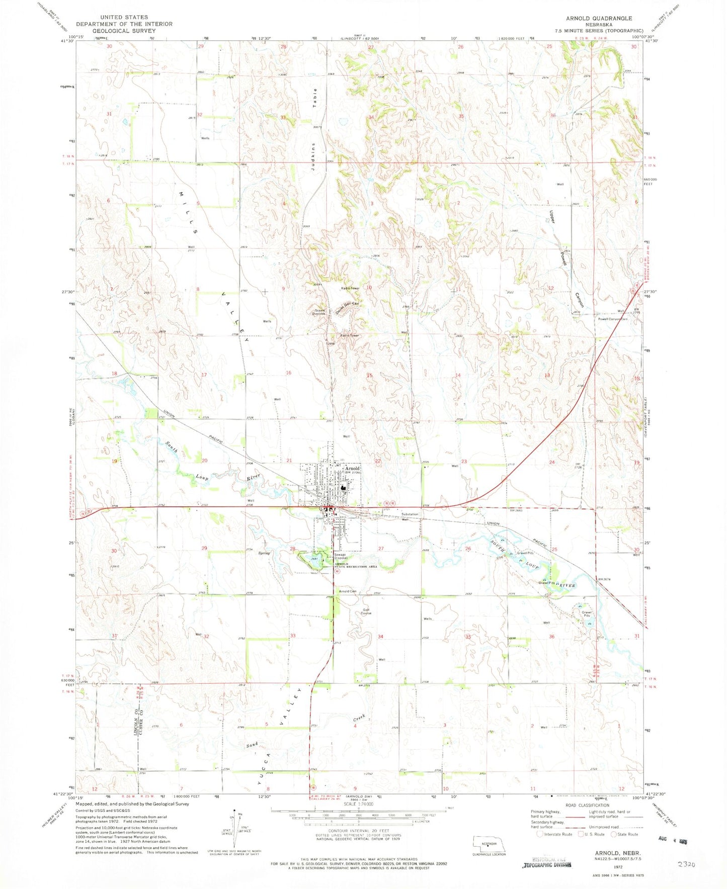
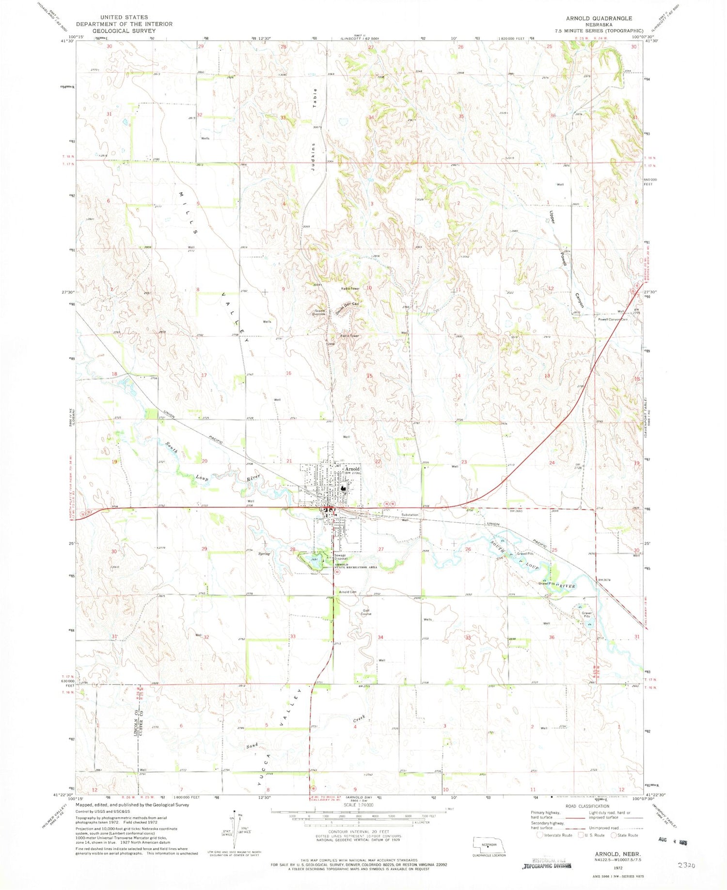
Historical USGS topographic quad map of Arnold in the state of Nebraska. Map scale may vary for some years, but is generally around 1:24,000. Print size is approximately 24" x 27"
This quadrangle is in the following counties: Custer, Lincoln.
The map contains contour lines, roads, rivers, towns, and lakes. Printed on high-quality waterproof paper with UV fade-resistant inks, and shipped rolled.
Contains the following named places: Arnold, Arnold 9 Hole Golf Course, Arnold Cemetery, Arnold Child Care Center, Arnold City Park, Arnold Dental Clinic, Arnold Lake, Arnold Lake State Recreation Area, Arnold Medical Clinic, Arnold Mini Park, Arnold Motel and Camp Site, Arnold Police Department, Arnold Post Office, Arnold Public Library, Arnold Public Schools, Arnold Volunteer Fire Department, Baptist Church, Church of the Nazarene, Devils Den Canyon, Devils Den Lookout, Farmers and Feeders Elevator, Hiebner Chiropractic Clinic, Judkins Table, Mills Valley, Old Mill Park, Powell Canyon Cemetery, Saint Agnes Catholic Church, Sand Creek, Township of Arnold, United Methodist Church, Village of Arnold, Yucca Valley, Zion Lutheran Church, ZIP Code: 69120