MyTopo
Classic USGS Arrowwood Point Oregon 7.5'x7.5' Topo Map
Couldn't load pickup availability
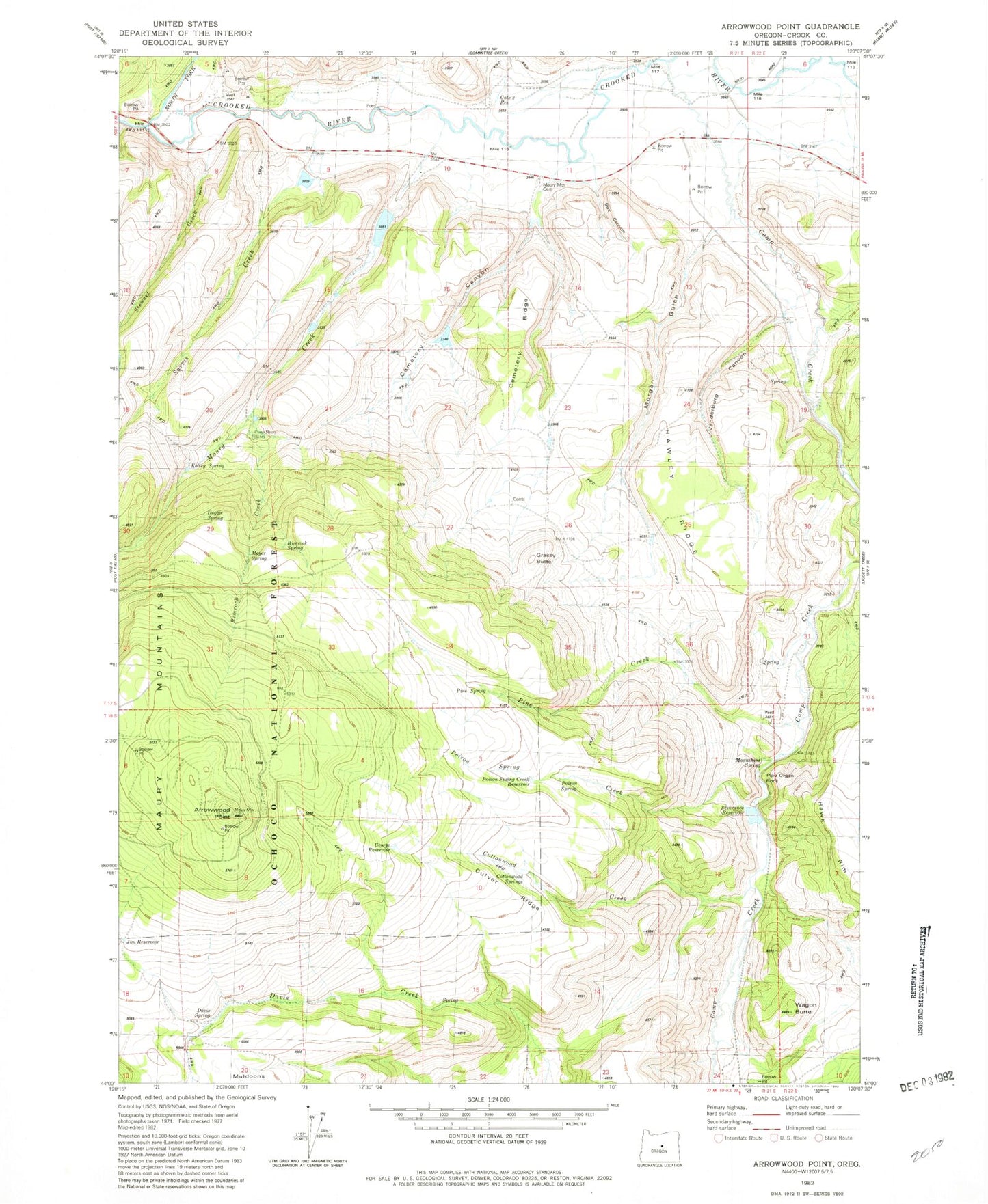
Historical USGS topographic quad map of Arrowwood Point in the state of Oregon. Map scale may vary for some years, but is generally around 1:24,000. Print size is approximately 24" x 27"
This quadrangle is in the following counties: Crook.
The map contains contour lines, roads, rivers, towns, and lakes. Printed on high-quality waterproof paper with UV fade-resistant inks, and shipped rolled.
Contains the following named places: Arrow Wood Camp, Arrowwood Point, Camp Creek, Camp Maury, Cemetery Canyon, Cemetery Creek, Cemetery Ridge, Crooked River Division, Culver Ridge, Glenn Ranch, Gone Creek, Grassy Butte, Hawley Ridge, Mainline Dam Number 1, Mainline Dam Number 2, Mainline Dam Number 3, Mainline Reservoir Number 1, Mainline Reservoir Number 2, Mainline Reservoir Number 3, Maury Creek, Maury Mountain Cemetery, Morgan Gulch, Mowry Post Office, North Fork Crooked River, Poison Creek, Severance Ranch, Stewart Creek, Vanderburg Canyon, Wagon Butte