MyTopo
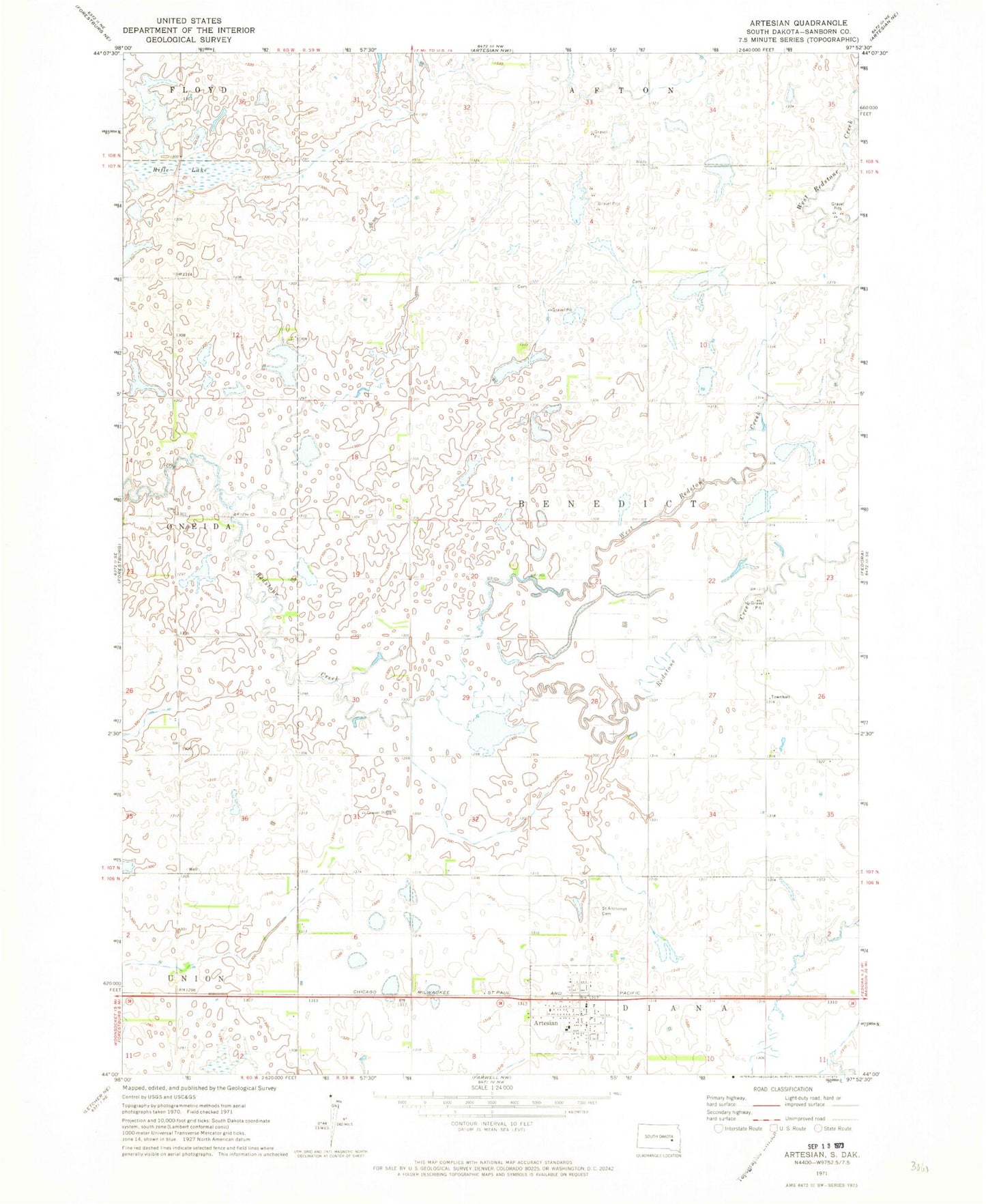
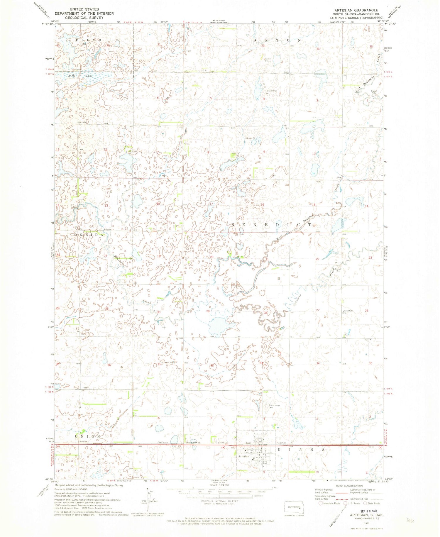
Classic USGS Artesian South Dakota 7.5'x7.5' Topo Map
Couldn't load pickup availability
Historical USGS topographic quad map of Artesian in the state of South Dakota. Map scale may vary for some years, but is generally around 1:24,000. Print size is approximately 24" x 27"
This quadrangle is in the following counties: Sanborn.
The map contains contour lines, roads, rivers, towns, and lakes. Printed on high-quality waterproof paper with UV fade-resistant inks, and shipped rolled.
Contains the following named places: Artesian, Artesian Community Center, Artesian Post Office, Artesian Presbyterian Church, Artesian Volunteer Fire Department, Artesian Wesleyan Methodist Church, Callihan, Denton, Diana Cemetery, Lutheran Cemetery, Norwegian Lutheran Cemetery, Oneida Township Hall, Rifle Lake, Roberts School, Saint Anthony's Catholic Cemetery, Shaffer School, Town of Artesian, Township of Benedict, Tysdal School, West Redstone Creek, Wiso School, ZIP Code: 57314