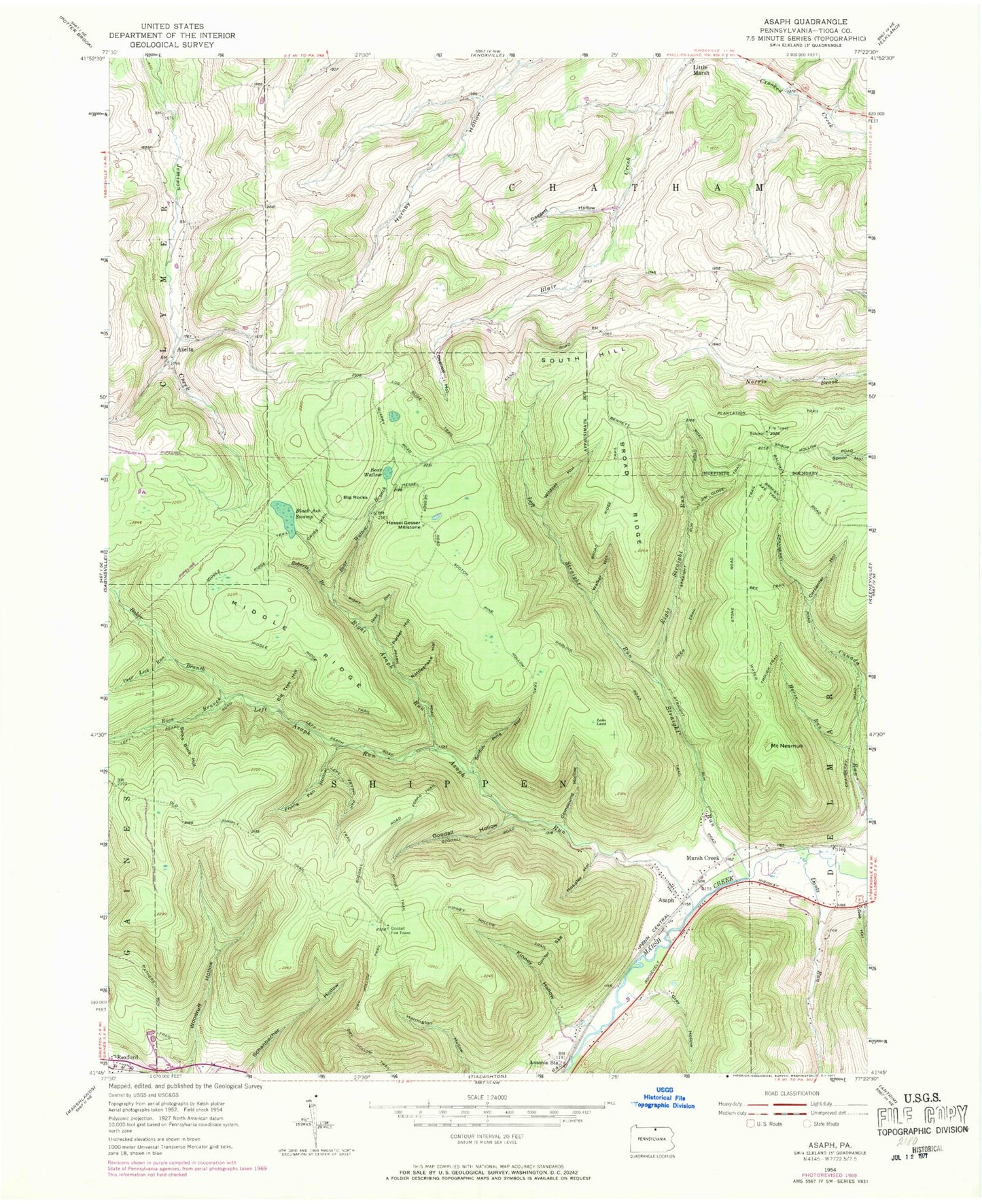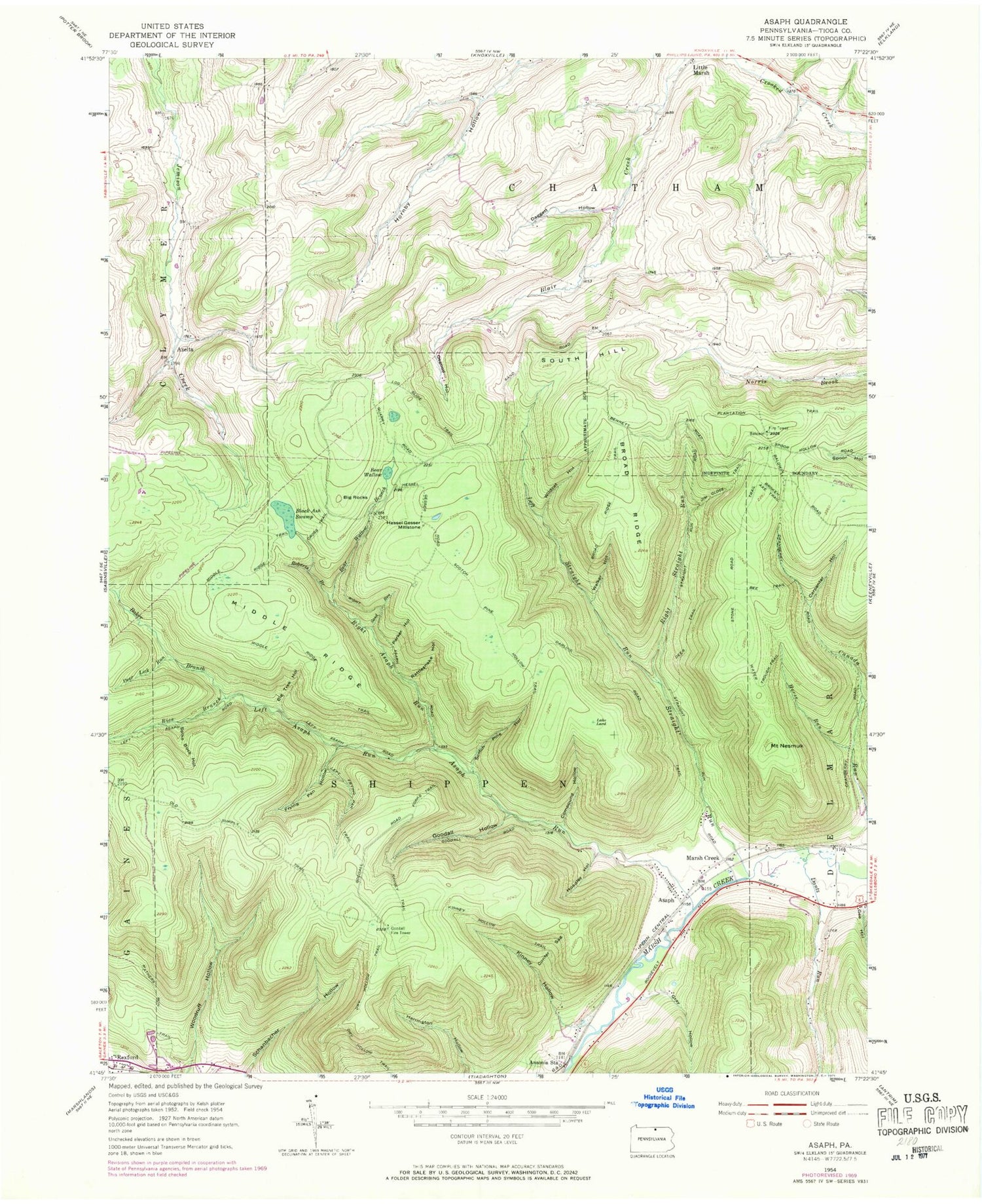
MyTopo
Classic USGS Asaph Pennsylvania 7.5'x7.5' Topo Map
Couldn't load pickup availability
Historical USGS topographic quad map of Asaph in the state of Pennsylvania. Typical map scale is 1:24,000, but may vary for certain years, if available. Print size: 24" x 27"
This quadrangle is in the following counties: Tioga.
The map contains contour lines, roads, rivers, towns, and lakes. Printed on high-quality waterproof paper with UV fade-resistant inks, and shipped rolled.
Contains the following named places: Ansonia Station, Asaph Run, Bear Wallow, Bee Trail, Big Rocks, Big Tree Hollow, Black Ash Swamp, Broad Ridge, Broad Ridge Trail, Broken Axe Trail, Carpenter Hollow, Compound Hollow, Confer Sag, Cross Trail, Daggett Hollow, Dantz Run, Darling Road Trail, Deer Lick Run, Deer Trail, Dry Hollow Trail, East Branch Canada Run, Forks Trail, Frying Pan Hollow, Gee Hollow, Goodall Hollow, Gray Hollow, Hessel Gesser Millstone, Hoadley Hollow, Horse Run, Jim Close Trail, Kinney Hollow, Kinney Hollow Trail, Kinney Trail, Lake Lard, Left Frying Pan Trail, Left Straight Run, Log Slide Trail, Marsh Creek, Mathers Run Trail, Middle Ridge, Middle Ridge Trail, Mount Nesmuk, Old Supply Trail, Osgood Hollow, Parker Hollow, Rattlesnake Hollow, Right Asaph Run, Right Straight Run, Roberts Branch, Sand Run, Schanbacher Hollow, Scotch Pine Hollow, Scotch Pine Hollow Trail, South Hill, Spike Buck Hollow, Stone Road Trail, Straight Run, Walker Hollow, Water Trough Trail, Wildcat Hollow, Woodruff Hollow, Baker Branch, Rice Branch, Sharretts Airport, Black Ash Swamp Natural Area, Asaph Run Picnic Area, Left Asaph Run, Cranberry Swamp, Asaph, Azelta, Reese Trail, Harrigton Trail, Schanbacher Trail, Woodruff Trail, Horse Lane Trail, Left Strait Run Trail, Goodall Fire Tower, Bear Wallow Branch, Township of Chatham, Township of Shippen