
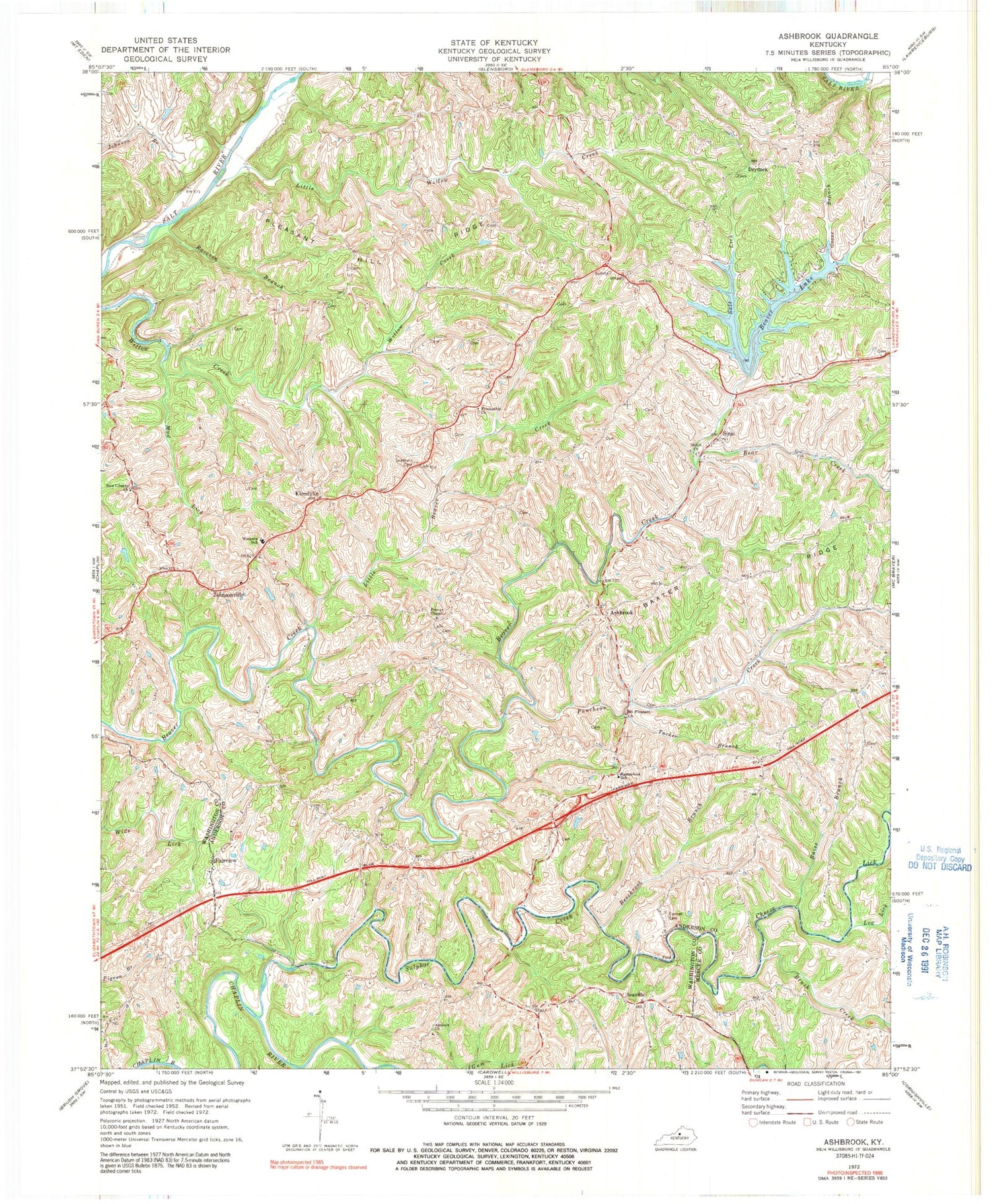
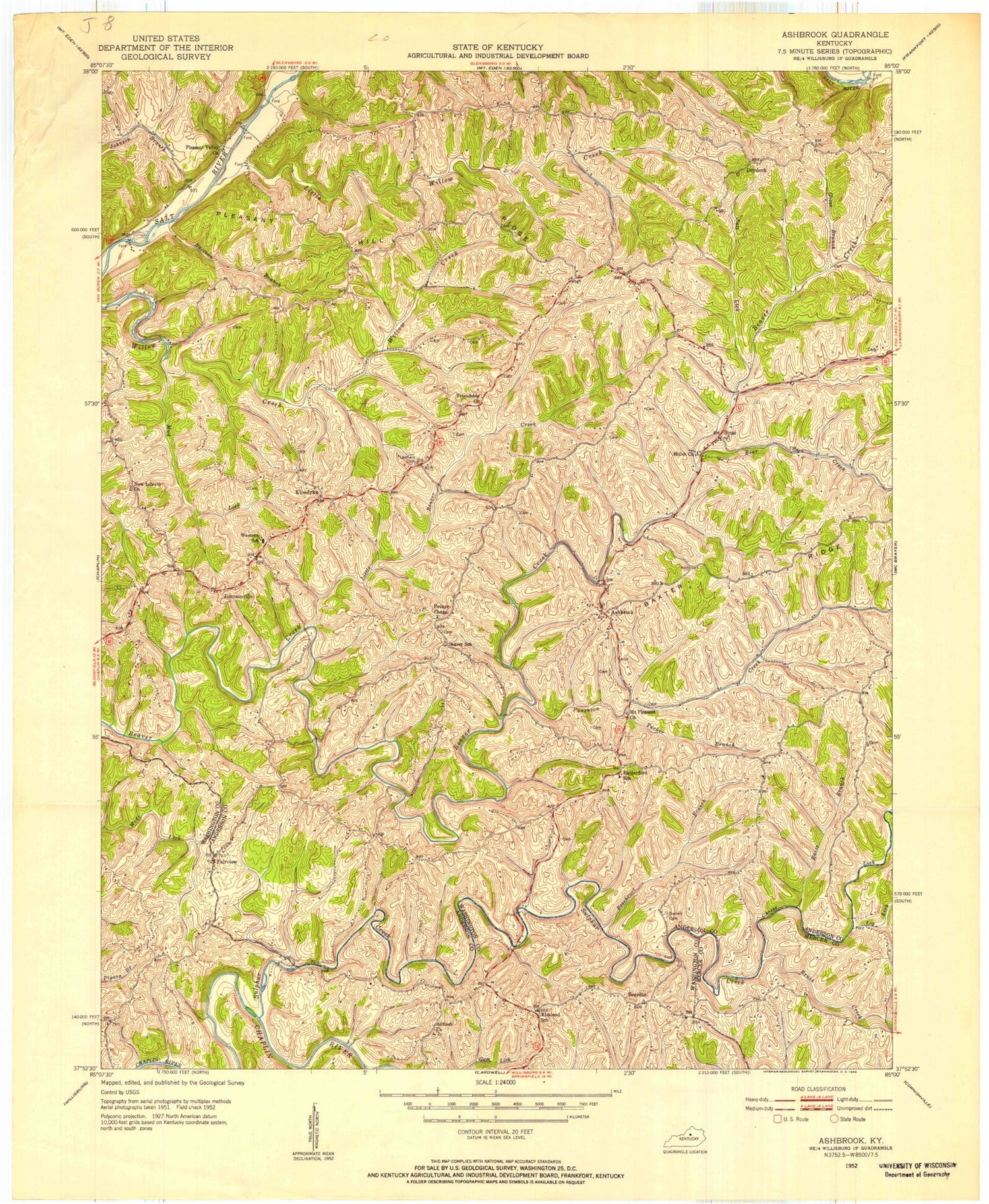
MyTopo
Classic USGS Ashbrook Kentucky 7.5'x7.5' Topo Map
Couldn't load pickup availability
Historical USGS topographic quad map of Ashbrook in the state of Kentucky. Map scale may vary for some years, but is generally around 1:24,000. Print size is approximately 24" x 27"
This quadrangle is in the following counties: Anderson, Mercer, Washington.
The map contains contour lines, roads, rivers, towns, and lakes. Printed on high-quality waterproof paper with UV fade-resistant inks, and shipped rolled.
Contains the following named places: Anderson County Fire District Station 4, Antioch Christian Church, Antioch Post Office, Ashbrook, Baxter Ridge, Bear Creek, Beaver Creek Post Office, Beaver Lake, Beaver Lake Boat Dock, Beechroot Branch, Brush Creek, Buntain School, Cheese Lick, Darnell Cemetery, Drydock, Fairview, Fairview Church Cemetery, Friendship Church, Goose Branch, Hooppole Post Office, Jefferies, Johnsonville, Kirkland Post Office, Kirkland School, Klondyke, Leathers Cemetery, Leathers Store Post Office, Little Beaver Creek, Little Willow Creek, Log Lick, Mount Pleasant Church, Mud Lick, New Liberty Church Cemetery, Pennys Chapel Cemetery, Pennys Chapel Methodist Church, Pleasant Hill Ridge, Puncheon Creek, Raccoon Branch, Raise Branch, Rutherford School, Salt Lick, Searcy School, Seaville, Seaville Post Office, Shiloh Church, Sinai, Sinai Post Office, Southwest Anderson Division, Stinnett Post Office, Sulphur Creek, Tucker Branch, Vandyke Mill, Vandyke Post Office, Western School


