MyTopo
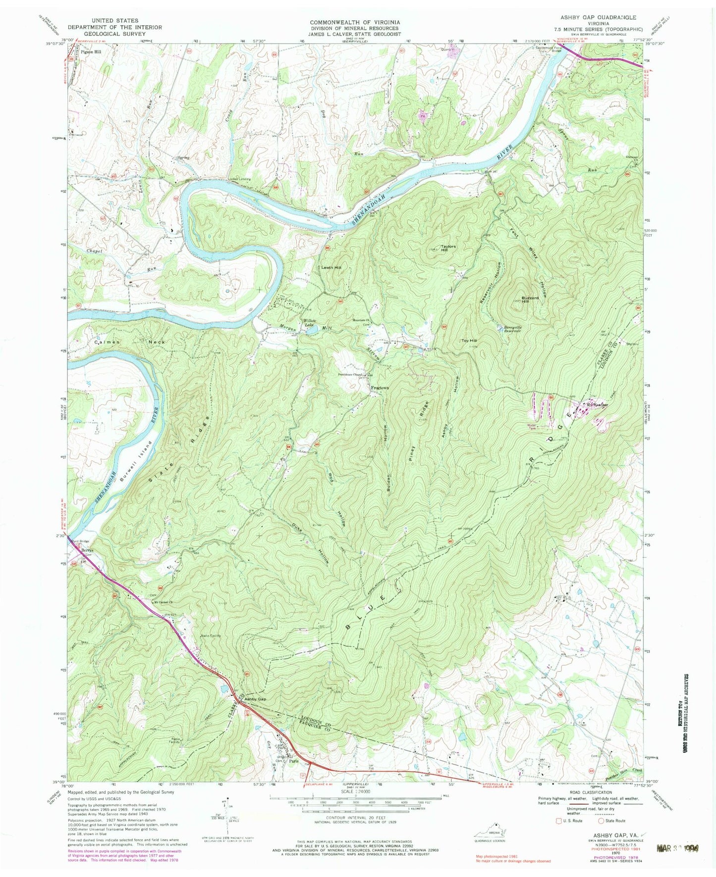
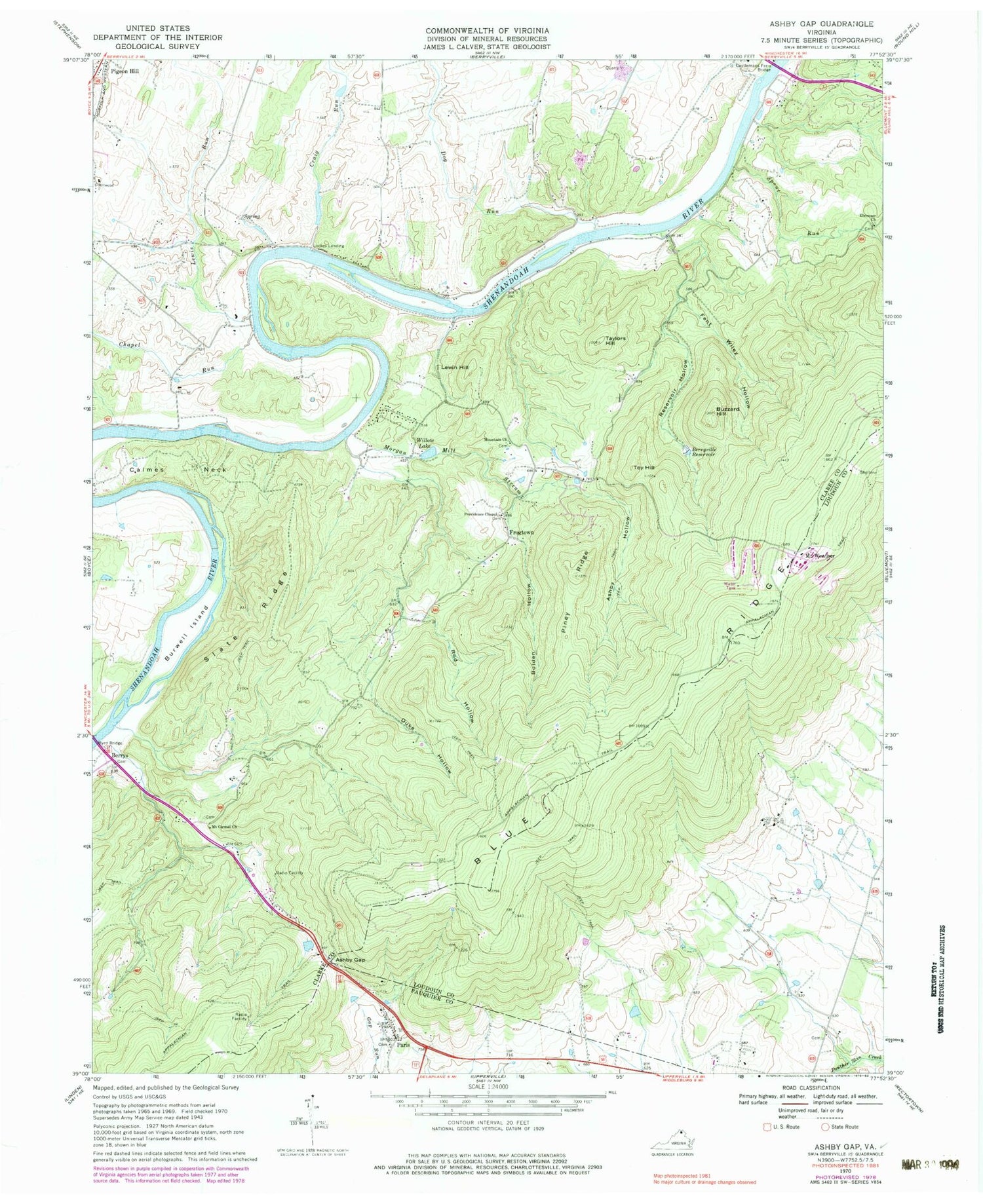
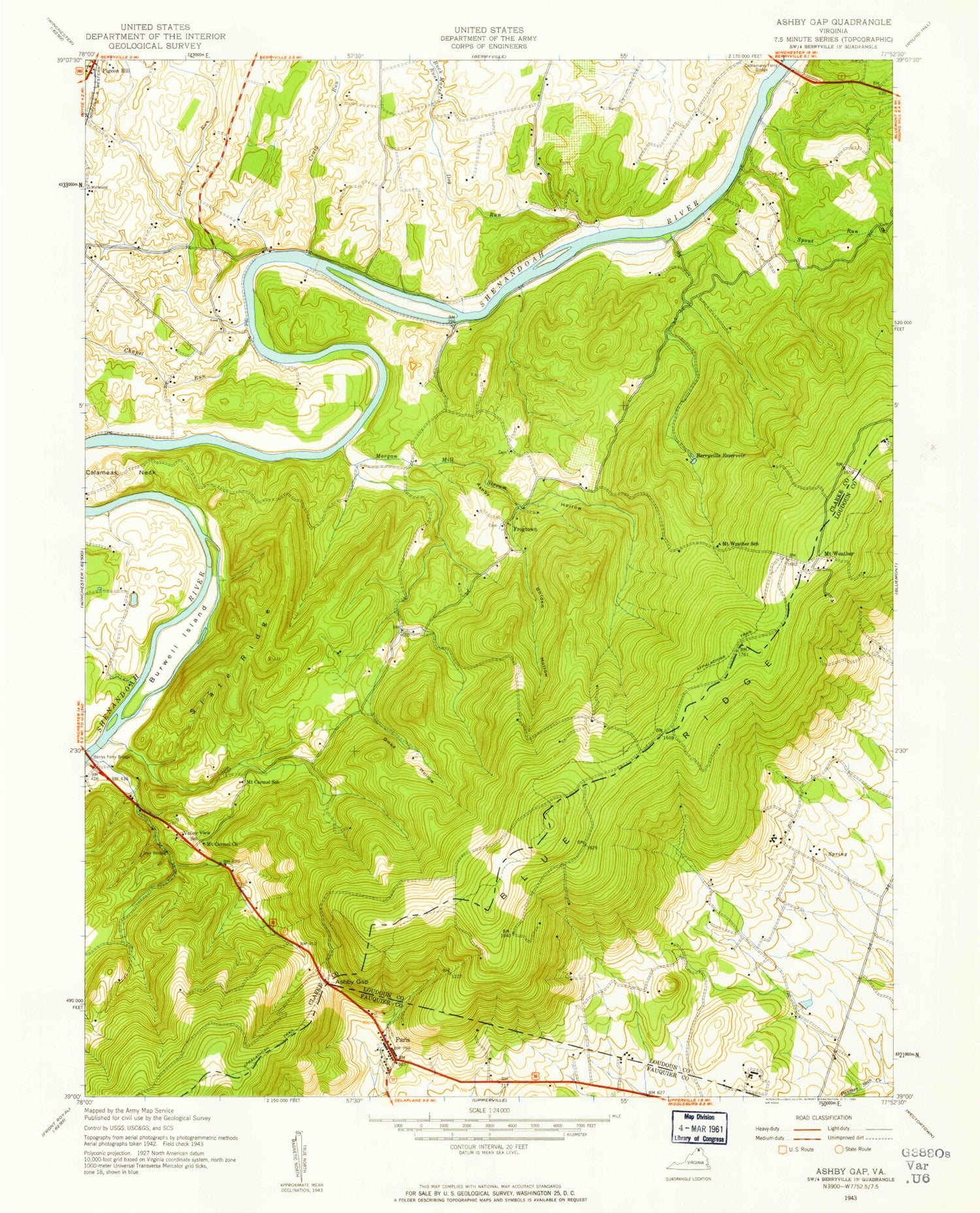
Classic USGS Ashby Gap Virginia 7.5'x7.5' Topo Map
Couldn't load pickup availability
Historical USGS topographic quad map of Ashby Gap in the state of Virginia. Typical map scale is 1:24,000, but may vary for certain years, if available. Print size: 24" x 27"
This quadrangle is in the following counties: Clarke, Fauquier, Loudoun.
The map contains contour lines, roads, rivers, towns, and lakes. Printed on high-quality waterproof paper with UV fade-resistant inks, and shipped rolled.
Contains the following named places: Ashby Gap, Ashby Hollow, Berryville Reservoir, Burwell Island, Buzzard Hill, Byrd Bridge, Calmes Neck, Castlemans Ferry Bridge, Chapel Run, Craig Run, Dog Run, Duke Hollow, Ebenezer Church, Fent Wiley Hollow, Lewis Run, Morgan Mill Stream, Mount Carmel Church, Mountain Church, Piney Ridge, Providence Chapel, Reservoir Hollow, Rod Hollow, Slate Ridge, Spout Run, Taylors Hill, Willow Lake, Short Hill Farm Dam, Short Hill Farm Lake, Berrys, Frogtown, Lewin Hill, Lockes Landing, Mount Weather Emergency Operations Center, Paris, Toy Hill, WAPP-FM (Berryville), Ashby Run, Ashby Gap Estates, Ball Estate, Barker Land, Berrys Ferry (historical), Calmes Neck Estates, Care Free Acres, Castleman Ferry (historical), Castlemans Ferry, Chilly Hollow Estates, Clarke County, Fisher Hill, Hill and Dale Estate, Longwood, Mount Carmel School (historical), Mount Weather School (historical), Mountain Lake, Mountain Lake Campground, North Hill Estate, Paris Heights, Pine Acres, Prices Mill (historical), River Park, Scrabble Estate, Spout Run, Springsberry Estate, Top Hill, Trap Bridge, Valley View School (historical), Watermelon Park, Willow Lake, Paris Post Office, Dunbars Corner, Powells Corner, Millwood District, Blue Ridge Volunteer Fire and Rescue Company 8, FEMA Special Facility Fire Department - Mount Weather Fire Department, Pickles Airport, Idlewild River Farm, Paris Census Designated Place