MyTopo
Classic USGS Ashby Nebraska 7.5'x7.5' Topo Map
Regular price
$16.95
Regular price
Sale price
$16.95
Unit price
per
Couldn't load pickup availability
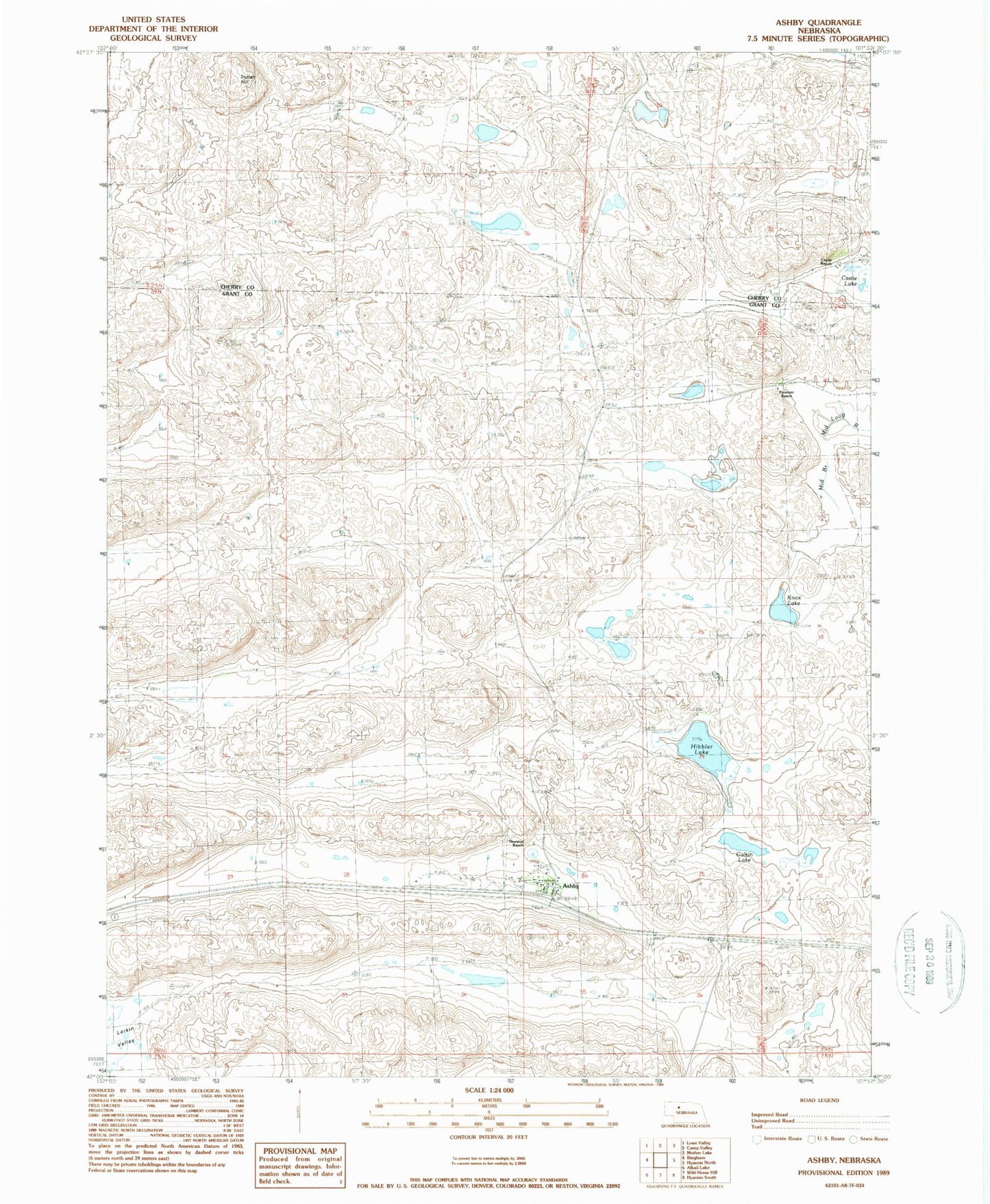
Historical USGS topographic quad map of Ashby in the state of Nebraska. Map scale may vary for some years, but is generally around 1:24,000. Print size is approximately 24" x 27"
This quadrangle is in the following counties: Cherry, Grant.
The map contains contour lines, roads, rivers, towns, and lakes. Printed on high-quality waterproof paper with UV fade-resistant inks, and shipped rolled.
Contains the following named places: Ashby, Ashby Post Office, Ashby Public School, Ashby United Church of Christ, Calkin Lake, Castle Ranch, Hibbler Lake, Indian Hill, Knox Lake, Peterson Ranch, Sandhills Fire and Rescue Ashby Station, Swede Valley Lutheran Church, Thurston Ranch, ZIP Code: 69333