
MyTopo
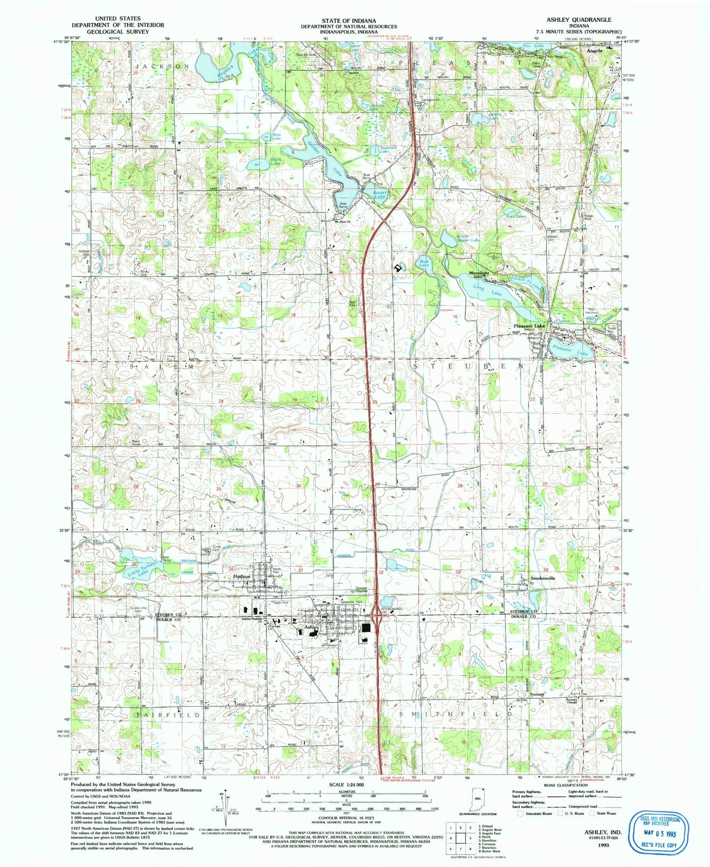
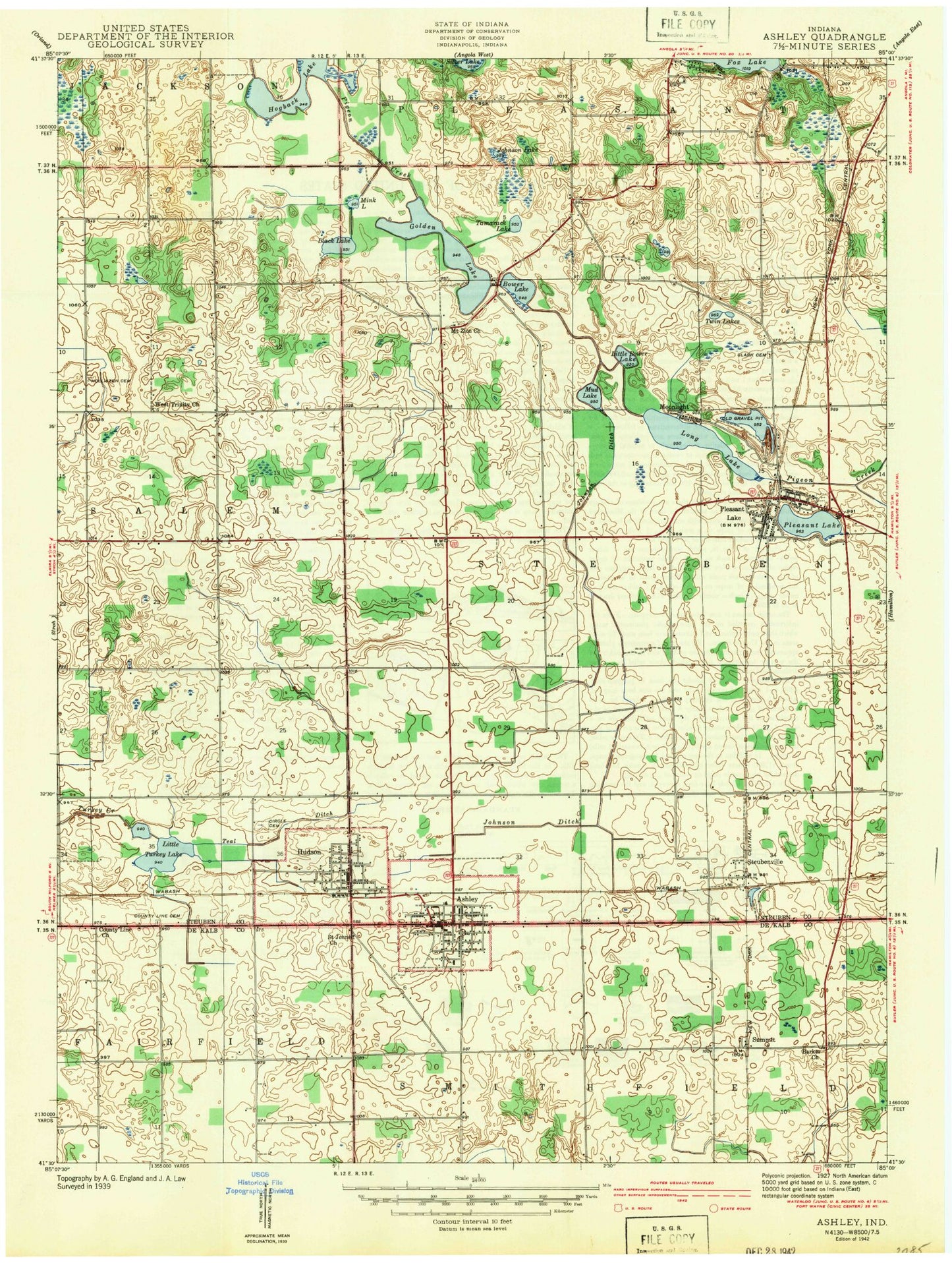
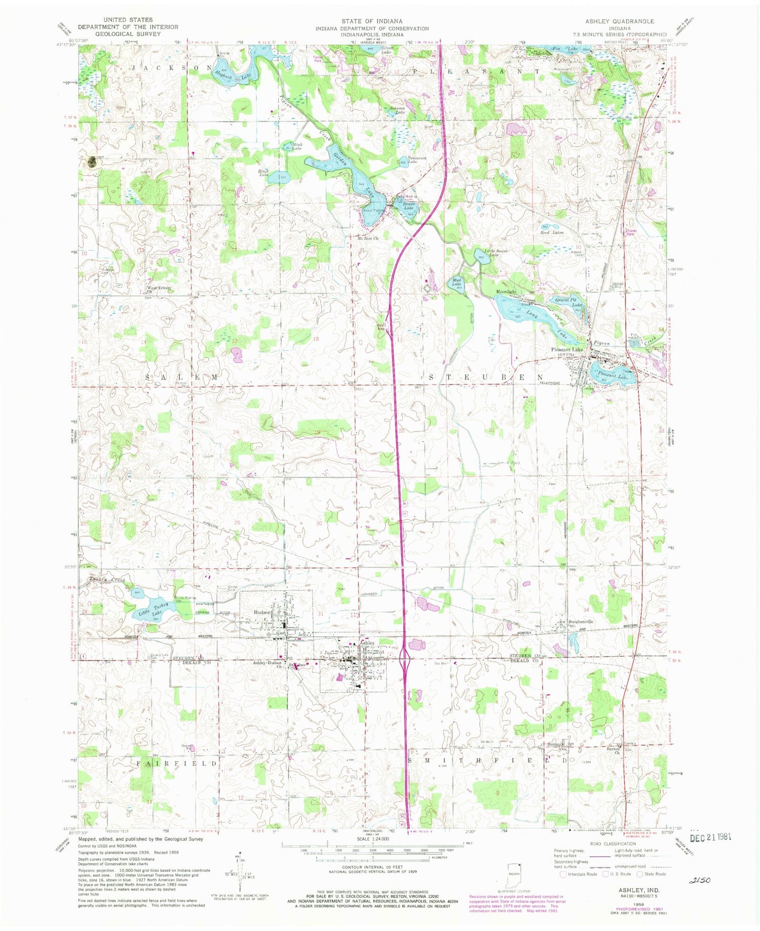
Classic USGS Ashley Indiana 7.5'x7.5' Topo Map
Couldn't load pickup availability
Historical USGS topographic quad map of Ashley in the state of Indiana. Map scale may vary for some years, but is generally around 1:24,000. Print size is approximately 24" x 27"
This quadrangle is in the following counties: DeKalb, Steuben.
The map contains contour lines, roads, rivers, towns, and lakes. Printed on high-quality waterproof paper with UV fade-resistant inks, and shipped rolled.
Contains the following named places: Ashley, Ashley Elementary School, Ashley Fire Department, Ashley Police Department, Ashley Post Office, Ashley Volunteer Fire Department, Ashley-Hudson Church, Ashley-Hudson Church of the Nazarene, Barker Church, Barkers Chapel Cemetery, Barkers Chapel Methodist Church, Black Lake, Bower Lake, Carpenter Park, Circle Cemetery, Conrad Ditch, County Line Cemetery, Firemans Park, Golden Lake, Gravel Pit Lake, Hamman Ditch, Hardy Park, Hogback Lake, Hollister Cemetery, Hudson, Hudson Fire Department, Hudson Police Department, Hudson Post Office, Johnson Ditch, Johnson Lake, Jonley Lake, Little Bower Lake, Little Turkey Lake, Long Lake, Matson Cemetery, Mink Lake, Moonlight, Mount Zion Cemetery, Mount Zion Church, Mount Zion United Methodist Church, Myers Bait and Fish Hatchery, Pleasant Lake, Pleasant Lake Cemetery, Pleasant Lake Elementary School, Pleasant Lake Post Office, Reed Lakes, Saint Johns Church, Saint Johns Church of Christ, Smathers Ditch, Steuben Township Volunteer Fire Department, Steubenville, Summit, Tamarack Lake, Town of Ashley, Town of Hudson, Township of Steuben, Trinity Cemetery, West Trinity Church, WXJC-TV (Angola), ZIP Codes: 46705, 46779