
MyTopo
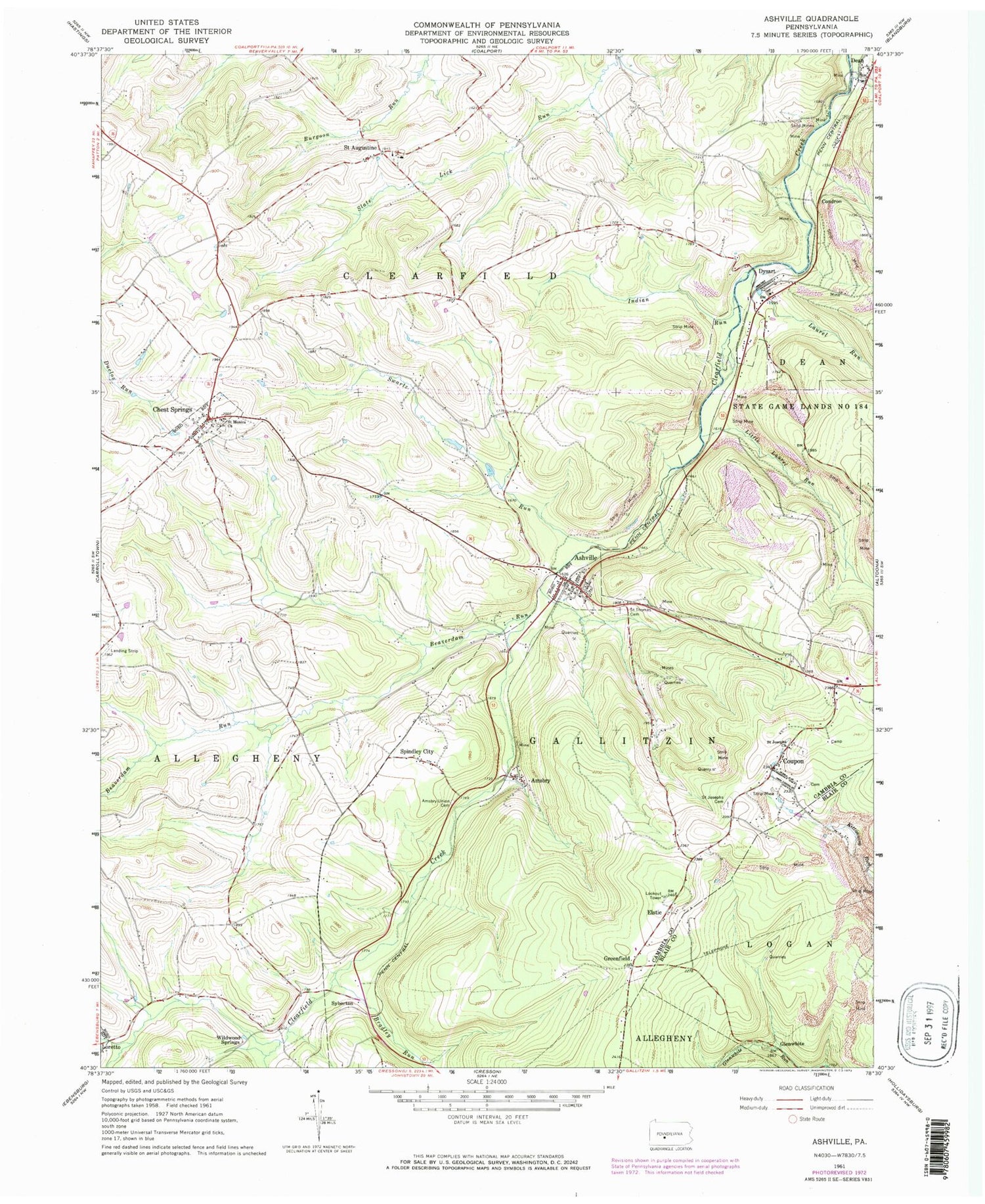
Classic USGS Ashville Pennsylvania 7.5'x7.5' Topo Map
Couldn't load pickup availability
Historical USGS topographic quad map of Ashville in the state of Pennsylvania. Map scale may vary for some years, but is generally around 1:24,000. Print size is approximately 24" x 27"
This quadrangle is in the following counties: Blair, Cambria.
The map contains contour lines, roads, rivers, towns, and lakes. Printed on high-quality waterproof paper with UV fade-resistant inks, and shipped rolled.
Contains the following named places: Amsbry, Amsbry Union Cemetery, Ashville, Ashville Borough Police Department, Ashville Post Office, Ashville Volunteer Fire Company Station 60, Beaverdam Run, Borough of Ashville, Borough of Chest Springs, Bradley Run, Brubaker Run, Burgoons Gap, Chest Springs, Chest Springs Cemetery, Chest Springs Post Office, Condron, Condron Station, Coupon, Dawson Station, Dean, Dysart, Dysart Post Office, Dystart Station, Elstie, Elstie Fire Tower, Gallaher - Douglass Cemetery, Greenfield, Indian Run, Laurel Run, Little Laurel Run, Saint Augustine, Saint Augustine Cemetery, Saint Joseph Cemetery - Polish, Saint Josephs Church, Saint Josephs Roman Catholic Cemetery, Saint Monicas Cemetery, Saint Thomas Cemetery, South Burgoon Gap, Spindley City, Strohmier Airport, Swartz Run, Syberton, Tippletown, Township of Allegheny, Township of Clearfield, Township of Gallitzin, Union Methodist Cemetery, Wildwood Springs, ZIP Codes: 16613, 16624, 16636


