MyTopo
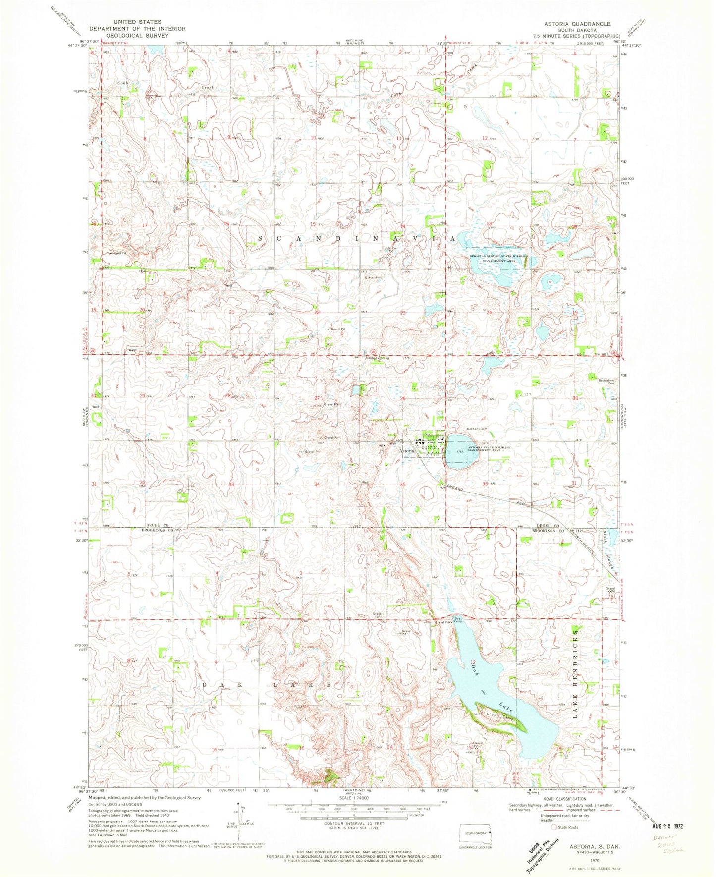
Classic USGS Astoria South Dakota 7.5'x7.5' Topo Map
Couldn't load pickup availability
Historical USGS topographic quad map of Astoria in the state of South Dakota. Map scale may vary for some years, but is generally around 1:24,000. Print size is approximately 24" x 27"
This quadrangle is in the following counties: Brookings, Deuel.
The map contains contour lines, roads, rivers, towns, and lakes. Printed on high-quality waterproof paper with UV fade-resistant inks, and shipped rolled.
Contains the following named places: Astoria, Astoria Post Office, Astoria State Wildlife Management Area, Astoria Volunteer Fire Department, Battle Creek School, Bethany Cemetery, Bethel Lutheran Church, Bethlehem Cemetery, Good View School, Hillside School, Jorstad Spring, Oak Lake, Oak Lake Girl Scout Camp, Scandinavia Post Office, Singsaas Slough State Wildlife Management Area, Snow Mound School, Town of Astoria, Township of Scandinavia, United Norwegian Church, ZIP Code: 57213