MyTopo
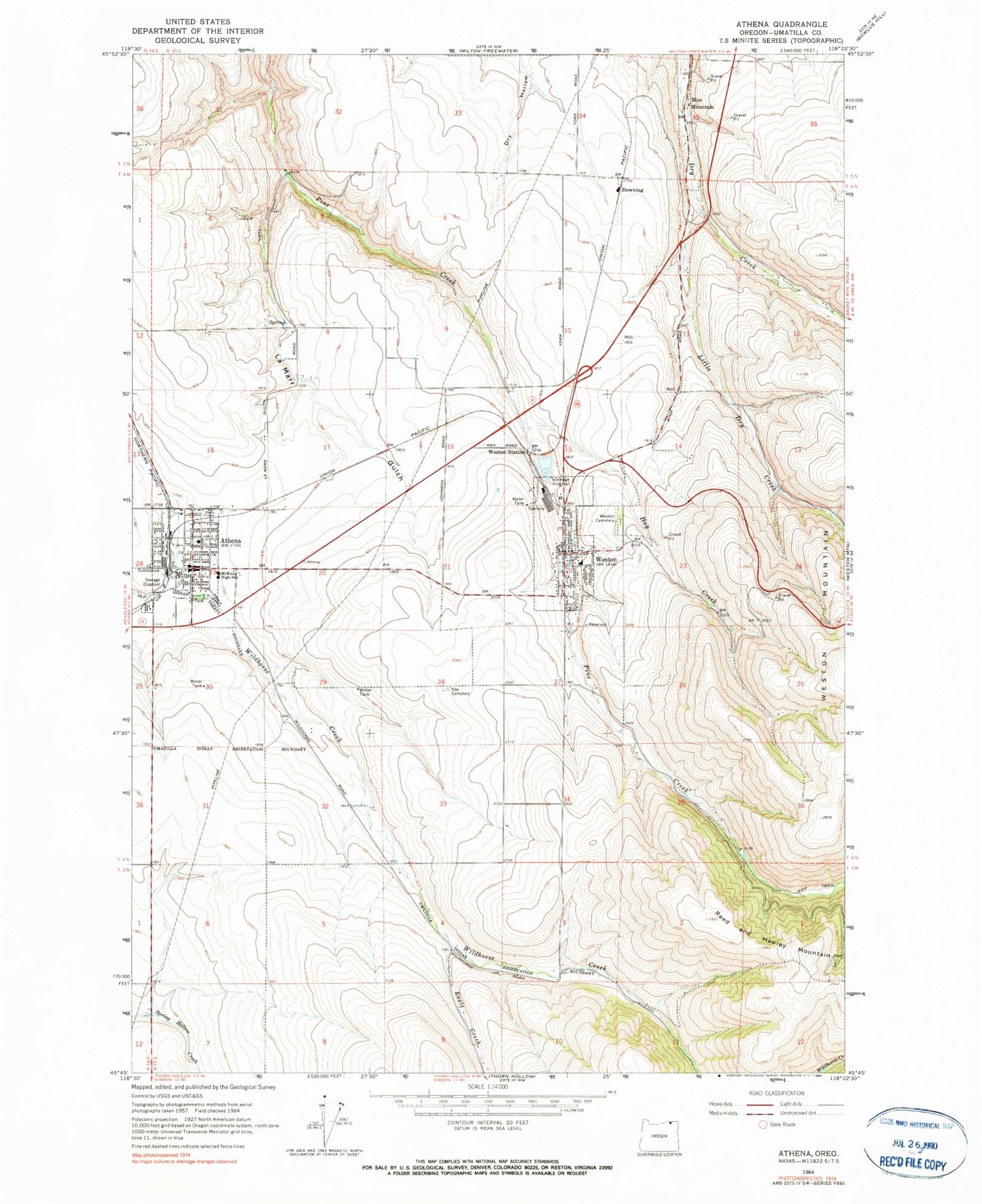
Classic USGS Athena Oregon 7.5'x7.5' Topo Map
Couldn't load pickup availability
Historical USGS topographic quad map of Athena in the state of Oregon. Map scale may vary for some years, but is generally around 1:24,000. Print size is approximately 24" x 27"
This quadrangle is in the following counties: Umatilla.
The map contains contour lines, roads, rivers, towns, and lakes. Printed on high-quality waterproof paper with UV fade-resistant inks, and shipped rolled.
Contains the following named places: Athena, Athena City Hall, Athena City Park, Athena Elementary School, Athena Memorial Ball Park, Athena Municipal Court, Athena Police Department, Athena Post Office, Athena Public Library, Athena Public Works Department, Athena Volunteer Fire Department, Athena Wastewater Treatment Plant, Barrett Field Airport, Blue Mountain, City of Athena, City of Weston, Downing, Duggor Park, Eagle Creek, Earthquake Spring, East Umatilla County Health District, East Umatilla County Rural Fire Protection District Station 1 Headquarters, Elliott Memorial Park, Green Spring, Hay Creek, Key Cemetery, La Marr Gulch, Little Dry Creek, Poplar Springs Dam, Poplar Springs Reservoir, Weston, Weston - McEwen High School, Weston Cemetery, Weston City Hall, Weston Middle School, Weston Police Department, Weston Post Office, Weston Public Library, Weston Station, Weston Wastewater Treatment Plant