MyTopo
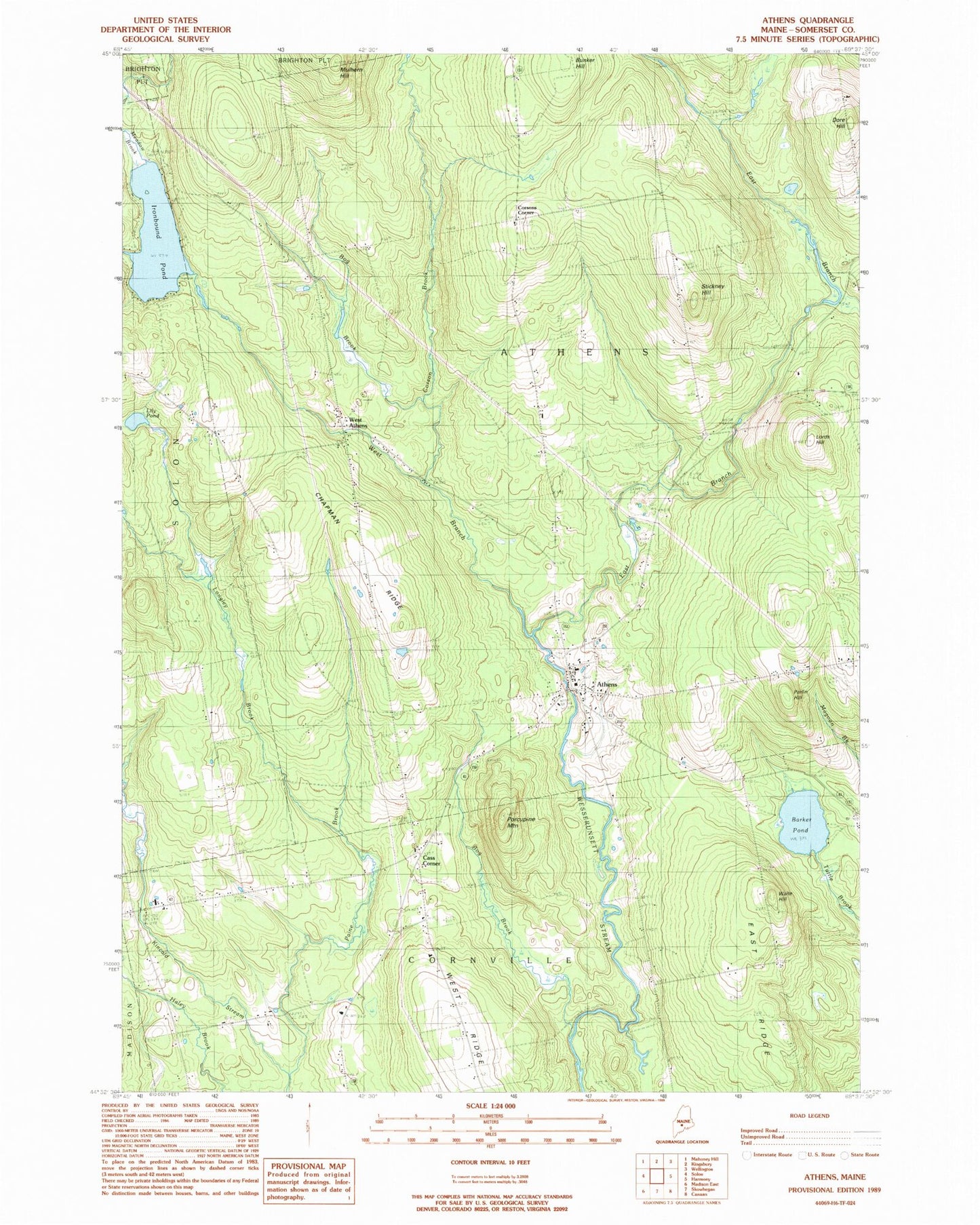
Classic USGS Athens Maine 7.5'x7.5' Topo Map
Couldn't load pickup availability
Historical USGS topographic quad map of Athens in the state of Maine. Map scale may vary for some years, but is generally around 1:24,000. Print size is approximately 24" x 27"
This quadrangle is in the following counties: Somerset.
The map contains contour lines, roads, rivers, towns, and lakes. Printed on high-quality waterproof paper with UV fade-resistant inks, and shipped rolled.
Contains the following named places: Athens, Athens Cemetery, Athens Community School, Athens Historical Society Museum, Athens Post Office, Athens Volunteer Fire Department, Barker Pond, Bog Brook, Cass Corner, Chapman Ridge, Cleveland School, Cornville Elementary School, Corson Brook, Corsons Corner, Dore Hill, Dore Hill Cemetery, East Branch Wesserunsett Stream, Ironbound Pond, Kinsman Cemetery, Lily Pond, Longley Brook, Lords Hill, Lords Hill Cemetery, Meadow Brook, Mount Rest Cemetery, Mulhern Hill, Paine Brook, Parlin Hill, Porcupine Mountain, Somerset Academy, Somerset Academy Community Center, Spurwink School Cornville, Stetson School, Stickney Hill, Town of Athens, Waite Hill, Washington School, West Athens, West Branch Wesserunsett Stream, Whittier School, ZIP Code: 04912