MyTopo
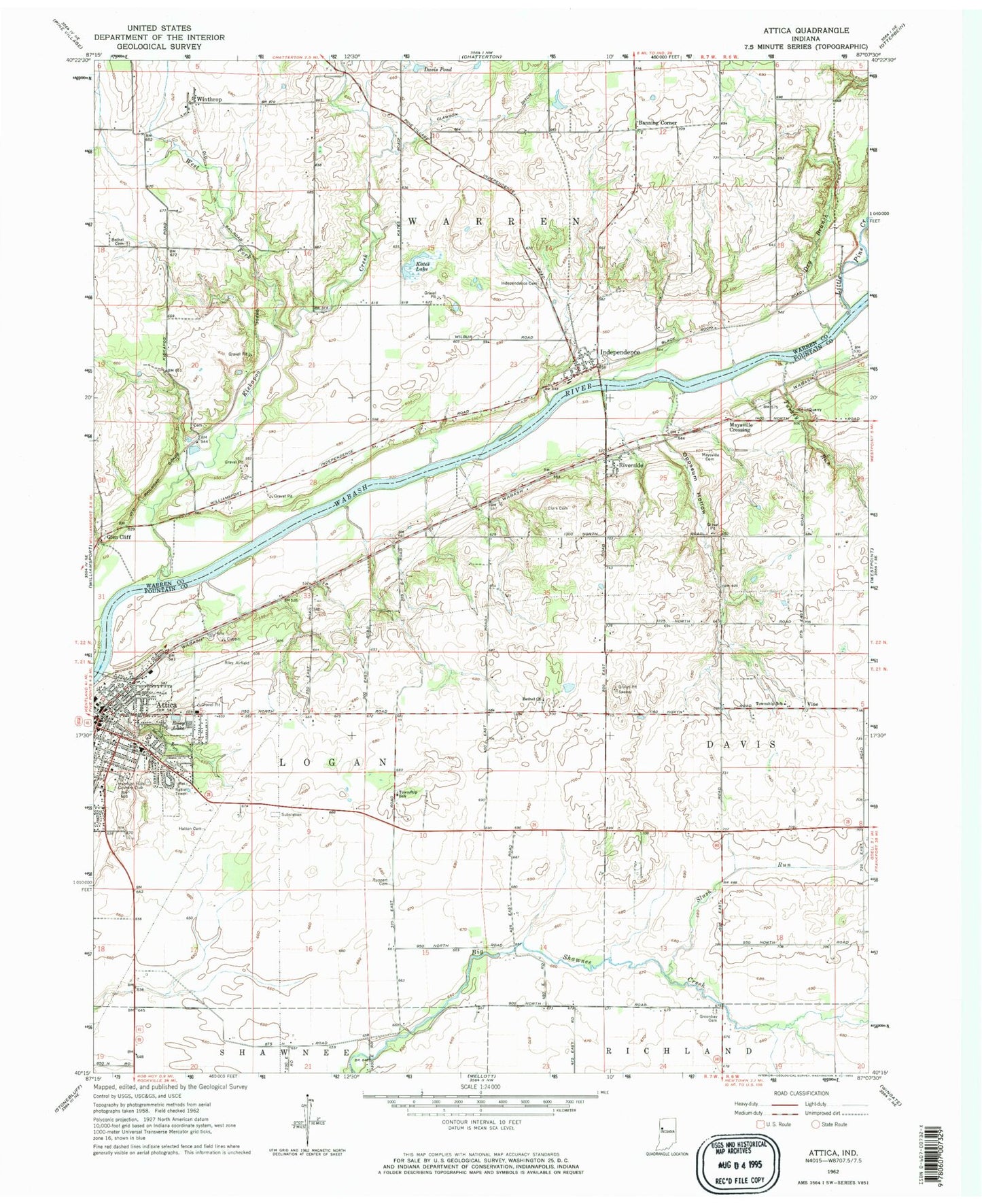
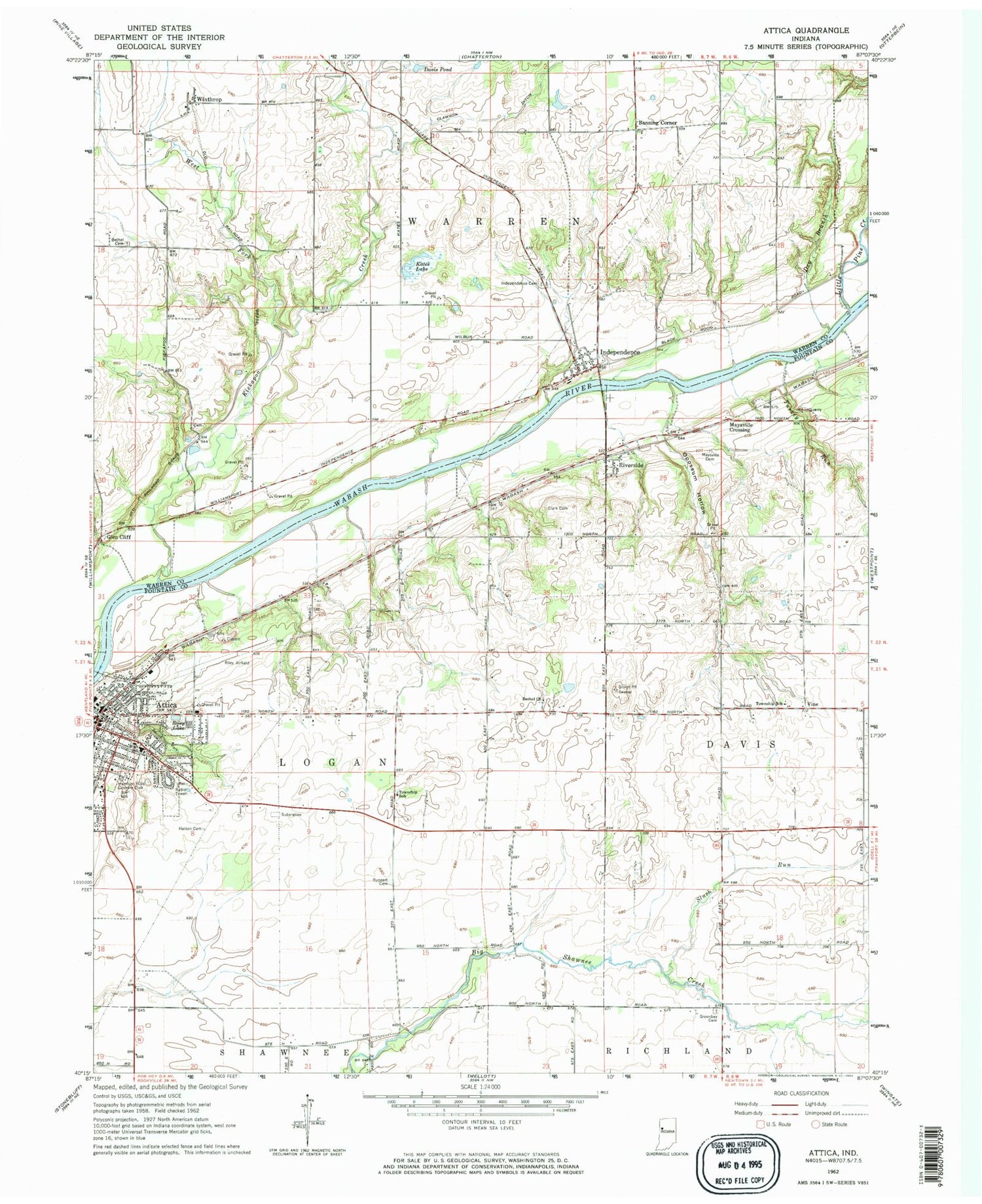
Classic USGS Attica Indiana 7.5'x7.5' Topo Map
Couldn't load pickup availability
Historical USGS topographic quad map of Attica in the state of Indiana. Map scale may vary for some years, but is generally around 1:24,000. Print size is approximately 24" x 27"
This quadrangle is in the following counties: Fountain, Warren.
The map contains contour lines, roads, rivers, towns, and lakes. Printed on high-quality waterproof paper with UV fade-resistant inks, and shipped rolled.
Contains the following named places: Attica, Attica Fire Department, Attica Police Department, Attica Post Office, Attica Volunteer Fire Department, Banning Corner, Bethel Cemetery, Bethel Church, City of Attica, Clark Cemetery, Clawson Ditch, Davis Pond, Dry Branch, Glen Cliff, Greenbay Cemetery, Grindstone Creek, Harrison Hills Country Club, Hatton Cemetery, Independence, Independence Cemetery, Independence Census Designated Place, Kates Lake, Kickapoo Creek, Laotto Elementary School, Little Pine Creek, Maysville Cemetery, Maysville Crossing, Opossum Hollow, Ravine Park, Riley Field, Riley Lake, Riverside, Ruppert Cemetery, Slush Run, Township of Davis, Township of Logan, Township of Warren, Turkey Run, Vine, West Fork Kickapoo Creek, Winthrop, ZIP Code: 47918