MyTopo
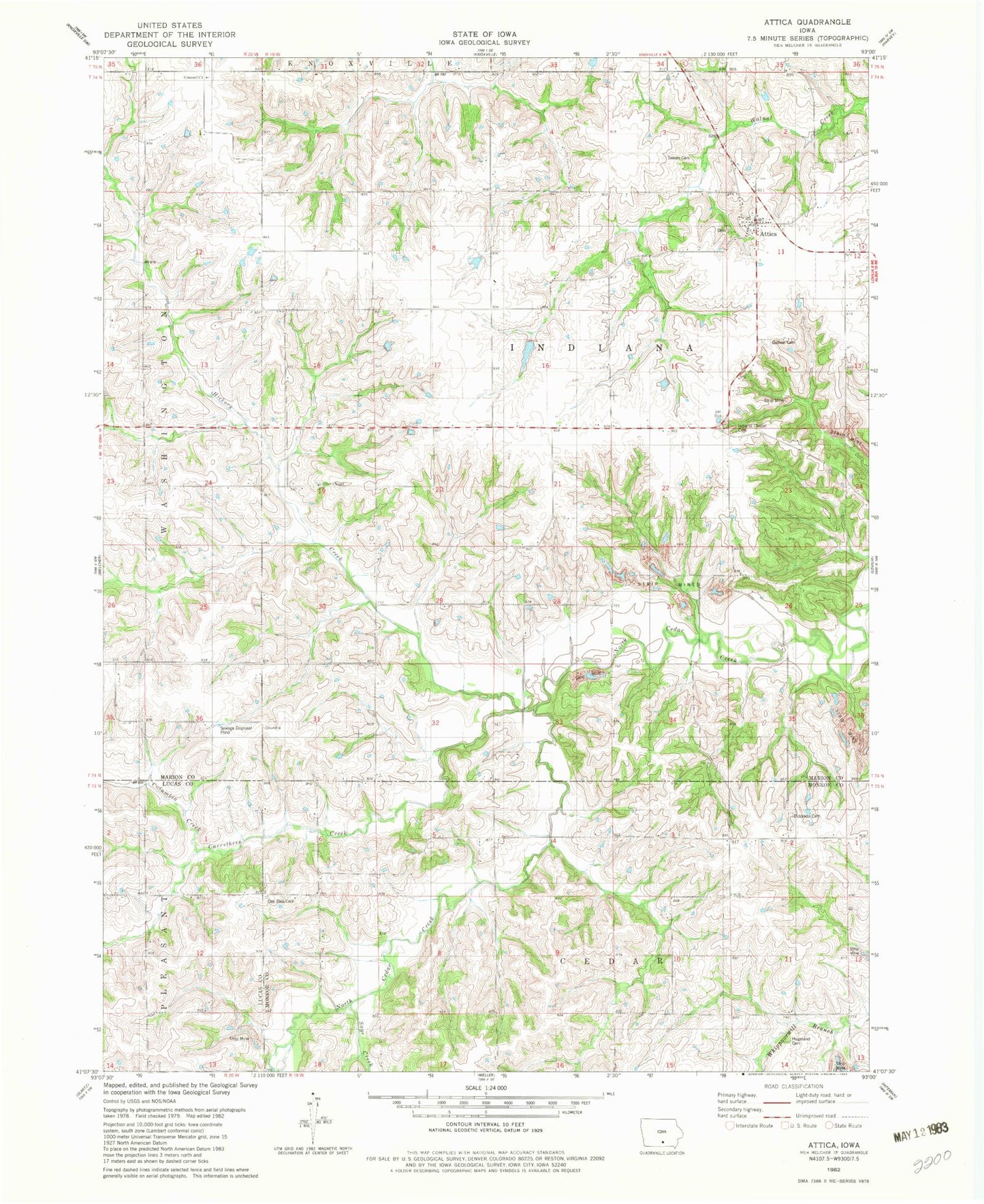
Classic USGS Attica Iowa 7.5'x7.5' Topo Map
Couldn't load pickup availability
Historical USGS topographic quad map of Attica in the state of Iowa. Map scale may vary for some years, but is generally around 1:24,000. Print size is approximately 24" x 27"
This quadrangle is in the following counties: Lucas, Marion, Monroe.
The map contains contour lines, roads, rivers, towns, and lakes. Printed on high-quality waterproof paper with UV fade-resistant inks, and shipped rolled.
Contains the following named places: Attica, Attica Post Office, Carruthers Creek, Cedar Valley School, Clear Creek School, Columbia Creek, Concord Church, Cooper Springs Post Office, Copper Spring, Eldorado Cemetery, Eldorado School, Elm Grove School, Gullion Cemetery, Hammond Bridge, Hickory Creek, Hogeland - Kirkendall Cemetery, Indiana, Indiana Chapel Cemetery, Indiana Township Fire Department, Mormon Cemetery, Oak Dale Cemetery, Oakdale School, Olive Chapel, Olive Chapel Cemetery, Pleasant Ridge School, Pleasant Valley School, Prairie College School, Round Grove School, Sage Creek, Simmons School, Springfield School, Sween Cemetery, Thompsonville Post Office, Township of Indiana, Willow Grove School